2020s Maps of Peshtigo, Wisconsin
Explore 5 historic maps of Peshtigo from the 2020s. These maps offer a rare glimpse into what life looked like during the 2020s — showing old roads, neighborhoods, homes, and landmarks that have changed or disappeared over time.
Whether you're researching your family's past, planning a metal detecting trip, or studying how Peshtigo's landscape evolved across the 2020s, these high-resolution maps are a powerful tool for exploring the history of this region.
- Focus on a specific era: All maps on this page are from the 2020s, giving you a focused view of this time period.
- See what’s changed: Compare century-old streets, trails, and buildings to today's modern landscape using overlays and satellite layers.
- Research with precision: Use these maps for genealogy, historical research, land use analysis, or educational projects.
- View, download, or print: Maps are fully viewable online in high resolution, and can be downloaded or printed for your own records.
Start exploring Peshtigo's history through authentic maps from the 2020s. This is your window into the past.
Peshtigo, WI maps
(5)- 2022 Map of Peshtigo Harbor, 2022 Print
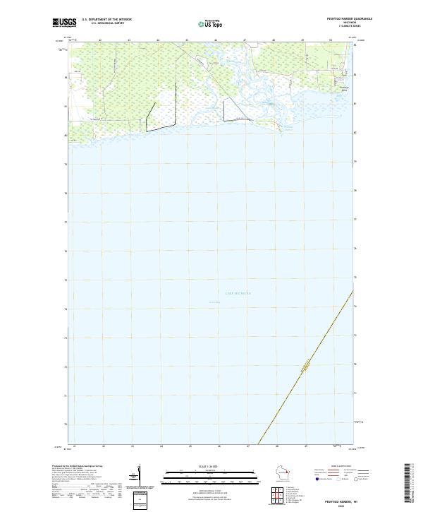 2022 Peshtigo Harbor2022 Print · USGSCoastal Marinette County is captured here at the edge of the bay in the early 2020s. Researchers can trace the delta of the Peshtigo River as it empties into Peshtigo Harbor near landmarks like Peshtigo Point and Dyers Slough.
 - 2022 Map of Marinette East, 2022 Print
 2022 Marinette East2022 Print · USGSThe twin border cities of the Menominee River estuary are shown here in detail during the early 2020s. Trace the urban development near the Menominee County Courthouse or explore the coastal features of Seagull Bar and Green Island.
 - 2022 Map of Harmony, 2022 Print
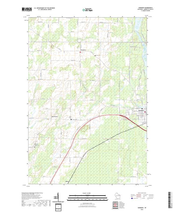 2022 Harmony2022 Print · USGSMarinette County's rural landscape comes into focus in the early 2020s, centered on the river-fed lands surrounding the city of Peshtigo. Genealogists and historians can locate significant sites like the Peshtigo Fire Cem, Harmony, and Wilcox.
 - 2022 Map of Marinette West, 2022 Print
 2022 Marinette West2022 Print · USGSThe riverfront border between Wisconsin and Michigan comes into focus in this recent survey of the Twin Cities region. Genealogists and historians can trace numerous burial sites like Forest Home Cem and explore the area surrounding the Indian Mound.
 - 2022 Map of Oconto East, 2022 Print
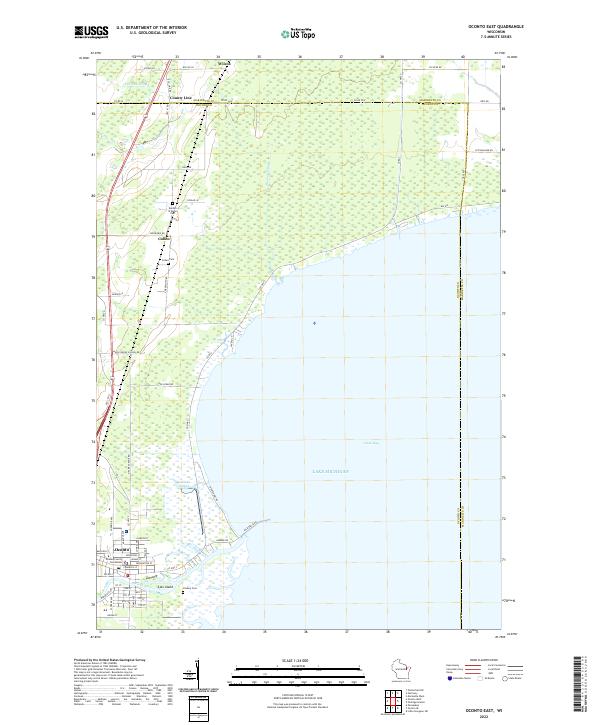 2022 Oconto East2022 Print · USGSThe western shores of Green Bay come alive in this contemporary survey of the Oconto riverfront and its rural surroundings. Researchers can pinpoint the Oconto County Courthouse or trace family roots at Garden of Hope Cem and Cullen Cem.
End of results
Showing maps 1-5 of 5
Top cities near Peshtigo
- Marinette historical maps
- Menominee historical maps
- Oconto historical maps
- Peshtigo historical maps
- Porterfield historical maps
- Pensaukee historical maps
See more
Frequently asked questions
- What are the different types of historical maps available for Peshtigo?
- What is the oldest map of Peshtigo?
- Where can I purchase historical maps of Peshtigo for my home or office?
- Where can I download high-res historical maps of Peshtigo?
- Are there historical topographic maps available for Peshtigo?
- Is there historical aerial imagery available for Peshtigo?
- Where are historical maps of Peshtigo sourced from?