1900s (20th Century) Maps of New London, Wisconsin
Explore 10 historic maps of New London from the 1900s (20th Century). These maps offer a rare glimpse into what life looked like during the 1900s — showing old roads, neighborhoods, homes, and landmarks that have changed or disappeared over time.
Whether you're researching your family's past, planning a metal detecting trip, or studying how New London's landscape evolved across the 1900s, these high-resolution maps are a powerful tool for exploring the history of this region.
- Focus on a specific era: All maps on this page are from the 1900s, giving you a focused view of this time period.
- See what’s changed: Compare century-old streets, trails, and buildings to today's modern landscape using overlays and satellite layers.
- Research with precision: Use these maps for genealogy, historical research, land use analysis, or educational projects.
- View, download, or print: Maps are fully viewable online in high resolution, and can be downloaded or printed for your own records.
Start exploring New London's history through authentic maps from the 1900s. This is your window into the past.
New London, WI maps
(10)- 1955 Map of Green Bay, 1968 Print
 1955 Green Bay1968 Print · USGSCentral and Eastern Wisconsin are captured here in the mid-fifties, showing the industrial growth of the Fox Valley and Wisconsin River corridors. Genealogists and historians can trace rail lines like the Green Bay and Western through settlements like Weyauwega, Clintonville, and Pulaski.2 unique versions available
 - 1956 Map of New London, 1958 Print
 1956 New London1958 Print · USGSWisconsin's Fox Valley region in the mid-fifties shows a landscape of river-town commerce and deep rural roots. Genealogists can trace family sites at Wanderers Rest Cem or locate the many country schools like Golden Hill Sch and Hickory Grove Sch.
 - 1956 Map of Weyauwega, 1958 Print
 1956 Weyauwega1958 Print · USGSCentral Waupaca County is mapped here in the mid-fifties, showing a landscape defined by the winding Wolf River and a thriving network of rural townships. Genealogists can trace family roots at St Patricks Cem, Baldwins Mill Sch, and the State Sanatorium.
 - 1969 Map of New London, 1971 Print
 1969 New London1971 Print · USGSNew London and the surrounding river valleys are captured here in the late sixties, showcasing a landscape defined by the convergence of rail and water. Researchers can locate family landmarks such as Wayside Cem, Emanuel Ch, and the old Washington Jr High Sch.
 - 1969 Map of Readfield, 1971 Print
 1969 Readfield1971 Print · USGSWaupaca County in the late sixties shows a landscape shaped by the shifting currents of the Wolf River and the transit lines of the Soo Line. Genealogists and local historians can trace family locations near Readfield, Shaw Landing, and the Pioneer Cem.3 unique versions available
 - 1969 Map of Hortonville, 1971 Print
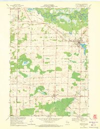 1969 Hortonville1971 Print · USGSOutagamie County during the late sixties shows a landscape of steady agricultural life and vital rail connections. Researchers can locate family landmarks like SS Peter and Paul Cem and trace the paths of the Soo Line through Medina.2 unique versions available
 - 1969 Map of Northport, 1971 Print
 1969 Northport1971 Print · USGSWaupaca County's river valleys and rural townships are captured here in the late sixties as the river-and-rail economy persisted. Genealogists and local historians can trace family-named landmarks and essential community sites like Fitzgerald Corners, St Patrick Cem, and the Maple Hill Sch.
 - 1984 Map of Appleton, 1985 Print
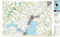 1984 Appleton1985 Print · USGSThe Fox River Valley in the mid-eighties shows a bustling corridor of industry and nature, from the shores of Lake Winnebago to the Oneida Indian Reservation. Trace local heritage through landmarks like Riverside Cem or explore the wetlands of Poygan Marsh State Wildlife Area.2 unique versions available
 - 1992 Map of New London, 1995 Print
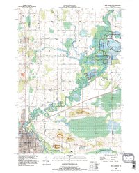 1992 New London1995 Print · USGSThe riverfront city of New London and the nearby settlement of Sugar Bush are captured here as they appeared in the early nineties. Genealogists and local historians can trace family-named sites like Ruckdashel Cem and landmarks such as Mosquito Hill.
 - 1993 Map of Northport, 1995 Print
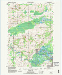 1993 Northport1995 Print · USGSWaupaca County's river valleys and wetlands are captured in the mid-1990s as the Wolf River winds through the countryside. Researchers can trace local lineage through sites like St Patrick Cem, the settlement at Fitzgerald Corners, and family land along Nicolai Road.
End of results
Showing maps 1-10 of 10
Top cities near New London
- Neenah historical maps
- Fox Crossing historical maps
- Greenville historical maps
- Clintonville historical maps
- Dale historical maps
- Hortonville historical maps
See more
Top neighborhoods of New London
Frequently asked questions
- What are the different types of historical maps available for New London?
- What is the oldest map of New London?
- Where can I purchase historical maps of New London for my home or office?
- Where can I download high-res historical maps of New London?
- Are there historical topographic maps available for New London?
- Is there historical aerial imagery available for New London?
- Where are historical maps of New London sourced from?