Old Maps of Mequon, Wisconsin
Explore 24 old maps of Mequon, spanning from 1892 to today. These high-resolution historic maps reveal how streets, neighborhoods, landmarks, and natural features evolved over time — perfect for genealogy, metal detecting, research, and local history exploration.
What you can do with these maps:
- See how Mequon changed over time: Compare historical maps to modern-day views to trace roads, homesites, rail lines & more.
- View detailed metadata: Each map includes creators, publishers, year, scale, and archive source.
- Overlay maps with satellite & LiDAR: Visualize the past alongside modern tools to explore terrain & human change.
- Trusted historical sources: Maps sourced from the USGS, Library of Congress, and other archives.
- Access maps your way: View online, download high-res files, or order prints for personal or research use.
Start exploring old maps of Mequon to uncover forgotten places, hidden landmarks, and the deep history beneath your feet.
Mequon, WI maps
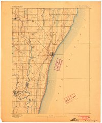
(24)- 1892 Map of Milwaukee
 1892 Milwaukee1892 Print · USGSCovers Mequon, including Milwaukee, West Allis, and other nearby areas2 unique versions available
 - 1892 Map of Waukesha
 1892 Waukesha1892 Print · USGSCovers Mequon, including Milwaukee, Waukesha, and other nearby areas
 - 1892 Map of Port Washington
 1892 Port Washington1892 Print · USGSCovers Mequon, including Grafton, Cedarburg, and other nearby areas
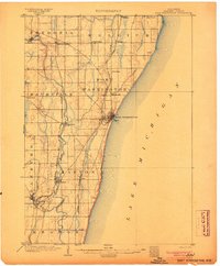
 - 1901 Map of Milwaukee
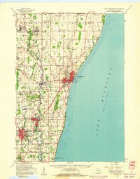
 1901 Milwaukee1901 Print · USGSCovers Mequon, including Milwaukee, West Allis, and other nearby areas
 - 1901 Map of Waukesha
 1901 Waukesha1901 Print · USGSCovers Mequon, including Milwaukee, Waukesha, and other nearby areas
 - 1904 Map of West Bend
 1904 West Bend1904 Print · USGSCovers Mequon, including West Bend, Germantown, and other nearby areas3 unique versions available
 - 1904 Map of Port Washington
 1904 Port Washington1904 Print · USGSCovers Mequon, including Grafton, Cedarburg, and other nearby areas2 unique versions available
 - 1906 Map of Waukesha
 1906 Waukesha1906 Print · USGSCovers Mequon, including Milwaukee, Waukesha, and other nearby areas4 unique versions available
 - 1906 Map of Milwaukee
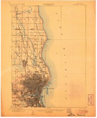 1906 Milwaukee1906 Print · USGSCovers Mequon, including Milwaukee, West Allis, and other nearby areas4 unique versions available
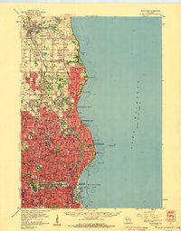
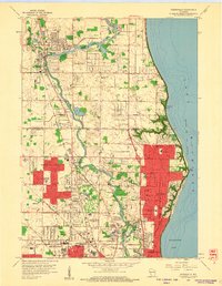
 - 1954 Map of Milwaukee, 1967 Print
 1954 Milwaukee1967 Print · USGSCovers Mequon, including Milwaukee, West Allis, and other nearby areas3 unique versions available
 - 1957 Map of Madison, 1967 Print
 1957 Madison1967 Print · USGSCovers Mequon, including Milwaukee, Madison, and other nearby areas3 unique versions available
 - 1958 Map of Milwaukee
 1958 Milwaukee1958 Print · USGSCovers Mequon, including Milwaukee, West Allis, and other nearby areas
 - 1958 Map of Milwaukee, 1960 Print
 1958 Milwaukee1960 Print · USGSCovers Mequon, including Milwaukee, West Allis, and other nearby areas3 unique versions available
 - 1958 Map of Thiensville, 1960 Print
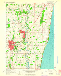
 1958 Thiensville1960 Print · USGSCovers Mequon, including Milwaukee, Whitefish Bay, and other nearby areas4 unique versions available
 - 1958 Map of Menomonee Falls, 1961 Print
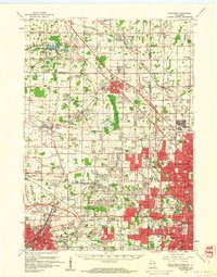
 1958 Menomonee Falls1961 Print · USGSCovers Mequon, including Milwaukee, Menomonee Falls, and other nearby areas4 unique versions available
 - 1959 Map of Cedarburg, 1960 Print
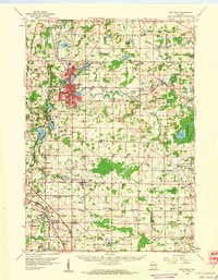
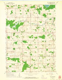
 1959 Cedarburg1960 Print · USGSCovers Mequon, including Grafton, Cedarburg, and other nearby areas4 unique versions available
 - 1959 Map of West Bend, 1960 Print
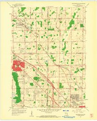
 1959 West Bend1960 Print · USGSCovers Mequon, including West Bend, Germantown, and other nearby areas
 - 1959 Map of Port Washington, 1960 Print
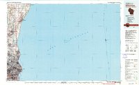
 1959 Port Washington1960 Print · USGSCovers Mequon, including Grafton, Cedarburg, and other nearby areas
 - 1959 Map of Waukesha, 1961 Print
 1959 Waukesha1961 Print · USGSCovers Mequon, including Milwaukee, Waukesha, and other nearby areas3 unique versions available
 - 1959 Map of Five Corners, 1964 Print
 1959 Five Corners1964 Print · USGSCovers Mequon, including Germantown, Cedarburg, and other nearby areas4 unique versions available
 - 1960 Map of Madison
 1960 Madison1960 Print · USGSCovers Mequon, including Milwaukee, Madison, and other nearby areas2 unique versions available
 - 1980 Map of Milwaukee, 1981 Print
 1980 Milwaukee1981 Print · USGSCovers Mequon, including Milwaukee, West Allis, and other nearby areas
 - 1984 Map of Oconomowoc, 1985 Print
 1984 Oconomowoc1985 Print · USGSCovers Mequon, including Milwaukee, Waukesha, and other nearby areas
 - 1991 Map of Oconomowoc
 1991 Oconomowoc1991 Print · USGSCovers Mequon, including Milwaukee, Waukesha, and other nearby areas
End of results
Showing maps 1-24 of 24
Top cities near Mequon
- Milwaukee historical maps
- Waukesha historical maps
- West Allis historical maps
- Wauwatosa historical maps
- Brookfield historical maps
- New Berlin historical maps
See more
Top neighborhoods of Mequon
- Thornapple Farm historical maps
- Freistadt historical maps
- Huntington Park historical maps
- Westchester Lakes historical maps
- Eastwyn Bay historical maps
- The Pines historical maps
See more
Frequently asked questions
- What are the different types of historical maps available for Mequon?
- What is the oldest map of Mequon?
- Where can I purchase historical maps of Mequon for my home or office?
- Where can I download high-res historical maps of Mequon?
- Are there historical topographic maps available for Mequon?
- Is there historical aerial imagery available for Mequon?
- Where are historical maps of Mequon sourced from?