1940s Maps of Pierce County, Wisconsin
Explore 11 historic maps of Pierce County from the 1940s. These maps offer a rare glimpse into what life looked like during the 1940s — showing old roads, neighborhoods, homes, and landmarks that have changed or disappeared over time.
Whether you're researching your family's past, planning a metal detecting trip, or studying how Pierce County's landscape evolved across the 1940s, these high-resolution maps are a powerful tool for exploring the history of this region.
- Focus on a specific era: All maps on this page are from the 1940s, giving you a focused view of this time period.
- See what’s changed: Compare century-old streets, trails, and buildings to today's modern landscape using overlays and satellite layers.
- Research with precision: Use these maps for genealogy, historical research, land use analysis, or educational projects.
- View, download, or print: Maps are fully viewable online in high resolution, and can be downloaded or printed for your own records.
Start exploring Pierce County's history through authentic maps from the 1940s. This is your window into the past.
Pierce County, WI maps
(11)- 1940 Map of Maiden Rock
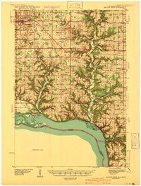 1940 Maiden Rock1940 Print · USGSPierce County’s bluff country meets the Mississippi River in this pre-war survey of the Wisconsin-Minnesota border. Genealogists can trace hundreds of family-named landmarks, from Clayfield Ch to vanished rural schoolhouses like Oakvale Sch and Drake Sch.2 unique versions available
 - 1941 Map of Arkansaw
 1941 Arkansaw1941 Print · USGSPepin and Pierce counties appear at the start of the 1940s as a land of rural schools and river-valley farming. Researchers can trace family sites at Plum City, Dead Lake Cem, or schools like Maxwell Prairie Sch along the Chippewa River.
 - 1942 Map of Arkansaw
 1942 Arkansaw1942 Print · USGSThe Driftless Area of Pepin and Pierce counties comes to life in the 1940s, showing a landscape of deep coulees and river valleys. Genealogists can locate dozens of country schools like Whipple Hill Sch and historic local landmarks such as St Joseph Ch and Exile.2 unique versions available
 - 1944 Map of Red Wing
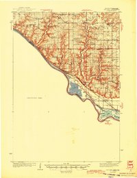 1944 Red Wing1944 Print · USGSThe Wisconsin side of the Mississippi River valley is shown here just before the mid-century, where rail and river networks met. Genealogists can locate family-named landmarks and rural hubs like Moeville, Hager City, and St Marys Sch.2 unique versions available
 - 1946 Map of Hudson, 1954 Print
 1946 Hudson1954 Print · USGSThe riverfront communities of the St. Croix Valley are captured here just after the war, showing the distinct border towns of Wisconsin. Genealogists and local historians can trace the streets and benchmarks of Hudson, North Hudson, and Prescott.
 - 1946 Map of Knapp, 1967 Print
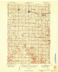
 1946 Knapp1967 Print · USGSThe borderlands of St. Croix, Pierce, and Dunn Counties come to life in this mid-century survey of the Wisconsin dairy country. Genealogists can locate dozens of country schools like Broadview Sch and Denver Sch, as well as the Dunkard Ch and Teegarden Cem.
 - 1946 Map of River Falls, 1968 Print
 1946 River Falls1968 Print · USGSPierce and St. Croix counties come alive in the mid-1940s, centered on the river-fed hub of River Falls. Genealogists and historians can trace dozens of rural schoolhouses and country churches, including Cherma Ch, Lafette Sch, and Glover.
 - 1949 Map of River Falls
 1949 River Falls1949 Print · USGSThe St. Croix and Pierce County borderlands near the late 1940s reveal a landscape of tight-knit rural communities and bustling riverside towns. Genealogists can trace family roots through dozens of local landmarks like Cherma Ch, Warren Cem, and the Nineteen Hundred Sch.2 unique versions available
 - 1949 Map of Hudson
 1949 Hudson1949 Print · USGSThe riverfront communities of St. Croix and Pierce counties are captured here in the late 1940s as the rail-and-river economy flourished. Genealogists and historians can trace the paths of the Chicago St Paul Minneapolis and Omaha line through Hudson and down to the river junction at Prescott.
 - 1949 Map of Knapp
 1949 Knapp1949 Print · USGSDunn, St. Croix, and Pierce counties come together in the late 1940s, showing a landscape defined by small-scale farming and the rail corridor. Genealogists can locate dozens of country schools and churches like Wilson Ch, East Hill Sch, and Hatchville Ch.
 - 1949 Map of Baldwin
 1949 Baldwin1949 Print · USGSThe dairy lands of St. Croix and Pierce counties thrive in the late 1940s as the rail line connects the bustling hubs of Baldwin and Woodville. Genealogists and historians can locate dozens of neighborhood landmarks, from the Emmanuel Lutheran Ch to rural schools like Birchdale Sch and Loyalty Sch.2 unique versions available
End of results
Showing maps 1-11 of 11
Top cities of Pierce County
- Prescott historical maps
- Ellsworth historical maps
- River Falls historical maps
- Oak Grove historical maps
- Trenton historical maps
- Clifton historical maps
See more
Frequently asked questions
- What are the different types of historical maps available for Pierce County?
- What is the oldest map of Pierce County?
- Where can I purchase historical maps of Pierce County for my home or office?
- Where can I download high-res historical maps of Pierce County?
- Are there historical topographic maps available for Pierce County?
- Is there historical aerial imagery available for Pierce County?
- Where are historical maps of Pierce County sourced from?