
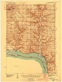
1940 Map of Maiden Rock
USGS Topo · Published 1940About this map
Ellsworth serves as a prominent focal point in this survey of Pierce County, situated where the uplands begin their descent toward the Mississippi valley. The landscape is defined by the deep incisions of the Rush River, Trimbelle River, and Isabelle Creek, which carve through the terrain before meeting Lake Pepin. The settlement pattern revealed here is one of dense rural infrastructure, featuring a remarkable concentration of one-room schoolhouses such as Cudd Sch and Hill and Dale Sch, alongside community anchors like Mission Ch and St Pauls Ch.
Find a feature on this map
67 named features on this map. Tap any name to fly to it.
Don’t see what you’re looking for? This feature index may not catch every label — zoom into the map to look around manually.
Map Details
Editions of this 1940 Maiden Rock Map
2 editions found
Other maps of this area

1932 · Wabasha
USGS Topo · 1:62,500

1935 · Arkansaw
USGS Topo · 1:48,000

1941 · Arkansaw
USGS Topo · 1:62,500

1942 · Arkansaw
USGS Topo · 1:62,500

1944 · Red Wing
USGS Topo · 1:62,500

1946 · Knapp
USGS Topo · 1:62,500

1946 · River Falls
USGS Topo · 1:62,500

1949 · River Falls
USGS Topo · 1:62,500

1949 · Knapp
USGS Topo · 1:62,500

1949 · Baldwin
USGS Topo · 1:62,500