Old Maps of Buena Vista, Wisconsin for Academic Research
Study the evolution of Buena Vista with 16 high-resolution historic maps. Whether you're teaching, researching, or modeling changes in land use, these maps provide essential visual documentation of urban, environmental, and geographic change.
- Analyze long-term change: Track patterns in development, transportation, and natural features.
- Ideal for environmental or urban studies: Support academic projects with primary historical map data.
- Use in the classroom or lab: Educators and researchers rely on these maps to bring historical context to life.
These maps are a powerful tool for teaching, research, and visualizing how Buena Vista has changed over the decades.
Buena Vista, WI maps
(16)- 1955 Map of Green Bay, 1968 Print
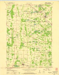
 1955 Green Bay1968 Print · USGSCentral and Eastern Wisconsin are captured here in the mid-fifties, showing the industrial growth of the Fox Valley and Wisconsin River corridors. Genealogists and historians can trace rail lines like the Green Bay and Western through settlements like Weyauwega, Clintonville, and Pulaski.2 unique versions available
 - 1957 Map of Amherst, 1959 Print
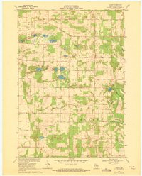
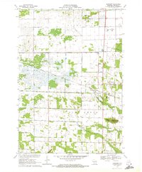
 1957 Amherst1959 Print · USGSPortage County at the end of the fifties is a landscape of intersecting railroads and rural school districts. Genealogists can trace family lines at Spiritland Cem or locate the site of the Lincoln Sch (Abandoned) near the Almond village limits.
 - 1957 Map of Whiting, 1959 Print
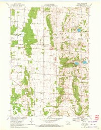
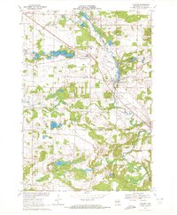
 1957 Whiting1959 Print · USGSCentral Wisconsin is captured here in the late fifties, showcasing the river-and-rail corridor connecting Whiting and Bancroft. Researchers can trace old rural schoolhouses like Pearl Sch and cemeteries such as McDill Cem across the Portage County landscape.
 - 1969 Map of Blaine, 1972 Print
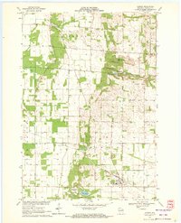
 1969 Blaine1972 Print · USGSPortage County at the close of the 1960s reveals a rural landscape defined by its glacial lakes and scattered farming communities. Genealogists and local historians can trace family locations near Blaine, St Patricks Ch, and the Hillside Cem.
 - 1969 Map of Arnott, 1972 Print
 1969 Arnott1972 Print · USGSPortage County at the end of the sixties reveals a transition between agricultural townships and growing recreational spaces. Researchers can find long-established landmarks like the St Mary of Mt Carmel Ch, the Townhall, and old family burial grounds like Morrill Cem.
 - 1969 Map of Almond, 1972 Print
 1969 Almond1972 Print · USGSPortage County’s agricultural and rail-dependent character is evident here during the late sixties. Researchers can trace family history through numerous rural sites like St Johns Cem, Spiritland Cem, and the tracks of the Chicago and North Western railroad.
 - 1969 Map of Amherst, 1972 Print
 1969 Amherst1972 Print · USGSPortage County at the end of the sixties shows a landscape of glacial lakes and established rail towns like Amherst and Nelsonville. Genealogists and local historians can trace legacy sites such as St Mary of Mt Carmel Ch, the Amish Sch, and Lower Amherst Cem along the Tomorrow River.
 - 1970 Map of Bancroft, 1972 Print
 1970 Bancroft1972 Print · USGSPortage County at the start of the seventies reveals a landscape of reclaimed marshlands and rail-dependent hamlets. Genealogists and local historians can trace the foundations of Bancroft and West Bancroft alongside landmarks like Mosquito Bluff and the Pine Grove Cem.2 unique versions available
 - 1970 Map of Whiting, 1972 Print
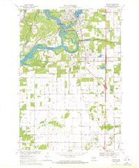 1970 Whiting1972 Print · USGSPortage County at the start of the seventies shows a landscape defined by the winding Wisconsin River and the growing communities of Whiting and Plover. Researchers can trace old family sites near Maine Cem, St Bronislava, or the River Pines Sanatorium.2 unique versions available
 - 1985 Map of Wisconsin Rapids
 1985 Wisconsin Rapids1985 Print · USGSCentral Wisconsin in the mid-eighties shows a landscape of engineered waterways and active rail corridors between Wisconsin Rapids and Waupaca. Genealogists and researchers can trace local landmarks like Roche A Cri State Park, the SOO LINE, and small settlements like Coddington or Rudolph.2 unique versions available
 - 2022 Map of Whiting, 2022 Print
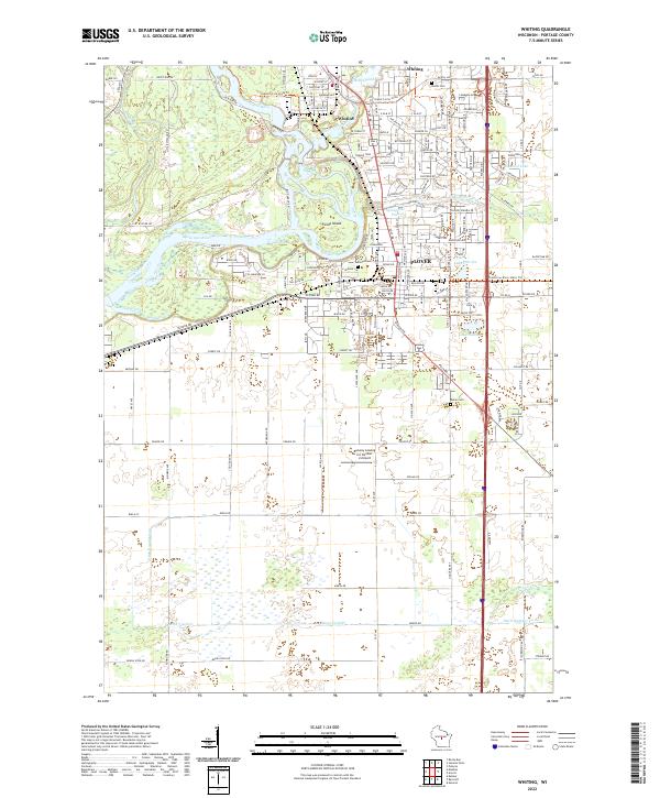 2022 Whiting2022 Print · USGSWhiting and Plover sit at the historic confluence of the Wisconsin and Plover Rivers in the early 2020s. Researchers can locate family plots at McDill Cem or Maine Cem and trace the modern expansion around Lake Pacawa and the Runway Leasing Inc Number 2 Airport.
 - 2022 Map of Blaine, 2022 Print
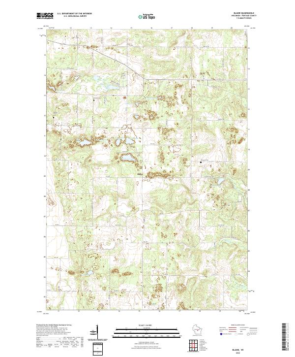 2022 Blaine2022 Print · USGSPortage County’s glacial lake country is captured here in the early twenty-first century, centered on the community of Blaine. Researchers can trace family history through local burial grounds like Hillside Cem and Elmwood Cem or explore the shores of Wolf Lake and Pickerel Lake.
 - 2022 Map of Almond, 2022 Print
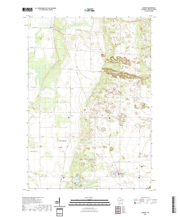 2022 Almond2022 Print · USGSAlmond and the southern Portage County landscape are captured here in the early twenty-first century. Researchers can trace local heritage through numerous burial sites like Spiritland Cem and Guardian Angel Cem or locate the hamlets of Keene and West Almond.
 - 2022 Map of Bancroft, 2022 Print
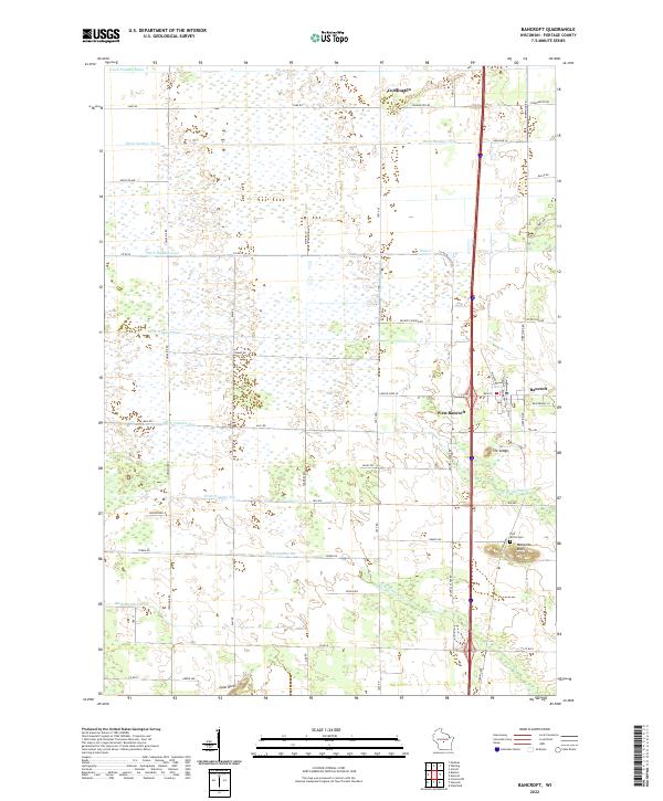 2022 Bancroft2022 Print · USGSPortage County at the start of the 2020s shows a landscape of engineered drainage and quiet rural hubs. Researchers can trace the local road network and find sites like the Pine Grove Cem, Mosquito Bluff, and the settlement of Bancroft.
 - 2022 Map of Arnott, 2022 Print
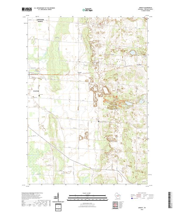 2022 Arnott2022 Print · USGSPortage County’s rural townships are documented here during a period of modern growth and recreational transition. Researchers can trace family history at Saint Mary of Mount Carmel Cem or follow the route of the Tomorrow River State Trl past Arnott and Fancher.
 - 2022 Map of Amherst, 2022 Print
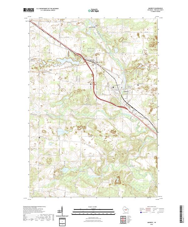 2022 Amherst2022 Print · USGSPortage County’s river valleys and glacial lakes are preserved in this contemporary survey of the Amherst area. Researchers can trace the layout of local cemeteries like Greenwood Cem or follow the route of the Tomorrow River State Trl.
End of results
Showing maps 1-16 of 16
Top cities near Buena Vista
- Stevens Point historical maps
- Plover historical maps
- Stockton historical maps
- Whiting historical maps
- Amherst historical maps
- Alban historical maps
See more
Top neighborhoods of Buena Vista
Frequently asked questions
- What are the different types of historical maps available for Buena Vista?
- What is the oldest map of Buena Vista?
- Where can I purchase historical maps of Buena Vista for my home or office?
- Where can I download high-res historical maps of Buena Vista?
- Are there historical topographic maps available for Buena Vista?
- Is there historical aerial imagery available for Buena Vista?
- Where are historical maps of Buena Vista sourced from?