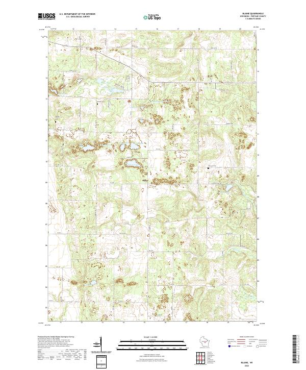
2022 Map of Blaine
USGS Topo · Published 2022About this map
Blaine serves as the central point of this Portage County landscape, where the glacial geography of Wisconsin is visible through a dense cluster of kettle lakes and small waterways. The terrain is defined by numerous named water bodies, including Wolf Lake, Pickerel Lake, and Fountain Lake, which are interconnected by a network of local roads such as Co RD TT and Co RD D. The distribution of these lakes suggests a landscape heavily influenced by post-glacial drainage, with Emmons Cr and Minery Cr carving through the eastern sections. Genealogists and local historians will find several burial sites preserved on this sheet, including Hillside Cem near Peters Lake, Buena Vista Cem to the west, and Elmwood Cem situated near the intersection of Co RD TT and 16th RD. The land is divided into the townships of T22N and T21N, reflecting the established Public Land Survey System grid that organizes the rural farmsteads and lakeside properties.
Find a feature on this map
62 named features on this map. Tap any name to fly to it.
Don’t see what you’re looking for? This feature index may not catch every label — zoom into the map to look around manually.
Map Details
Editions of this 2022 Blaine Map
This is the sole edition of this map. No revisions or reprints were ever made.
Other maps of this area

1955 · Green Bay
USGS Topo · 1:250,000

1957 · Amherst
USGS Topo · 1:48,000

1957 · Waupaca
USGS Topo · 1:48,000

1959 · Wautoma
USGS Topo · 1:48,000

1961 · Redgranite
USGS Topo · 1:62,500

1961 · Wild Rose
USGS Topo · 1:24,000

1968 · Plainfield
USGS Topo · 1:24,000
1968 · Wautoma NE
USGS Topo · 1:24,000
1969 · King
USGS Topo · 1:24,000
1969 · Blaine
USGS Topo · 1:24,000