
1961 Map of Wild Rose
USGS Topo · Published 1966About this map
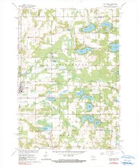
Glacial topography defines the village of Wild Rose and the surrounding townships of Springwater and Mount Morris in the early 1960s. The landscape is a dense cluster of kettle lakes and springs, including Kusel Lake, Silver Lake, and the expansive Pine Lake, which supports recreational sites like the Lutheran Camp. The Wild Rose State Fish Hatchery is located along the western edge of the village near Humphrey Creek, signaling the importance of the local watershed to both conservation and local industry.
Find a feature on this map
49 named features on this map. Tap any name to fly to it.
Don’t see what you’re looking for? This feature index may not catch every label — zoom into the map to look around manually.
Map Details
Editions of this 1961 Wild Rose Map
2 editions found
Other maps of this area

1955 · Green Bay
USGS Topo · 1:250,000

1957 · Amherst
USGS Topo · 1:48,000

1957 · Waupaca
USGS Topo · 1:48,000

1959 · Wautoma
USGS Topo · 1:48,000

1961 · Redgranite
USGS Topo · 1:62,500

1961 · Saxeville
USGS Topo · 1:24,000
1961 · Redgranite
USGS Topo · 1:24,000

1961 · Spring Lake
USGS Topo · 1:24,000
1968 · Wautoma
USGS Topo · 1:24,000
1968 · Wautoma NE
USGS Topo · 1:24,000