1970s Maps of Worcester, Wisconsin
Explore 2 historic maps of Worcester from the 1970s. These maps offer a rare glimpse into what life looked like during the 1970s — showing old roads, neighborhoods, homes, and landmarks that have changed or disappeared over time.
Whether you're researching your family's past, planning a metal detecting trip, or studying how Worcester's landscape evolved across the 1970s, these high-resolution maps are a powerful tool for exploring the history of this region.
- Focus on a specific era: All maps on this page are from the 1970s, giving you a focused view of this time period.
- See what’s changed: Compare century-old streets, trails, and buildings to today's modern landscape using overlays and satellite layers.
- Research with precision: Use these maps for genealogy, historical research, land use analysis, or educational projects.
- View, download, or print: Maps are fully viewable online in high resolution, and can be downloaded or printed for your own records.
Start exploring Worcester's history through authentic maps from the 1970s. This is your window into the past.
Worcester, WI maps
(2)- 1971 Map of Pike Lake SW, 1973 Print
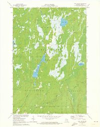 1971 Pike Lake SW1973 Print · USGSPrice County, Wisconsin, is shown here in the early 1970s, at a time when the Northwoods remained a dense expanse of timber and water. Outdoor researchers can trace the shorelines of Wilson Flowage and Riley Lake or locate early mineral sites like the local Gravel Pit.3 unique versions available
 - 1979 Map of Dover, 1985 Print
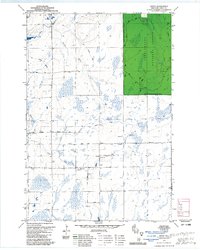 1979 Dover1985 Print · USGSPrice County in the late 1970s is shown here as a landscape of timber, wetlands, and scattered rural settlements. Researchers can trace the path of the Old Railroad Grade or locate local landmarks like the Emery Cem and the Dover Townhall.3 unique versions available
End of results
Showing maps 1-2 of 2
Top cities near Worcester
- Park Falls historical maps
- Worcester historical maps
- Phillips historical maps
- Fifield historical maps
- Ogema historical maps
- Prentice historical maps
See more
Top neighborhoods of Worcester
Frequently asked questions
- What are the different types of historical maps available for Worcester?
- What is the oldest map of Worcester?
- Where can I purchase historical maps of Worcester for my home or office?
- Where can I download high-res historical maps of Worcester?
- Are there historical topographic maps available for Worcester?
- Is there historical aerial imagery available for Worcester?
- Where are historical maps of Worcester sourced from?