Old Maps of Racine County, Wisconsin for Academic Research
Study the evolution of Racine County with 53 high-resolution historic maps. Whether you're teaching, researching, or modeling changes in land use, these maps provide essential visual documentation of urban, environmental, and geographic change.
- Analyze long-term change: Track patterns in development, transportation, and natural features.
- Ideal for environmental or urban studies: Support academic projects with primary historical map data.
- Use in the classroom or lab: Educators and researchers rely on these maps to bring historical context to life.
These maps are a powerful tool for teaching, research, and visualizing how Racine County has changed over the decades.
Racine County, WI maps
(53)- 1891 Map of Bayview
 1891 Bayview1891 Print · USGSSouthern Wisconsin at the close of the nineteenth century reveals a landscape of burgeoning rail corridors and quiet farming townships along the Lake Michigan shore. Genealogists and local historians can trace early settlements like Paynesville, Caledonia, and Franksville.2 unique versions available
 - 1891 Map of Muskego, 1896 Print
 1891 Muskego1896 Print · USGSSoutheast Wisconsin in the early 1890s was a landscape of expansive lake systems and rural townships connected by early rail and river routes. Genealogists can trace family holdings and vanished crossroads like Big Bend, Prospect Hill, and Denoon.
 - 1892 Map of Racine
 1892 Racine1892 Print · USGSSoutheastern Wisconsin's lakeshore was a hub of rail and river industry at the close of the nineteenth century. Genealogists and historians can trace the early street grids of Racine and Kenosha or locate vanished rail stops at Western Union Junction and Windsor.2 unique versions available
 - 1892 Map of Eagle
 1892 Eagle1892 Print · USGSSoutheast Wisconsin's glaciated landscape is captured here in the late nineteenth century as new rail lines transformed the frontier into a network of dairy and mill towns. Genealogists can trace early homesteads and rail stops like Genesee Depot, Caldwell Prairie, and Eagleville near the shores of Phantom Lake.
 - 1893 Map of Silver Lake
 1893 Silver Lake1893 Print · USGSSoutheastern Wisconsin at the end of the nineteenth century is a land of emerging rail hubs and numerous glacial lakes. You can trace the path of the Chicago Milwaukee and St. Paul Railroad through Union Grove or explore the water-rich landscape around Silver Lake and Camp Lake.2 unique versions available
 - 1893 Map of Geneva
 1893 Geneva1893 Print · USGSSoutheastern Wisconsin thrived as a rail and lakeside hub in the 1890s. Genealogists and historians can trace old homesteads near Geneva, Slades Corners, and Springfield, or follow the routes of the Wisconsin Central Railroad.2 unique versions available
 - 1894 Map of Eagle
 1894 Eagle1894 Print · USGSSoutheast Wisconsin in the late nineteenth century was defined by a thriving rail network and glacial lake landscapes. Researchers can trace the early footprints of settlements like Genesee and East Troy alongside the Fox River and the Wisconsin Central Railroad.
 - 1897 Map of Eagle
 1897 Eagle1897 Print · USGSSoutheast Wisconsin in the late nineteenth century was a landscape of thriving rail-side villages and interconnected kettle lakes. Genealogists and researchers can trace early homesteads and rail stops like Genesee Depot, North Prairie, and the bustling lakefront at Mukwonago.
 - 1901 Map of Bayview
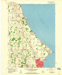
 1901 Bayview1901 Print · USGSThe Lake Michigan shoreline south of Milwaukee comes alive in the late Victorian era as industry and rail lines expand. Trace early coastal growth in Cudahy and South Milwaukee, or locate old interior settlements like New Coeln, Kilbournville, and Lamberton P.O..4 unique versions available
 - 1901 Map of Muskego
 1901 Muskego1901 Print · USGSSoutheastern Wisconsin at the close of the nineteenth century was a landscape of budding dairy hubs and interconnected glacial lakes. Researchers can trace early rural life across these townships, finding legacy sites like Union Church, the path of the Wisconsin Central Railroad, and original footprints for Tess Corners and Big Bend.4 unique versions available
 - 1904 Map of Lake Geneva, 1955 Print
 1904 Lake Geneva1955 Print · USGSSoutheast Wisconsin at the turn of the century shows a landscape defined by its great lakes and a dense network of competing rail lines. Genealogists and local historians can trace the early village footprints of Burlington, Genoa Junction, and Spring Prairie along the White River.
 - 1905 Map of Racine
 1905 Racine1905 Print · USGSCoastal Wisconsin at the turn of the century is defined by its industrial lakefront and a dense web of competing rail lines. Researchers can trace the early city footprints of Racine and Kenosha alongside rail junctions like Corliss and Ranney.3 unique versions available
 - 1906 Map of Eagle
 1906 Eagle1906 Print · USGSSoutheastern Wisconsin's glaciated terrain is remarkably detailed in this early century survey of the Fox River valley. Genealogists and local historians can trace the early rail-stop settlements of Genesee Depot, North Prairie, and Eagleville alongside landmarks like Lake Beulah and Honey Creek.6 unique versions available
 - 1906 Map of Silver Lake
 1906 Silver Lake1906 Print · USGSSoutheastern Wisconsin at the turn of the century shows a landscape of glacial lakes and critical rail junctions during its peak dairy era. Genealogists and historians can trace the early layouts of Union Grove, Salem, and Wilmot alongside the routes of the Wisconsin Central Railroad.3 unique versions available
 - 1906 Map of Lake Geneva
 1906 Lake Geneva1906 Print · USGSSoutheastern Wisconsin's glacial landscape is fully developed as a premier resort and rail hub in the early 1900s. Researchers can trace the early grids of Lake Geneva and Burlington or locate old rail stops at Genoa Junction and Springfield.4 unique versions available
 - 1954 Map of Rockford
 1954 Rockford1954 Print · USGSThe Rock River valley and the Illinois-Wisconsin borderlands are captured here in the mid-1950s during a period of robust industrial and agricultural activity. Genealogists and historians can trace rail-era corridors like the Illinois Central RR and locate landmarks from Big Foot Prairie to Lake Geneva.
 - 1955 Map of Rockford
 1955 Rockford1955 Print · USGSThe Rock River valley and southern Wisconsin dairy country are shown here in the mid-fifties as the region's manufacturing centers grew. Genealogists and historians can trace the paths of the Chicago and North Western RR and Illinois Central RR through hubs like Rockford and Beloit.
 - 1958 Map of Racine North, 1960 Print
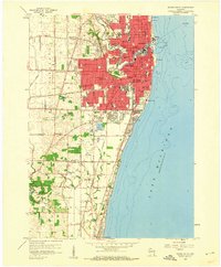
 1958 Racine North1960 Print · USGSNear the Lake Michigan shore in the late fifties, the northern outskirts of Racine show a landscape of growing suburbs and enduring farmsteads. Genealogists can trace family names at St Matthews Cem or locate community centers like Scanlon Sch and Tabor.3 unique versions available
 - 1958 Map of Racine South, 1960 Print
 1958 Racine South1960 Print · USGSRacine and its southern lakefront suburbs are caught at a mid-century peak of rail activity and community expansion. Researchers can trace family sites at Mound Cemetery or locate the old Chicago North Shore and Milwaukee line.3 unique versions available
 - 1958 Map of South Milwaukee, 1960 Print
 1958 South Milwaukee1960 Print · USGSCoastal Milwaukee County and northern Racine County show a landscape of rapid mid-century development and heavy industry along Lake Michigan. Researchers can trace the layout of family-named roads and rural schools like Caddy Vista Sch, alongside major landmarks like General Mitchell Field and Paynesville Chapel.2 unique versions available
 - 1958 Map of Franksville, 1960 Print
 1958 Franksville1960 Print · USGSThe Racine-Milwaukee county line and the winding Root River meet here in the late fifties, showcasing a landscape of rural schoolhouses and rail lines. Genealogists and local historians can trace family roots at Paynesville Chapel, Independent Cem, or across the crossroads of Kilbournville and Husher.4 unique versions available
 - 1958 Map of Racine, 1971 Print
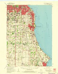
 1958 Racine1971 Print · USGSThe Lake Michigan shoreline in the late fifties was a study in contrasts between the industrial bustle of Kenosha and the quiet woods of the Allegan State Forest. Genealogists and historians can trace the urban footprint of Evanston or locate strategic sites like Fort Sheridan and the Wind Point Light.3 unique versions available
 - 1958 Map of Rockford, 1974 Print
 1958 Rockford1974 Print · USGSNorthern Illinois and southern Wisconsin are shown here in the mid-twentieth century as rail-dependent industrial towns began to interface with growing lakefront communities. Genealogists can trace family roots through settlements like Saylesville and Tess Corners or locate historical landmarks like the Rockford Ordnance Depot.4 unique versions available
 - 1959 Map of North Cape, 1960 Print
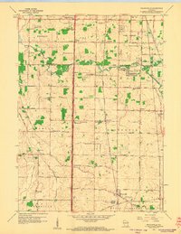
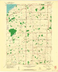 1959 North Cape1960 Print · USGSSoutheast Wisconsin farming townships at the end of the fifties show a landscape of small rural crossroads and family homesteads. Genealogists can locate legacy sites like Union Church, Oak Grove Cem, and several local schools from Apple Sch to Garfield Sch.3 unique versions available
 - 1959 Map of Waterford, 1960 Print
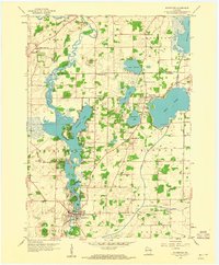 1959 Waterford1960 Print · USGSWaterford and the surrounding Fox River valley are captured in the late fifties as lakeside communities and rural drainage networks reshaped the terrain. Genealogists and local historians can trace family ties at Rural Home Cem, visit the site of the Colonel Heg Sch, or explore the mid-century streets of Tichigan.4 unique versions available
Showing maps 1-25 of 53
Top cities of Racine County
- Racine historical maps
- Mount Pleasant historical maps
- Caledonia historical maps
- Burlington historical maps
- Sturtevant historical maps
- Union Grove historical maps
See more
Frequently asked questions
- What are the different types of historical maps available for Racine County?
- What is the oldest map of Racine County?
- Where can I purchase historical maps of Racine County for my home or office?
- Where can I download high-res historical maps of Racine County?
- Are there historical topographic maps available for Racine County?
- Is there historical aerial imagery available for Racine County?
- Where are historical maps of Racine County sourced from?