1970s Maps of Forest, Wisconsin
Explore 5 historic maps of Forest from the 1970s. These maps offer a rare glimpse into what life looked like during the 1970s — showing old roads, neighborhoods, homes, and landmarks that have changed or disappeared over time.
Whether you're researching your family's past, planning a metal detecting trip, or studying how Forest's landscape evolved across the 1970s, these high-resolution maps are a powerful tool for exploring the history of this region.
- Focus on a specific era: All maps on this page are from the 1970s, giving you a focused view of this time period.
- See what’s changed: Compare century-old streets, trails, and buildings to today's modern landscape using overlays and satellite layers.
- Research with precision: Use these maps for genealogy, historical research, land use analysis, or educational projects.
- View, download, or print: Maps are fully viewable online in high resolution, and can be downloaded or printed for your own records.
Start exploring Forest's history through authentic maps from the 1970s. This is your window into the past.
Forest, WI maps
(5)- 1975 Map of Stillwater
 1975 Stillwater1975 Print · USGSThe Twin Cities and the St. Croix Valley are captured in the mid-seventies, showing the urban growth of Minneapolis and St Paul. Researchers can trace old rail corridors of the Northern Pacific RR and locate tribal lands at the Mille Lacs Indian Reservation.2 unique versions available
 - 1975 Map of Forest, 1978 Print
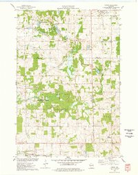 1975 Forest1978 Print · USGSWisconsin's western dairy and wetlands country is mapped here in the mid-seventies, highlighting the rural communities of St. Croix and Polk Counties. Trace the Chicago and North Western rail line and conservation sites like the Cylon State Public Hunting Grounds.
 - 1975 Map of Emerald, 1978 Print
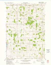 1975 Emerald1978 Print · USGSEmerald and Cylon appear in the mid-seventies as classic Wisconsin dairy settlements defined by their rivers and former rail corridors. Researchers can trace local lineage at Holy Rosary Cem and Greenwood Cem or follow the path of the Old Railroad Grade.
 - 1975 Map of Graytown, 1978 Print
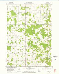 1975 Graytown1978 Print · USGSSmall farming settlements and the headwaters of the Willow River define this western Wisconsin region in the mid-seventies. Genealogists can trace family footprints at Sunnyside Sch, Reeve, and the Old Grade Railroad.
 - 1975 Map of Glenwood City, 1978 Print
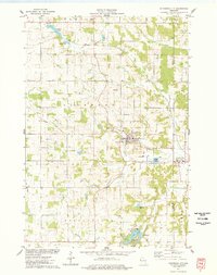 1975 Glenwood City1978 Print · USGSGlenwood City and the surrounding borderlands of St. Croix and Dunn counties are shown here in the mid-seventies, just as regional recreation was expanding. Trace the industrial landscape through various Gravel Pits or locate local landmarks like the Fairground, St Johns Cem, and the village of Downing.
End of results
Showing maps 1-5 of 5
Top cities near Forest
- Baldwin historical maps
- Amery historical maps
- Town of Lincoln historical maps
- Hammond historical maps
- Woodville historical maps
- Glenwood City historical maps
See more
Frequently asked questions
- What are the different types of historical maps available for Forest?
- What is the oldest map of Forest?
- Where can I purchase historical maps of Forest for my home or office?
- Where can I download high-res historical maps of Forest?
- Are there historical topographic maps available for Forest?
- Is there historical aerial imagery available for Forest?
- Where are historical maps of Forest sourced from?