1970s Maps of Sumpter, Wisconsin
Explore 6 historic maps of Sumpter from the 1970s. These maps offer a rare glimpse into what life looked like during the 1970s — showing old roads, neighborhoods, homes, and landmarks that have changed or disappeared over time.
Whether you're researching your family's past, planning a metal detecting trip, or studying how Sumpter's landscape evolved across the 1970s, these high-resolution maps are a powerful tool for exploring the history of this region.
- Focus on a specific era: All maps on this page are from the 1970s, giving you a focused view of this time period.
- See what’s changed: Compare century-old streets, trails, and buildings to today's modern landscape using overlays and satellite layers.
- Research with precision: Use these maps for genealogy, historical research, land use analysis, or educational projects.
- View, download, or print: Maps are fully viewable online in high resolution, and can be downloaded or printed for your own records.
Start exploring Sumpter's history through authentic maps from the 1970s. This is your window into the past.
Sumpter, WI maps
(6)- 1974 Map of Baraboo NW, 1976 Print
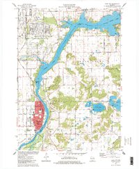
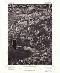 1974 Baraboo NW1976 Print · USGSThe city of Baraboo and the surrounding Wisconsin countryside are shown at the height of the 1970s through this aerial photographic survey. Researchers can trace the path of the Baraboo River or examine the shoreline of Devils Lake.
 - 1974 Map of Baraboo SW, 1976 Print
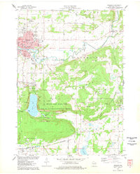
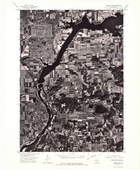 1974 Baraboo SW1976 Print · USGSWisconsin riverfront life and mid-seventies agricultural patterns are frozen in time on this detailed orthophoto. Researchers can trace the street-level growth of Prairie Du Sac and the winding course of the Wisconsin River.
 - 1975 Map of North Freedom NE, 1976 Print
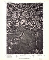 1975 North Freedom NE1976 Print · USGSSauk County's rural heartland is visible in the mid-seventies, showing the agricultural patterns and small-town footprints of central Wisconsin. Researchers can trace the path of the Baraboo River as it passes near North Freedom and the growing outskirts of Baraboo.2 unique versions available
 - 1975 Map of North Freedom SE, 1976 Print
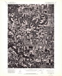 1975 North Freedom SE1976 Print · USGSSauk County’s agricultural and industrial landscape is captured in the mid-seventies in this detailed aerial survey. Researchers can trace land use patterns near Badger or locate the site of the Lodi Mill amidst the rolling farm acreage.2 unique versions available
 - 1975 Map of Sauk City, 1978 Print
 1975 Sauk City1978 Print · USGSThe Wisconsin River valley in the mid-seventies shows a landscape shaped by military industry and rail transport. Researchers can trace the massive Badger Army Ammunition Plant or locate the village of Merrimac near the Wiegands Bay shoreline.
 - 1975 Map of Baraboo, 1978 Print
 1975 Baraboo1978 Print · USGSBaraboo and the surrounding driftless terrain are captured here in the mid-1970s, showing the city's growth alongside significant conservation lands. Genealogists and hikers can trace old family plots like Zuch Cem or explore the preserved topography of Devils Lake State Park and the Baraboo Range.2 unique versions available
End of results
Showing maps 1-6 of 6
Top cities near Sumpter
- Madison historical maps
- Baraboo historical maps
- Reedsburg historical maps
- Prairie du Sac historical maps
- Lake Delton historical maps
- Sauk City historical maps
See more
Top neighborhoods of Sumpter
Frequently asked questions
- What are the different types of historical maps available for Sumpter?
- What is the oldest map of Sumpter?
- Where can I purchase historical maps of Sumpter for my home or office?
- Where can I download high-res historical maps of Sumpter?
- Are there historical topographic maps available for Sumpter?
- Is there historical aerial imagery available for Sumpter?
- Where are historical maps of Sumpter sourced from?