2020s Maps of Troy, Wisconsin
Explore 4 historic maps of Troy from the 2020s. These maps offer a rare glimpse into what life looked like during the 2020s — showing old roads, neighborhoods, homes, and landmarks that have changed or disappeared over time.
Whether you're researching your family's past, planning a metal detecting trip, or studying how Troy's landscape evolved across the 2020s, these high-resolution maps are a powerful tool for exploring the history of this region.
- Focus on a specific era: All maps on this page are from the 2020s, giving you a focused view of this time period.
- See what’s changed: Compare century-old streets, trails, and buildings to today's modern landscape using overlays and satellite layers.
- Research with precision: Use these maps for genealogy, historical research, land use analysis, or educational projects.
- View, download, or print: Maps are fully viewable online in high resolution, and can be downloaded or printed for your own records.
Start exploring Troy's history through authentic maps from the 2020s. This is your window into the past.
Troy, WI maps
(4)- 2022 Map of Black Hawk, 2022 Print
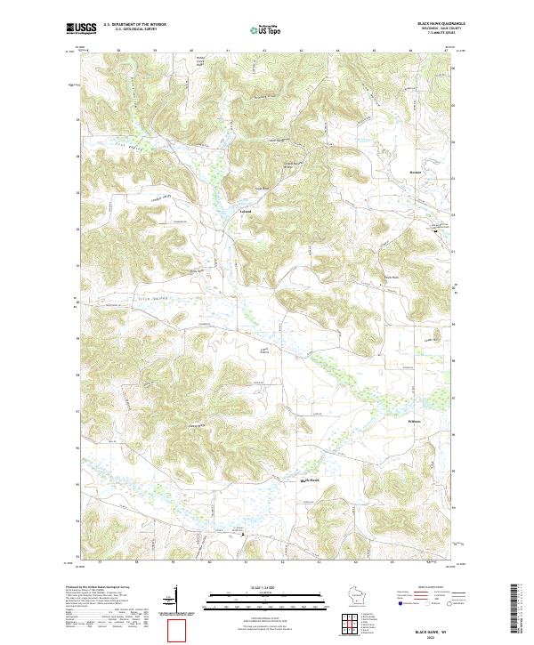 2022 Black Hawk2022 Print · USGSSauk County's rural heartland is captured here in the early twenty-first century, showing the enduring network of valleys and crossroads. Genealogists and local historians can trace family ties through Union Grove Cem, the landmark Leland Natural Bridge, and the community of Witwen.
 - 2022 Map of Sauk Prairie, 2022 Print
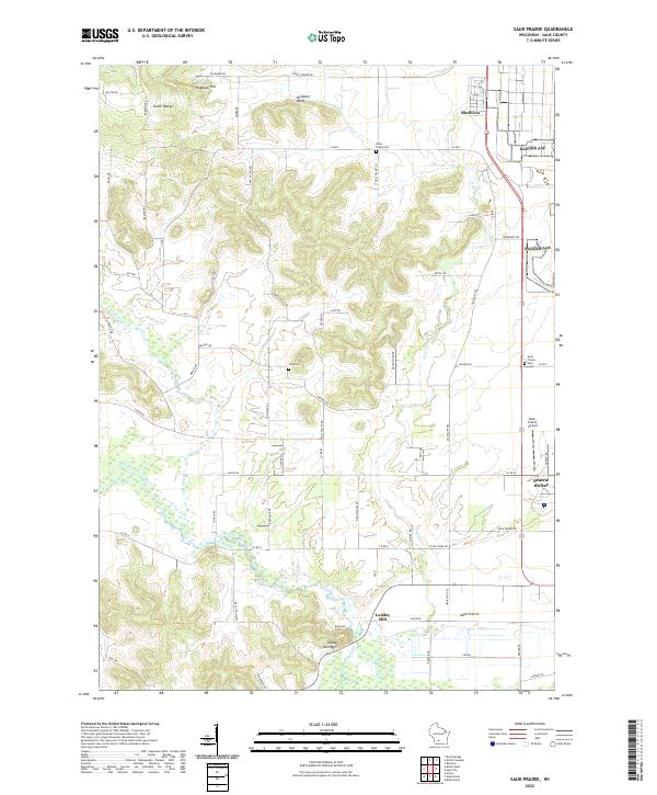 2022 Sauk Prairie2022 Print · USGSSauk County's glacial plains and high ridges are shown in modern detail as they transition from the heights of the South Range down to the Wisconsin River. Genealogists and local historians can locate several rural burial grounds including Otter Creek Cem and Zion Cem, or trace the old roads surrounding Loddes Mill and Bluffview.
 - 2022 Map of Arena, 2022 Print
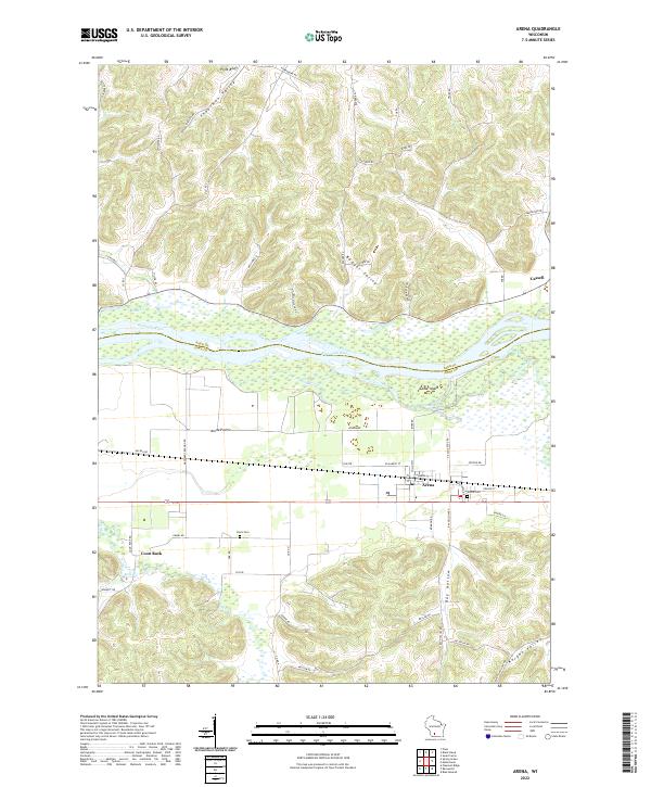 2022 Arena2022 Print · USGSThe Wisconsin River valley comes into sharp focus here as it divides Sauk and Iowa Counties. Researchers can trace the layout of Arena and Cassell, locate family plots at Arena Cem or Davis Cem, and explore landmarks like Coon Rock.
 - 2022 Map of Mazomanie, 2022 Print
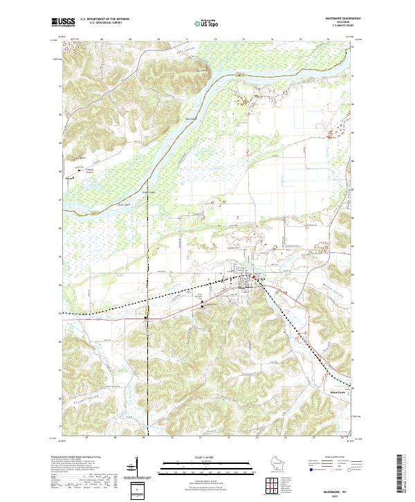 2022 Mazomanie2022 Print · USGSThe Wisconsin River valley and the village of Mazomanie are shown in detail as they appeared in the early 2020s. Researchers can trace local lineage through Saint Barnabas Cem, locate the site of Dover, or explore the terrain of Ferry Bluff.
End of results
Showing maps 1-4 of 4
Top cities near Troy
- Baraboo historical maps
- Mount Horeb historical maps
- Prairie du Sac historical maps
- Sauk City historical maps
- Roxbury historical maps
- Black Earth historical maps
See more
Top neighborhoods of Troy
Frequently asked questions
- What are the different types of historical maps available for Troy?
- What is the oldest map of Troy?
- Where can I purchase historical maps of Troy for my home or office?
- Where can I download high-res historical maps of Troy?
- Are there historical topographic maps available for Troy?
- Is there historical aerial imagery available for Troy?
- Where are historical maps of Troy sourced from?