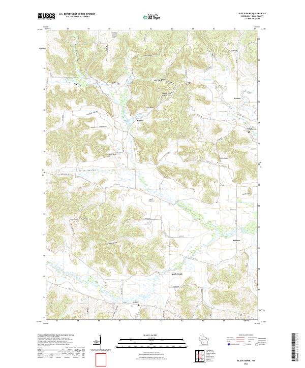
2022 Map of Black Hawk
USGS Topo · Published 2022About this map
The North Branch Honey Creek and its various forks define the drainage and settlement patterns of this corner of Sauk County. Small communities like Leland and Denzer are linked by a network of rural routes including Co Rd C and Co Rd PF, tracing the natural paths through valleys such as Irish Valley and Sandpit Valley. The landscape is punctuated by distinct geologic formations, most notably the Leland Natural Bridge and the prominent elevations of Pillar Rock and Tower Rock.
Find a feature on this map
74 named features on this map. Tap any name to fly to it.
Don’t see what you’re looking for? This feature index may not catch every label — zoom into the map to look around manually.
Map Details
Editions of this 2022 Black Hawk Map
This is the sole edition of this map. No revisions or reprints were ever made.
Other maps of this area

1901 · Denzer
USGS Topo · 1:62,500

1905 · Richland Center
USGS Topo · 1:125,000

1920 · Blue Mounds
USGS Topo · 1:62,500

1922 · Blue Mounds
USGS Topo · 1:62,500

1957 · Madison
USGS Topo · 1:250,000

1958 · North Freedom
USGS Topo · 1:62,500

1958 · La Crosse
USGS Topo · 1:250,000

1960 · Madison
USGS Topo · 1:250,000

1960 · Plain
USGS Topo · 1:62,500

1960 · Spring Green
USGS Topo · 1:62,500