Old Maps of Cassell, Troy for Genealogy
Trace your family roots with 12 historic maps of Cassell. These high-res maps reveal old neighborhoods, homesites, landmarks, and streets — helping you uncover where your ancestors lived and how the area evolved over time.
- Explore historic neighborhoods: Identify where your relatives may have lived in the 1800s or 1900s.
- Compare maps over time: Trace the changes in streets, buildings, and landmarks for multi-generational research.
- Perfect for genealogy & ancestry research: Used by family historians and researchers to map out lineage and migration.
These maps are an incredible resource for exploring your personal connection to Cassell's past.
Cassell, Troy maps
(12)- 1920 Map of Blue Mounds, 1959 Print
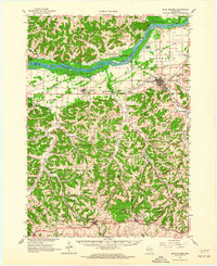
 1920 Blue Mounds1959 Print · USGSThe Driftless Area of Dane and Iowa counties comes to life in the years following the Great War, showing a landscape of ridge-top towns and river-valley rails. Genealogists can locate dozens of rural landmarks, from the Hyde Church to schools like Seitz School and Larsonville School.
 - 1922 Map of Blue Mounds
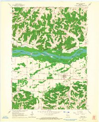
 1922 Blue Mounds1922 Print · USGSThe Wisconsin River valley and the Driftless Area uplands meet here in the early nineteen-twenties, showing a landscape defined by rail corridors and rural school districts. Researchers can pinpoint historic family landmarks like Hyde Church, the Coon Rock Mill, and Fairview School.3 unique versions available
 - 1957 Map of Madison, 1967 Print
 1957 Madison1967 Print · USGSSouth-central Wisconsin in the mid-fifties reveals a landscape of industrial hubs and glacial lakes linked by a dense rail and highway network. Genealogists and historians can trace the development of lakeside communities and find notable sites like Badger Ordnance Works and the Horicon National Wildlife Refuge.3 unique versions available
 - 1960 Map of Madison
 1960 Madison1960 Print · USGSCentral and Southern Wisconsin are captured in the late fifties, showing the region as its rail-and-river network matured. Trace the paths of the Soo Line RR or locate family roots near Lake Mendota and Horicon National Wildlife Refuge.2 unique versions available
 - 1962 Map of Blue Mounds, 1964 Print
 1962 Blue Mounds1964 Print · USGSThe Wisconsin River valley and the driftless hills of Dane County are captured here in the early sixties. Genealogists and hikers can trace old ridge roads to Little Norway, the White Church Cem, and the underground wonders of Cave of the Mounds.3 unique versions available
 - 1962 Map of Arena, 1964 Print
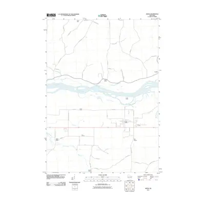
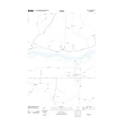
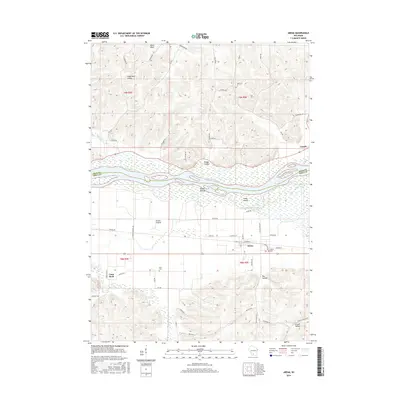
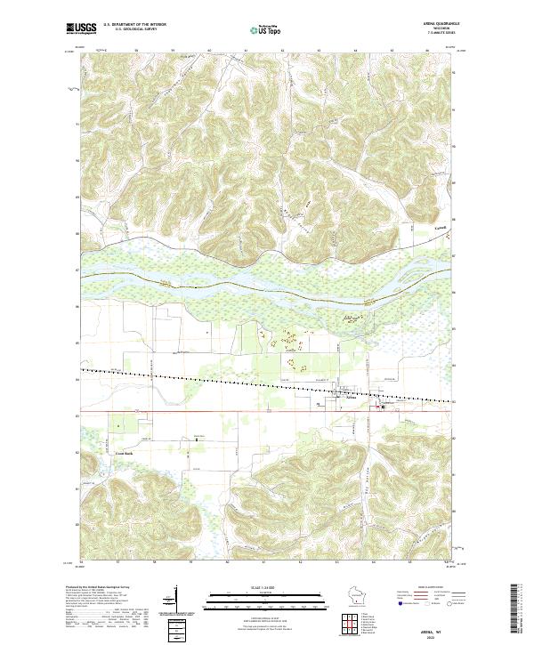
 1962 Arena1964 Print · USGSIowa and Sauk Counties are captured in the early sixties as the rail-and-river economy defined local life. Researchers can trace family roots at Arena Cem and Davis Cem or locate old landmarks like Coon Rock Cave and Cassell.2 unique versions available
 - 1991 Map of Madison
 1991 Madison1991 Print · USGSMadison and its iconic glacial lakes are captured here during a time of steady urban expansion and regional growth. Researchers can trace the mid-century development of the University of Wisconsin, locate family sites near Forest Hill Cem, or explore the footprint of the Badger Army Ammunition Plant.
 - 2010 Map of Arena, 2010 Print
 2010 Arena2010 Print · USGSCovers Cassell, including Arena, Arena, and other nearby areas
 - 2013 Map of Arena, 2013 Print
 2013 Arena2013 Print · USGSCovers Cassell, including Arena, Arena, and other nearby areas
 - 2016 Map of Arena, 2016 Print
 2016 Arena2016 Print · USGSCovers Cassell, including Arena, Arena, and other nearby areas
 - 2018 Map of Arena, 2018 Print
 2018 Arena2018 Print · USGSCovers Cassell, including Arena, Arena, and other nearby areas
 - 2022 Map of Arena, 2022 Print
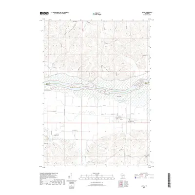
 2022 Arena2022 Print · USGSThe Wisconsin River valley comes into sharp focus here as it divides Sauk and Iowa Counties. Researchers can trace the layout of Arena and Cassell, locate family plots at Arena Cem or Davis Cem, and explore landmarks like Coon Rock.
End of results
Showing maps 1-12 of 12
Top cities near Cassell
- Mount Horeb historical maps
- Cross Plains historical maps
- Prairie du Sac historical maps
- Sauk City historical maps
- Town of Springdale historical maps
- Town of Roxbury historical maps
See more
Frequently asked questions
- What are the different types of historical maps available for Cassell?
- What is the oldest map of Cassell?
- Where can I purchase historical maps of Cassell for my home or office?
- Where can I download high-res historical maps of Cassell?
- Are there historical topographic maps available for Cassell?
- Is there historical aerial imagery available for Cassell?
- Where are historical maps of Cassell sourced from?