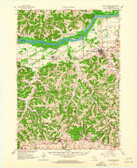
1962 Map of Blue Mounds
USGS Topo · Published 1964About this map
The Wisconsin River carves a dramatic northern boundary for this 1960s study, dotted with islands like Otter Island and Cedar Island before opening into the driftless hills of Dane and Iowa counties. To the south, the terrain rises sharply toward the prominence of Blue Mounds and the adjacent Blue Mounds State Park, a landscape defined by significant subterranean features including Cave of the Mounds and Lost River Cave. This era shows a rural network where small dairy farms and crossroad hamlets like Elvers and Barneveld are connected by the Chicago and North Western railroad.
Find a feature on this map
90 named features on this map. Tap any name to fly to it.
Don’t see what you’re looking for? This feature index may not catch every label — zoom into the map to look around manually.
Map Details
Editions of this 1962 Blue Mounds Map
3 editions found
Other maps of this area

1895 · Baraboo
USGS Topo · 1:62,500

1901 · Denzer
USGS Topo · 1:62,500

1902 · Mineral Point
USGS Topo · 1:125,000

1905 · Richland Center
USGS Topo · 1:125,000

1907 · Cross Plains
USGS Topo · 1:62,500

1908 · Baraboo
USGS Topo · 1:62,500

1909 · Cross Plains
USGS Topo · 1:62,500

1920 · Blue Mounds
USGS Topo · 1:62,500

1922 · Blue Mounds
USGS Topo · 1:62,500

1923 · Blanchardville
USGS Topo · 1:62,500