2020s Maps of Hayward, Wisconsin
Explore 6 historic maps of Hayward from the 2020s. These maps offer a rare glimpse into what life looked like during the 2020s — showing old roads, neighborhoods, homes, and landmarks that have changed or disappeared over time.
Whether you're researching your family's past, planning a metal detecting trip, or studying how Hayward's landscape evolved across the 2020s, these high-resolution maps are a powerful tool for exploring the history of this region.
- Focus on a specific era: All maps on this page are from the 2020s, giving you a focused view of this time period.
- See what’s changed: Compare century-old streets, trails, and buildings to today's modern landscape using overlays and satellite layers.
- Research with precision: Use these maps for genealogy, historical research, land use analysis, or educational projects.
- View, download, or print: Maps are fully viewable online in high resolution, and can be downloaded or printed for your own records.
Start exploring Hayward's history through authentic maps from the 2020s. This is your window into the past.
Hayward, WI maps
(6)- 2022 Map of Bean Lake, 2022 Print
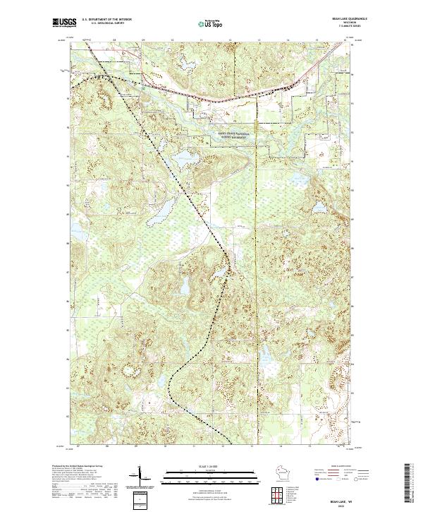 2022 Bean Lake2022 Print · USGSNorthern Wisconsin lake country and the protected river corridor are documented here in the early twenty-first century. Genealogists and researchers can trace the hydrology and family-named routes around Bean Lake, Tripp Lake, and the Saint Croix National Wild and Scenic Riverway.
 - 2022 Map of Reserve, 2022 Print
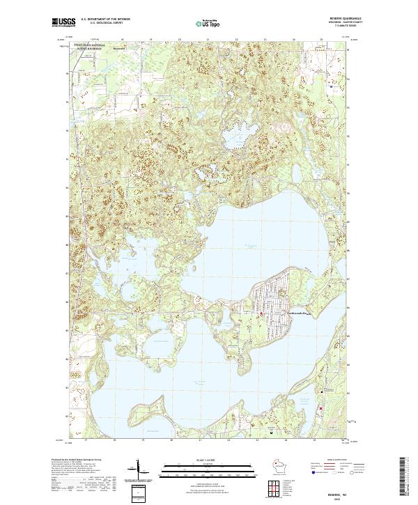 2022 Reserve2022 Print · USGSSawyer County's lake country is captured here in the early twenty-first century, showing the established shorelines of Lac Courte Oreilles and Grindstone Lake. Researchers can locate Saint Francis Solanus Cem and trace the residential growth of Northwoods Beach.
 - 2022 Map of Hayward, 2022 Print
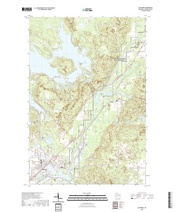 2022 Hayward2022 Print · USGSThe Northwoods around Hayward were well-established as a hub for both civic life and river recreation by the 2020s. Genealogists and historians can trace local roots through the Indian Cem, the Sawyer County Courthouse, and the settlement at Phipps.
 - 2022 Map of Seeley, 2022 Print
 2022 Seeley2022 Print · USGSSawyer County in the early twenty-first century is a landscape of glacial lakes and protected riverways near the village of Seeley. Genealogists and outdoor historians can trace family sites at Riverside Cem or navigate the shores of Round Lake and McClaine Lake.
 - 2022 Map of Stanberry East, 2022 Print
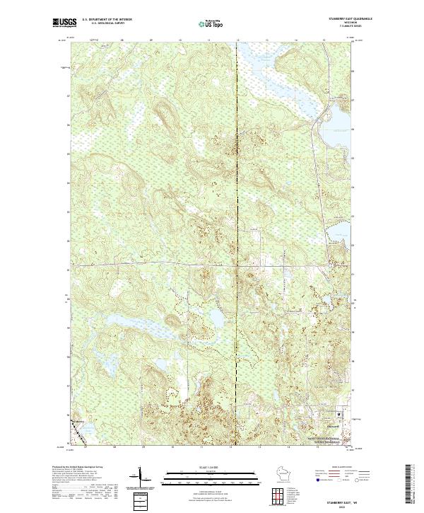 2022 Stanberry East2022 Print · USGSThe borderlands of Washburn and Sawyer counties come alive in this recent survey of the lake country. Researchers can trace family sites near Greenwood Cem or explore the vast wetlands of Kissick Swamp and the shores of Nelson Lake.
 - 2023 Map of Chief Lake, 2023 Print
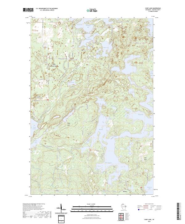 2023 Chief Lake2023 Print · USGSSawyer County’s intricate lake systems and tribal lands are meticulously detailed in this recent survey. Local historians can trace the communities of Reserve and New Post alongside the Lac Courte Oreilles Ojibwa Community College and Round Lake Cem.
End of results
Showing maps 1-6 of 6
Top cities near Hayward
- Hayward historical maps
- Cable historical maps
- Wascott historical maps
- Edgewater historical maps
- Radisson historical maps
- Couderay historical maps
Top neighborhoods of Hayward
Frequently asked questions
- What are the different types of historical maps available for Hayward?
- What is the oldest map of Hayward?
- Where can I purchase historical maps of Hayward for my home or office?
- Where can I download high-res historical maps of Hayward?
- Are there historical topographic maps available for Hayward?
- Is there historical aerial imagery available for Hayward?
- Where are historical maps of Hayward sourced from?