Old Maps of Seeley, Lenroot for Academic Research
Study the evolution of Seeley with 10 high-resolution historic maps. Whether you're teaching, researching, or modeling changes in land use, these maps provide essential visual documentation of urban, environmental, and geographic change.
- Analyze long-term change: Track patterns in development, transportation, and natural features.
- Ideal for environmental or urban studies: Support academic projects with primary historical map data.
- Use in the classroom or lab: Educators and researchers rely on these maps to bring historical context to life.
These maps are a powerful tool for teaching, research, and visualizing how Seeley has changed over the decades.
Seeley, Lenroot maps
(10)- 1944 Map of Hayward, 1965 Print
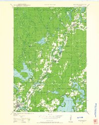 1944 Hayward1965 Print · USGSHayward and the northern Wisconsin lake country are captured here at the close of the Second World War. Researchers can trace the Chicago St Paul Minneapolis and Omaha rail line to find vanished schoolhouses like Sabin Sch and the Indian Sch.
 - 1953 Map of Ashland, 1964 Print
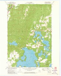
 1953 Ashland1964 Print · USGSNorthern Wisconsin's lakefront and timberlands are seen here in the mid-1950s, showing the intersection of industrial rail lines and vast wilderness. Genealogists and historians can trace the Soo Line through rail towns like Mellen or locate family roots in the Apostle Islands and Bad River Indian Reservation.3 unique versions available
 - 1958 Map of Ashland
 1958 Ashland1958 Print · USGSCoastal Wisconsin and the Michigan borderlands meet here in the late fifties, dominated by the timbered expanses and iron-rich ranges. Genealogists can trace family footprints in settlements like Odanah and Montreal, or locate landmarks such as the Coast Guard Station and Agricultural Experiment Station.
 - 1971 Map of Seeley, 1973 Print
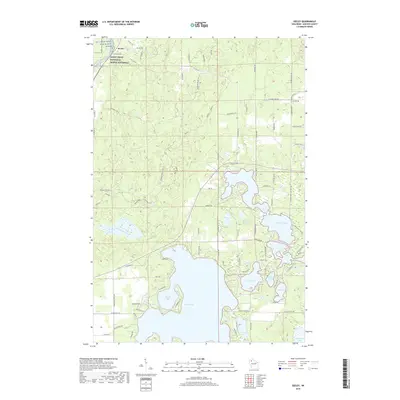
 1971 Seeley1973 Print · USGSSawyer County’s lake country is captured here in the early 1970s, just as modern conservation areas were being formalized. Researchers can locate the Seeley settlement and Chicago and North Western railroad alongside the Namekagon River.2 unique versions available
 - 1980 Map of Solon Springs
 1980 Solon Springs1980 Print · USGSNorthern Wisconsin in the early eighties was a landscape of dense timber and sprawling glacial waters. Trace the legacy of the Chicago and North Western rail line through Solon Springs, Hayward, and Minong at this pivotal moment.
 - 2010 Map of Seeley, 2010 Print
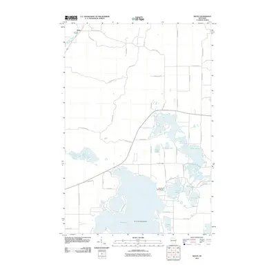 2010 Seeley2010 Print · USGSCovers Seeley, including Hayward, Spider Lake, and other nearby areas
 - 2013 Map of Seeley, 2013 Print
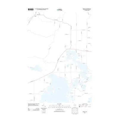 2013 Seeley2013 Print · USGSCovers Seeley, including Hayward, Spider Lake, and other nearby areas
 - 2015 Map of Seeley, 2015 Print
 2015 Seeley2015 Print · USGSCovers Seeley, including Hayward, Spider Lake, and other nearby areas
 - 2019 Map of Seeley, 2019 Print
 2019 Seeley2019 Print · USGSCovers Seeley, including Hayward, Spider Lake, and other nearby areas
 - 2022 Map of Seeley, 2022 Print
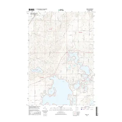
 2022 Seeley2022 Print · USGSSawyer County in the early twenty-first century is a landscape of glacial lakes and protected riverways near the village of Seeley. Genealogists and outdoor historians can trace family sites at Riverside Cem or navigate the shores of Round Lake and McClaine Lake.
End of results
Showing maps 1-10 of 10
Top cities near Seeley
- Hayward historical maps
- Cable historical maps
- Gordon historical maps
- Wascott historical maps
- Drummond historical maps
- Ojibwa historical maps
Frequently asked questions
- What are the different types of historical maps available for Seeley?
- What is the oldest map of Seeley?
- Where can I purchase historical maps of Seeley for my home or office?
- Where can I download high-res historical maps of Seeley?
- Are there historical topographic maps available for Seeley?
- Is there historical aerial imagery available for Seeley?
- Where are historical maps of Seeley sourced from?