Old Maps of Stanberry, Stinnett for Hiking & Exploration
Hike through history with 11 historic maps of Stanberry. Explore old trails, ghost towns, and forgotten backroads — perfect for outdoor adventurers and local explorers.
- Rediscover forgotten places: Map out old mining camps, roads, and footpaths that no longer exist on modern maps.
- Layer with modern tools: Combine with LiDAR or satellite views to plan hikes through historical terrain.
- Made for exploration: Popular among hikers, overlanders, and local history lovers.
Use these maps to find adventure and explore the hidden past of Stanberry.
Stanberry, Stinnett maps
(11)- 1947 Map of Chittamo, 1956 Print
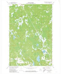
 1947 Chittamo1956 Print · USGSNorthwest Wisconsin's lake country is captured in the mid-1940s, showing a land of dense wetlands and winding river systems. Genealogists and historians can locate rural schoolhouses like Chittamo Sch and trace the original paths of the Totagatic River and Claire River.2 unique versions available
 - 1949 Map of Chittamo
 1949 Chittamo1949 Print · USGSNorthwestern Wisconsin at the end of the 1940s shows a landscape of scattered settlements and winding rivers before modern development. Genealogists and historians can trace family locations near Chittamo Sch, Stanberry, and the Totagatic Dam.
 - 1953 Map of Ashland, 1964 Print
 1953 Ashland1964 Print · USGSNorthern Wisconsin's lakefront and timberlands are seen here in the mid-1950s, showing the intersection of industrial rail lines and vast wilderness. Genealogists and historians can trace the Soo Line through rail towns like Mellen or locate family roots in the Apostle Islands and Bad River Indian Reservation.3 unique versions available
 - 1958 Map of Ashland
 1958 Ashland1958 Print · USGSCoastal Wisconsin and the Michigan borderlands meet here in the late fifties, dominated by the timbered expanses and iron-rich ranges. Genealogists can trace family footprints in settlements like Odanah and Montreal, or locate landmarks such as the Coast Guard Station and Agricultural Experiment Station.
 - 1971 Map of Stanberry West, 1973 Print
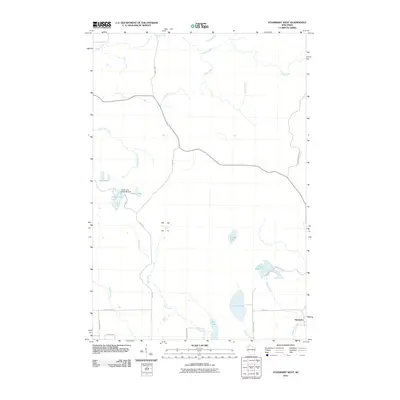
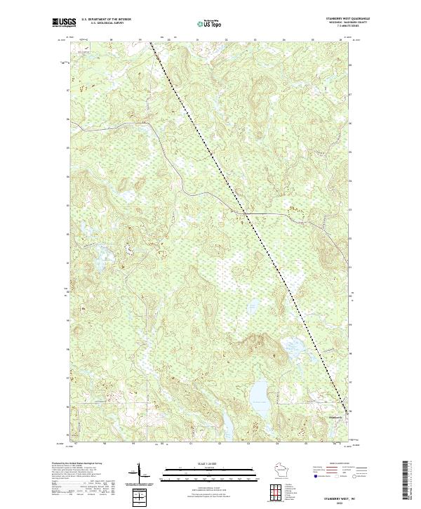
 1971 Stanberry West1973 Print · USGSWashburn County's lake country is captured here during the early seventies, showing a landscape of dense wetlands and timber management. Researchers can trace the Soo Line railroad through Stanberry or locate remote points along Mc Intosh Road and Gull Lake.
 - 1980 Map of Solon Springs
 1980 Solon Springs1980 Print · USGSNorthern Wisconsin in the early eighties was a landscape of dense timber and sprawling glacial waters. Trace the legacy of the Chicago and North Western rail line through Solon Springs, Hayward, and Minong at this pivotal moment.
 - 2010 Map of Stanberry West, 2010 Print
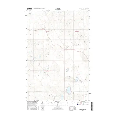
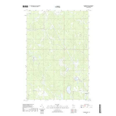
 2010 Stanberry West2010 Print · USGSCovers Stanberry, including Gull Lake, Frog Creek, and other nearby areas
 - 2013 Map of Stanberry West, 2013 Print
 2013 Stanberry West2013 Print · USGSCovers Stanberry, including Gull Lake, Frog Creek, and other nearby areas
 - 2015 Map of Stanberry West, 2015 Print
 2015 Stanberry West2015 Print · USGSCovers Stanberry, including Gull Lake, Frog Creek, and other nearby areas
 - 2018 Map of Stanberry West, 2018 Print
 2018 Stanberry West2018 Print · USGSCovers Stanberry, including Gull Lake, Frog Creek, and other nearby areas
 - 2022 Map of Stanberry West, 2022 Print
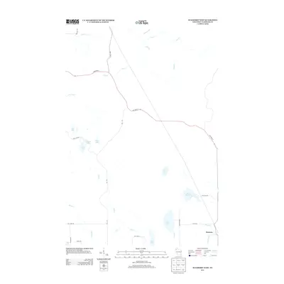
 2022 Stanberry West2022 Print · USGSWashburn County's Northwoods landscape in the early 2020s is defined by its glacial lakes and the small settlement of Stanberry. Researchers can trace the drainage of Tranus Lake and Sugar Bush Lake or locate family properties along Hall Rd and Gull Creek Rd.
End of results
Showing maps 1-11 of 11
Top cities near Stanberry
- Spooner historical maps
- Hayward historical maps
- Trego historical maps
- Cable historical maps
- Gordon historical maps
- Wascott historical maps
See more
Frequently asked questions
- What are the different types of historical maps available for Stanberry?
- What is the oldest map of Stanberry?
- Where can I purchase historical maps of Stanberry for my home or office?
- Where can I download high-res historical maps of Stanberry?
- Are there historical topographic maps available for Stanberry?
- Is there historical aerial imagery available for Stanberry?
- Where are historical maps of Stanberry sourced from?