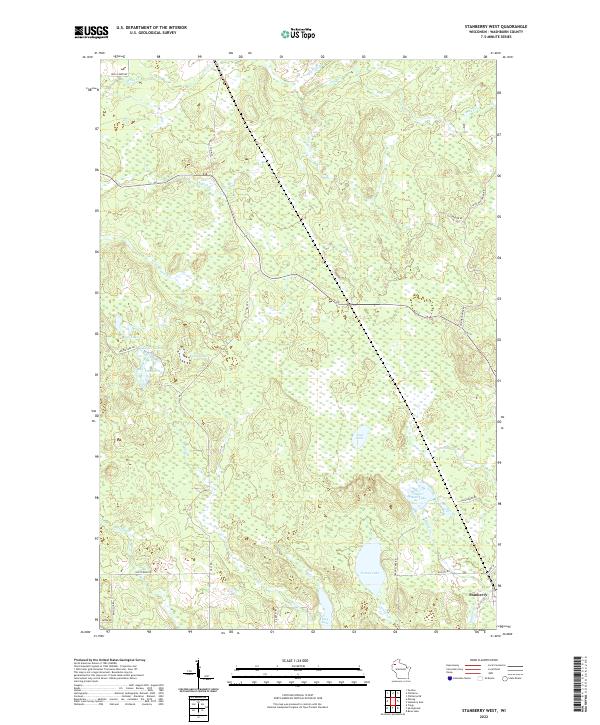
2022 Map of Stanberry West
USGS Topo · Published 2022About this map
Stanberry anchors the southeastern corner of this Northwoods landscape, where the local road network reflects the scattered, water-rich geography of Washburn County. The terrain is defined by a dense concentration of glacial lakes and wetlands, including Tranus Lake, Sugar Bush Lake, and the cluster of Taylor Lake and Fish Lake. These water bodies feed a complex network of small streams like Tranus Cr and Maggie Cr that navigate the marshy lowlands.
Find a feature on this map
36 named features on this map. Tap any name to fly to it.
Don’t see what you’re looking for? This feature index may not catch every label — zoom into the map to look around manually.
Map Details
Editions of this 2022 Stanberry West Map
This is the sole edition of this map. No revisions or reprints were ever made.
Other maps of this area

1947 · Chittamo
USGS Topo · 1:48,000

1947 · Minong
USGS Topo · 1:48,000

1948 · Spooner
USGS Topo · 1:48,000

1948 · Stone Lake
USGS Topo · 1:48,000

1949 · Chittamo
USGS Topo · 1:48,000

1949 · Minong
USGS Topo · 1:48,000

1949 · Spooner
USGS Topo · 1:48,000

1950 · Stone Lake
USGS Topo · 1:48,000

1953 · Ashland
USGS Topo · 1:250,000

1953 · Rice Lake
USGS Topo · 1:250,000