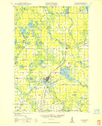
1949 Map of Spooner
USGS Topo · Published 1949About this map
Spooner stands at the heart of this northwestern Wisconsin landscape, serving as a hub for both the Chicago and North Western railway and the regional highway system shortly after World War II. The town's infrastructure is well-established, featuring the Spooner Municipal Airport, a State Experimental Farm, and a Fish Hatchery near the Yellow River. The area's glacial geography is defined by a dense network of water bodies, including Gull Lake, Trego Lake, and the winding Namekagon River. Local rural life is reflected in the numerous district schools such as Tadpole Sch, Julia Sch, and Blooming Valley Sch. Smaller settlements like Trego, Lampson, and Earl dot the rail lines and primary roads, while the presence of the Lampson Fire Tower and Isabella Fire Tower highlights the importance of forest management in this timber-rich region.
Find a feature on this map
102 named features on this map. Tap any name to fly to it.
Don’t see what you’re looking for? This feature index may not catch every label — zoom into the map to look around manually.
Map Details
Editions of this 1949 Spooner Map
This is the sole edition of this map. No revisions or reprints were ever made.
Other maps of this area

1947 · Chittamo
USGS Topo · 1:48,000

1947 · Minong
USGS Topo · 1:48,000
1948 · Spooner
USGS Topo · 1:48,000
1948 · Stone Lake
USGS Topo · 1:48,000

1949 · Chittamo
USGS Topo · 1:48,000

1949 · Hertel
USGS Topo · 1:48,000

1949 · Minong
USGS Topo · 1:48,000

1949 · Webb Lake
USGS Topo · 1:48,000

1949 · Rice Lake
USGS Topo · 1:48,000
1950 · Stone Lake
USGS Topo · 1:48,000