
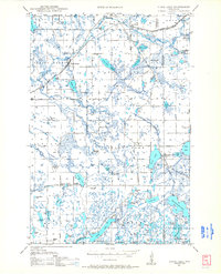
1948 Map of Stone Lake
USGS Topo · Published 1958About this map
Stone Lake and Spring Brook serve as the primary hubs in this lake-dotted corner of Wisconsin, where the rail lines of the Chicago and North Western and Minneapolis St Paul and Sault Ste Marie converge. The landscape is defined by its glacial hydrology, featuring dozens of named water bodies like Sissabagama Lake, Slim Lake, and the wide Slim Creek Flowage. Rural life in the late 1940s is marked by a network of localized institutions, including several one-room schoolhouses such as Edgewood Sch, Mackay Valley Sch, and Pine Knoll Sch. For those studying local history, the map preserves the exact locations of civic landmarks like the Potato Lake Fire Tower and the Evergreen Cem, alongside family-named features like Mackay Springs and Colbroth Lake.
Find a feature on this map
91 named features on this map. Tap any name to fly to it.
Don’t see what you’re looking for? This feature index may not catch every label — zoom into the map to look around manually.
Map Details
Editions of this 1948 Stone Lake Map
2 editions found
Other maps of this area

1944 · Couderay
USGS Topo · 1:48,000

1944 · Hayward
USGS Topo · 1:48,000

1945 · Meteor
USGS Topo · 1:48,000

1947 · Chittamo
USGS Topo · 1:48,000

1947 · Minong
USGS Topo · 1:48,000

1948 · Couderay
USGS Topo · 1:48,000

1948 · Spooner
USGS Topo · 1:48,000

1949 · Chittamo
USGS Topo · 1:48,000

1949 · Minong
USGS Topo · 1:48,000

1949 · Meteor
USGS Topo · 1:48,000