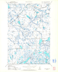
1948 Map of Stone Lake
USGS Topo · Published 1966About this map
Glacial lakes and rural schoolhouses define the landscape of northern Washburn and Sawyer Counties shortly after World War II. The village of Stone Lake serves as a hub for the surrounding waters, positioned near the Evergreen Cemetery and Little Sand Lake. Transport is dominated by three major rail lines, including the Chicago and North Western and the Minneapolis St Paul and Sault Ste Marie, which facilitate the local timber and agricultural economy. Scattered throughout the townships are essential rural landmarks such as Mackay Valley School and the Potato Lake Fire Tower, while commercial activity is represented by a Cranberry Bog near Spring Brook. The map details a period of transition as improved roads like Highway No 63 begin to supplant the older rail corridors for regional travel.
Find a feature on this map
82 named features on this map. Tap any name to fly to it.
Don’t see what you’re looking for? This feature index may not catch every label — zoom into the map to look around manually.
Map Details
Editions of this 1948 Stone Lake Map
2 editions found
Other maps of this area

1944 · Couderay
USGS Topo · 1:48,000

1944 · Hayward
USGS Topo · 1:48,000

1945 · Meteor
USGS Topo · 1:48,000

1947 · Chittamo
USGS Topo · 1:48,000

1947 · Minong
USGS Topo · 1:48,000

1948 · Couderay
USGS Topo · 1:48,000

1948 · Spooner
USGS Topo · 1:48,000

1948 · Stone Lake
USGS Topo · 1:48,000

1949 · Chittamo
USGS Topo · 1:48,000

1949 · Minong
USGS Topo · 1:48,000