2020s Maps of Fox Crossing, Wisconsin
Explore 2 historic maps of Fox Crossing from the 2020s. These maps offer a rare glimpse into what life looked like during the 2020s — showing old roads, neighborhoods, homes, and landmarks that have changed or disappeared over time.
Whether you're researching your family's past, planning a metal detecting trip, or studying how Fox Crossing's landscape evolved across the 2020s, these high-resolution maps are a powerful tool for exploring the history of this region.
- Focus on a specific era: All maps on this page are from the 2020s, giving you a focused view of this time period.
- See what’s changed: Compare century-old streets, trails, and buildings to today's modern landscape using overlays and satellite layers.
- Research with precision: Use these maps for genealogy, historical research, land use analysis, or educational projects.
- View, download, or print: Maps are fully viewable online in high resolution, and can be downloaded or printed for your own records.
Start exploring Fox Crossing's history through authentic maps from the 2020s. This is your window into the past.
Fox Crossing, WI maps
(2)- 2022 Map of Neenah, 2022 Print
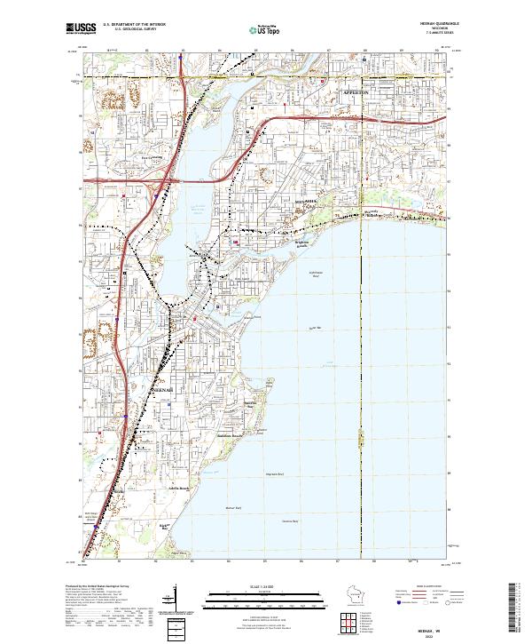 2022 Neenah2022 Print · USGSThe Fox River valley's industrial heart comes into focus during this era of suburban growth and lakeside recreation. Researchers can trace the development of Neenah and Menasha, from the shores of Doty Island to Saint Patrick's Cem.
 - 2022 Map of Oshkosh NE, 2022 Print
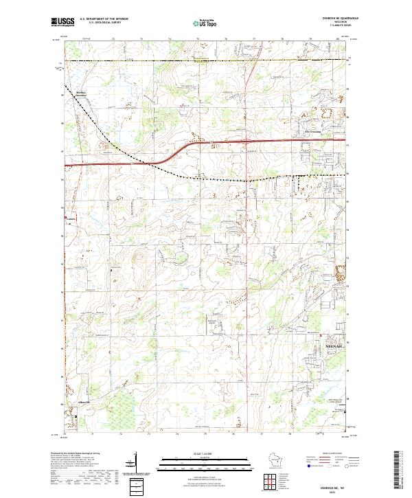 2022 Oshkosh NE2022 Print · USGSWinnebago County at the start of the 2020s shows the suburban interface between Fox Crossing and rural farmland. Genealogists and historians can locate legacy sites like Allenville Cemetery and trace the Arrowhead River and Rat River through Medina Junction.
End of results
Showing maps 1-2 of 2
Top cities near Fox Crossing
- Appleton historical maps
- Oshkosh historical maps
- Neenah historical maps
- Grand Chute historical maps
- Menasha historical maps
- Kaukauna historical maps
See more
Top neighborhoods of Fox Crossing
Frequently asked questions
- What are the different types of historical maps available for Fox Crossing?
- What is the oldest map of Fox Crossing?
- Where can I purchase historical maps of Fox Crossing for my home or office?
- Where can I download high-res historical maps of Fox Crossing?
- Are there historical topographic maps available for Fox Crossing?
- Is there historical aerial imagery available for Fox Crossing?
- Where are historical maps of Fox Crossing sourced from?