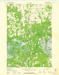
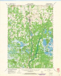
1900s (20th Century) Maps of Seneca, Wisconsin
Explore 15 historic maps of Seneca from the 1900s (20th Century). These maps offer a rare glimpse into what life looked like during the 1900s — showing old roads, neighborhoods, homes, and landmarks that have changed or disappeared over time.
Whether you're researching your family's past, planning a metal detecting trip, or studying how Seneca's landscape evolved across the 1900s, these high-resolution maps are a powerful tool for exploring the history of this region.
- Focus on a specific era: All maps on this page are from the 1900s, giving you a focused view of this time period.
- See what’s changed: Compare century-old streets, trails, and buildings to today's modern landscape using overlays and satellite layers.
- Research with precision: Use these maps for genealogy, historical research, land use analysis, or educational projects.
- View, download, or print: Maps are fully viewable online in high resolution, and can be downloaded or printed for your own records.
Start exploring Seneca's history through authentic maps from the 1900s. This is your window into the past.
Seneca, WI maps
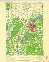
(15)- 1953 Map of Eau Claire, 1965 Print
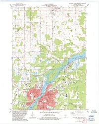
 1953 Eau Claire1965 Print · USGSWest-central Wisconsin in the mid-fifties shows a landscape of river-valley industry and vast wildlife refuges during the transition from rails to modern highways. Genealogists and historians can trace the rail corridors of the Chicago and North Western or locate family-named landmarks like Decorah Mound and Chippewa Island.4 unique versions available
 - 1955 Map of Green Bay, 1968 Print
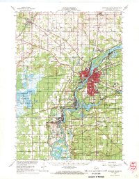
 1955 Green Bay1968 Print · USGSCentral and Eastern Wisconsin are captured here in the mid-fifties, showing the industrial growth of the Fox Valley and Wisconsin River corridors. Genealogists and historians can trace rail lines like the Green Bay and Western through settlements like Weyauwega, Clintonville, and Pulaski.2 unique versions available
 - 1957 Map of Wisconsin Rapids, 1959 Print
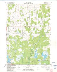
 1957 Wisconsin Rapids1959 Print · USGSThe mid-century paper-milling and cranberry-farming corridor along the Wisconsin River is shown here in detail during a period of steady growth. Researchers can trace the development of Wisconsin Rapids, the extensive Cranberry Bogs, and rural landmarks like St Johns Ch and Nepco Lake.
 - 1957 Map of Pittsville, 1959 Print
 1957 Pittsville1959 Print · USGSWood County in the late fifties was a specialized landscape of marshland agriculture and remote rural outposts. Genealogists and historians can trace family-named schools like Wallace Sch, find the Babcock Cem, and locate the expansive Cranberry Bogs.2 unique versions available
 - 1958 Map of Eau Claire
 1958 Eau Claire1958 Print · USGSWestern Wisconsin in the late fifties shows a landscape of growing regional hubs and massive wildlife refuges. Trace the rail lines of the Chicago and North Western between Eau Claire and Marshfield, or explore the terrain around Iron Mound and Lake Wissota.
 - 1964 Map of Eau Claire
 1964 Eau Claire1964 Print · USGSWest-central Wisconsin in the mid-1960s was a hub of river-driven industry and expanding rail networks. Researchers can trace historic homesteads near Menomonie, follow the Soo Line RR through Marshfield, or explore the grounds of the Camp McCoy Military Reservation.
 - 1967 Map of Wisconsin Rapids, 1969 Print
 1967 Wisconsin Rapids1969 Print · USGSThe industrial riverfronts of Wood County and the extensive cranberry marshlands of the central sands are captured in this mid-century survey. Researchers can trace family roots through numerous rural landmarks like St John Ch, Trinity Cem, and the community at Eight Corners.2 unique versions available
 - 1967 Map of Pittsville, 1969 Print
 1967 Pittsville1969 Print · USGSWood County in the late sixties shows a unique landscape of managed wetlands and cranberry production. Genealogists and local historians can trace family sites near Pittsville, find the Cranmoor Sch, or locate cemeteries like St Johns Cem and Babcock Cem.2 unique versions available
 - 1984 Map of Wisconsin Rapids North
 1984 Wisconsin Rapids North1984 Print · USGSWisconsin Rapids and the village of Biron are seen here in the mid-1980s as the river-driven industry of Wood County continued to shape the landscape. Researchers can trace local heritage at St Philomena Cem, the Cranberry Bogs, and the Soo Line rail corridors.
 - 1984 Map of Lake Dexter
 1984 Lake Dexter1984 Print · USGSWood County’s marshy lowlands and agricultural tracts are captured here in the mid-eighties, showing the intersection of local industry and the outdoors. Researchers can trace the path of the Green Bay and Western Railroad Grade or locate family plots at St Johns Cem and Dexterville.
 - 1984 Map of Nekoosa
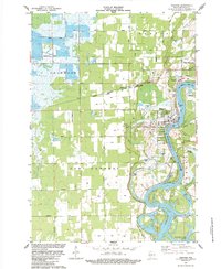 1984 Nekoosa1984 Print · USGSThe Wisconsin River corridor in the mid-1980s reveals a unique landscape of industrial river towns and sprawling commercial wetlands. Genealogists and local historians can trace the development of Nekoosa and Port Edwards near landmarks like Nekoosa Cem and the Townhall.
 - 1984 Map of Vesper
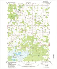 1984 Vesper1984 Print · USGSWood County in the mid-1980s shows a landscape of specialized agriculture and rural faith. Genealogists and local historians can trace family plots at Trinity Cem and Sigel Cem, while mapping the industrial footprint of the Soo Line and the extensive Cranberry Bogs near Walker.
 - 1984 Map of Wisconsin Rapids South
 1984 Wisconsin Rapids South1984 Print · USGSThe Wisconsin River corridor south of Wisconsin Rapids shows a landscape of steady industrial growth and recreational development in the 1980s. Trace local landmarks like the Drive-in Theater, Pioneer Cem, and the rail lines of the Chicago Milwaukee St Paul and Pacific.
 - 1985 Map of Black River Falls
 1985 Black River Falls1985 Print · USGSCentral Wisconsin in the mid-1980s is defined by its sprawling wildlife refuges and the winding Black River corridor. Genealogists and researchers can trace rural settlements like Millston and Warrens or locate historical sites such as the Iron Mine and the grounds of Fort McCoy.2 unique versions available
 - 1985 Map of Wisconsin Rapids
 1985 Wisconsin Rapids1985 Print · USGSCentral Wisconsin in the mid-eighties shows a landscape of engineered waterways and active rail corridors between Wisconsin Rapids and Waupaca. Genealogists and researchers can trace local landmarks like Roche A Cri State Park, the SOO LINE, and small settlements like Coddington or Rudolph.2 unique versions available
End of results
Showing maps 1-15 of 15
Top cities near Seneca
- Wisconsin Rapids historical maps
- Nekoosa historical maps
- Port Edwards historical maps
- Pittsville historical maps
- Biron historical maps
- Sherry historical maps
See more
Top neighborhoods of Seneca
Frequently asked questions
- What are the different types of historical maps available for Seneca?
- What is the oldest map of Seneca?
- Where can I purchase historical maps of Seneca for my home or office?
- Where can I download high-res historical maps of Seneca?
- Are there historical topographic maps available for Seneca?
- Is there historical aerial imagery available for Seneca?
- Where are historical maps of Seneca sourced from?