Old Maps of Atkinson Ranch, Wyoming
Explore 12 old maps of Atkinson Ranch, spanning from 1943 to today. These high-resolution historic maps reveal how streets, neighborhoods, landmarks, and natural features evolved over time — perfect for genealogy, metal detecting, research, and local history exploration.
What you can do with these maps:
- See how Atkinson Ranch changed over time: Compare historical maps to modern-day views to trace roads, homesites, rail lines & more.
- View detailed metadata: Each map includes creators, publishers, year, scale, and archive source.
- Overlay maps with satellite & LiDAR: Visualize the past alongside modern tools to explore terrain & human change.
- Trusted historical sources: Maps sourced from the USGS, Library of Congress, and other archives.
- Access maps your way: View online, download high-res files, or order prints for personal or research use.
Start exploring old maps of Atkinson Ranch to uncover forgotten places, hidden landmarks, and the deep history beneath your feet.
Atkinson Ranch, WY maps
(12)- 1943 Map of Esterbrook, 1963 Print
 1943 Esterbrook1963 Print · USGSThe Laramie Range high country comes into focus in the early 1940s, showing a landscape of remote mountain ranches and forest lookouts. Researchers can trace historic family holdings like La Bonte Ranch and find small rural schoolhouses such as Morton Sch and Hanks Sch.
 - 1945 Map of Esterbrook
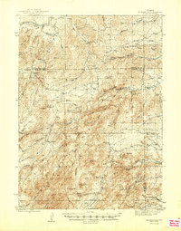 1945 Esterbrook1945 Print · USGSThe Converse and Albany county line in the 1940s reveals a high-plains landscape of remote mountain schools and family ranches. Genealogists can locate family landmarks like La Bonte Ranch and Morton Sch or trace the old Horseshoe Trail.2 unique versions available
 - 1954 Map of Torrington, 1963 Print
 1954 Torrington1963 Print · USGSEastern Wyoming and the Nebraska borderlands are captured here during the mid-fifties, showing a landscape shaped by the Platte River and the Laramie Range. Researchers can trace deep history at the Fort Laramie National Historical Site, the Old Doty Ranch Site, and along the Old Fetterman Road.4 unique versions available
 - 1958 Map of Torrington
 1958 Torrington1958 Print · USGSEastern Wyoming and the Nebraska borderlands are captured in the late fifties, showcasing a landscape of high plains ranching and river-fed industry. Trace the historic paths of the Union Pacific railroad and find legacy sites like Fort Laramie and Sunrise.
 - 1981 Map of Laramie Peak
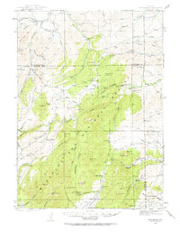
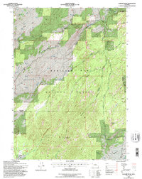
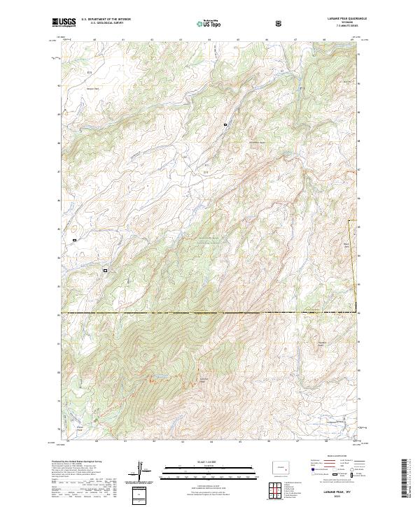
 1981 Laramie Peak1981 Print · USGSThe Laramie Mountains and Medicine Bow National Forest define this landscape in the early eighties. Genealogists and historians can trace high-country settlements like Toltec and Binford, or locate industrial sites like the Mica Mine near the North Laramie River.2 unique versions available
 - 1985 Map of Laramie Peak
 1985 Laramie Peak1985 Print · USGSThe Laramie Range in the mid-1980s is captured here, centered on the high terrain of Medicine Bow National Forest. Researchers can trace the rugged topography around Laramie Peak and find named high-country clearings like Friend Park and Kenyon Park.
 - 1992 Map of Laramie Peak, 1996 Print
 1992 Laramie Peak1996 Print · USGSThe Converse County high country is mapped here in the early nineties, centered on the towering presence of Laramie Peak. Hikers and historians can trace the Horse and Pack Trail, the campgrounds of Friend Park, and the route of Esterbrook Road.2 unique versions available
 - 2012 Map of Laramie Peak, 2012 Print
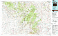
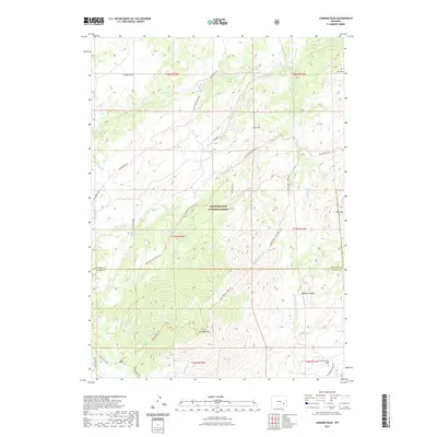
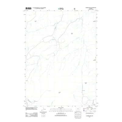 2012 Laramie Peak2012 Print · USGSCovers Atkinson Ranch, including Pickerall Ranch, Albany County, and other nearby areas
 - 2015 Map of Laramie Peak, 2015 Print
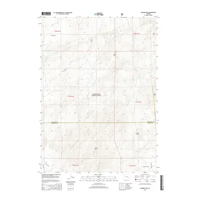 2015 Laramie Peak2015 Print · USGSCovers Atkinson Ranch, including Pickerall Ranch, Albany County, and other nearby areas
 - 2017 Map of Laramie Peak, 2017 Print
 2017 Laramie Peak2017 Print · USGSCovers Atkinson Ranch, including Pickerall Ranch, Albany County, and other nearby areas
 - 2021 Map of Laramie Peak, 2021 Print
 2021 Laramie Peak2021 Print · USGSCovers Atkinson Ranch, including Pickerall Ranch, Albany County, and other nearby areas
 - 2023 Map of Laramie Peak, 2023 Print
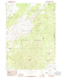
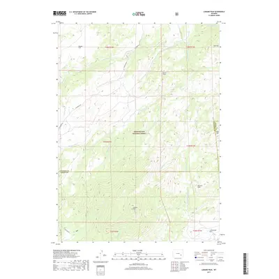
 2023 Laramie Peak2023 Print · USGSThe high peaks and drainages of the Laramie Range come into focus in this recent survey of the Medicine Bow National Forest. Outdoor enthusiasts and local historians can trace the paths of Roaring Fork Creek Trl and Harris Park Trl near the historic Friend Park.
End of results
Showing maps 1-12 of 12
Frequently asked questions
- What are the different types of historical maps available for Atkinson Ranch?
- What is the oldest map of Atkinson Ranch?
- Where can I purchase historical maps of Atkinson Ranch for my home or office?
- Where can I download high-res historical maps of Atkinson Ranch?
- Are there historical topographic maps available for Atkinson Ranch?
- Is there historical aerial imagery available for Atkinson Ranch?
- Where are historical maps of Atkinson Ranch sourced from?