2020s Maps of Byron, Wyoming
Explore 2 historic maps of Byron from the 2020s. These maps offer a rare glimpse into what life looked like during the 2020s — showing old roads, neighborhoods, homes, and landmarks that have changed or disappeared over time.
Whether you're researching your family's past, planning a metal detecting trip, or studying how Byron's landscape evolved across the 2020s, these high-resolution maps are a powerful tool for exploring the history of this region.
- Focus on a specific era: All maps on this page are from the 2020s, giving you a focused view of this time period.
- See what’s changed: Compare century-old streets, trails, and buildings to today's modern landscape using overlays and satellite layers.
- Research with precision: Use these maps for genealogy, historical research, land use analysis, or educational projects.
- View, download, or print: Maps are fully viewable online in high resolution, and can be downloaded or printed for your own records.
Start exploring Byron's history through authentic maps from the 2020s. This is your window into the past.
Byron, WY maps
(2)- 2021 Map of Byron, 2021 Print
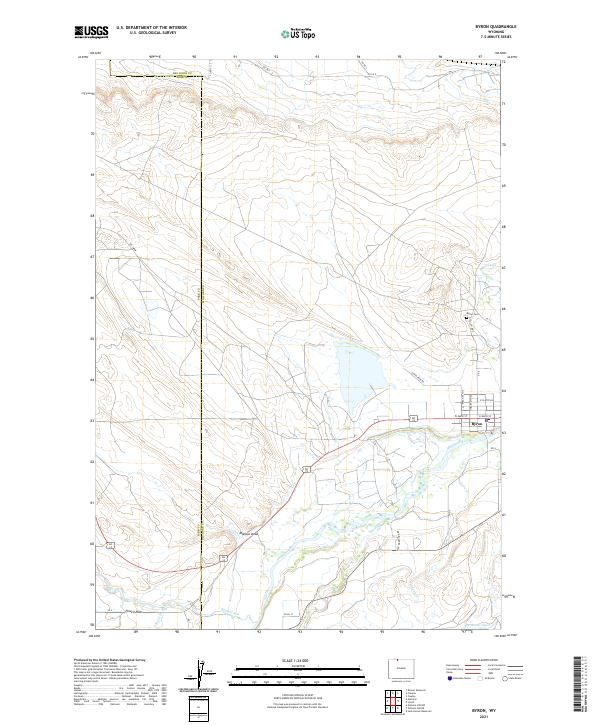 2021 Byron2021 Print · USGSByron and the Shoshone River valley are shown here in the early twenty-first century, highlighting the vital irrigation networks of the Big Horn Basin. Researchers can trace local landmarks like Byron Cem and the routes of the Sidon Canal and Elk Lovell Canal.
 - 2021 Map of Lovell, 2021 Print
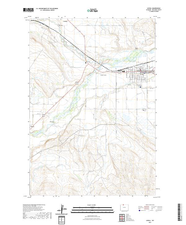 2021 Lovell2021 Print · USGSBig Horn County irrigation and settlement patterns are clearly visible in this recent study of the Shoshone River valley. Genealogists and local historians can trace family plots at Mexican Cem and navigate the streets of Lovell, Cowley, and Byron.
End of results
Showing maps 1-2 of 2
Top cities near Byron
- Powell historical maps
- Lovell historical maps
- Cowley historical maps
- Deaver historical maps
- Frannie historical maps
Frequently asked questions
- What are the different types of historical maps available for Byron?
- What is the oldest map of Byron?
- Where can I purchase historical maps of Byron for my home or office?
- Where can I download high-res historical maps of Byron?
- Are there historical topographic maps available for Byron?
- Is there historical aerial imagery available for Byron?
- Where are historical maps of Byron sourced from?