Old Maps of Medicine Bow, Wyoming for Academic Research
Study the evolution of Medicine Bow with 10 high-resolution historic maps. Whether you're teaching, researching, or modeling changes in land use, these maps provide essential visual documentation of urban, environmental, and geographic change.
- Analyze long-term change: Track patterns in development, transportation, and natural features.
- Ideal for environmental or urban studies: Support academic projects with primary historical map data.
- Use in the classroom or lab: Educators and researchers rely on these maps to bring historical context to life.
These maps are a powerful tool for teaching, research, and visualizing how Medicine Bow has changed over the decades.
Medicine Bow, WY maps
(10)- 1915 Map of Como Ridge
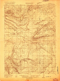 1915 Como Ridge1915 Print · USGSThe high plains of Carbon County come alive in the early twentieth century as the legendary Lincoln Highway pushes westward alongside the Union Pacific. Genealogists and historians can trace the early development of Medicine Bow and locate rural landmarks like the Ambler School and Robbers Roost.2 unique versions available
 - 1918 Map of Como Ridge
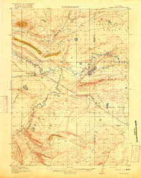 1918 Como Ridge1918 Print · USGSMedicine Bow and the surrounding Carbon County high plains are captured here just before the close of the Great War. Researchers can trace the early path of the Union Pacific railroad and find rural landmarks like the Ambler School and Robbers Roost.2 unique versions available
 - 1954 Map of Rawlins, 1968 Print
 1954 Rawlins1968 Print · USGSThe high plains and mountain ranges of southern Wyoming are shown here in the mid-1950s as the Union Pacific railroad and early highways fueled local industry. Genealogists and historians can trace old homesteads and outposts like the Overland Stage Station, the Utah Oil Refining Station, and the Hadsell Winter Headquarters.2 unique versions available
 - 1958 Map of Rawlins
 1958 Rawlins1958 Print · USGSSouthern Wyoming at the mid-century shows a landscape defined by the Union Pacific Railroad and the high basins of the Continental Divide. Researchers can trace old transportation routes near Fort Fred Steele or explore the mining history around Hanna and Medicine Bow.2 unique versions available
 - 1962 Map of Rawlins
 1962 Rawlins1962 Print · USGSSouthern Wyoming at the dawn of the sixties shows a landscape shaped by the Union Pacific and the high peaks of the Medicine Bow Mountains. Researchers can trace the path of the old stage routes through Overland Stage Station and Fort Fred Steele.
 - 1967 Map of Rawlins
 1967 Rawlins1967 Print · USGSCentral Wyoming and northern Colorado in the 1980s are defined here by the Union Pacific corridor and the high peaks of the Sierra Madre. Researchers can trace the legacy of old mining and rail towns like Carbon, Hanna, and Medicine Bow along the Overland Trail.
 - 1971 Map of Medicine Bow, 1975 Print
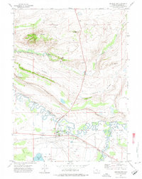 1971 Medicine Bow1975 Print · USGSMedicine Bow in the early seventies is a hub of railroad and ranching life along the Union Pacific main line. Genealogists and researchers can trace local landmarks like Medicine Bow, the Cem, and outlying sites such as Robbers Roost Ranch.2 unique versions available
 - 1980 Map of Medicine Bow
 1980 Medicine Bow1980 Print · USGSCarbon County’s high plains and industrial corridors are captured here in the late twentieth century, centered on the coal-rich territory around Hanna. Genealogists and historians can trace the paths of the historic Overland Trail and the Union Pacific Railroad past settlements like Elmo and Fort Steele.
 - 1988 Map of Rawlins
 1988 Rawlins1988 Print · USGSSouthern Wyoming and the Colorado borderlands are detailed here in the late eighties, featuring the intersection of the historic Overland Trail and the Union Pacific. Researchers can trace old rail towns like Medicine Bow and Wamsutter or landmark peaks like Medicine Bow Peak.
 - 2021 Map of Medicine Bow, 2021 Print
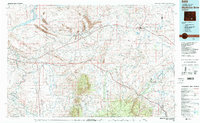
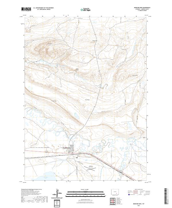 2021 Medicine Bow2021 Print · USGSThe high plains of Carbon County come alive in this recent survey of Medicine Bow, where the river and rail corridors meet. Trace the historic street grid of the town, locate Trails End Cem, and follow the winding path of Rock Creek across the desert floor.
End of results
Showing maps 1-10 of 10
Top cities near Medicine Bow
Frequently asked questions
- What are the different types of historical maps available for Medicine Bow?
- What is the oldest map of Medicine Bow?
- Where can I purchase historical maps of Medicine Bow for my home or office?
- Where can I download high-res historical maps of Medicine Bow?
- Are there historical topographic maps available for Medicine Bow?
- Is there historical aerial imagery available for Medicine Bow?
- Where are historical maps of Medicine Bow sourced from?