Old Maps of Buck Place, Wyoming for Academic Research
Study the evolution of Buck Place with 6 high-resolution historic maps. Whether you're teaching, researching, or modeling changes in land use, these maps provide essential visual documentation of urban, environmental, and geographic change.
- Analyze long-term change: Track patterns in development, transportation, and natural features.
- Ideal for environmental or urban studies: Support academic projects with primary historical map data.
- Use in the classroom or lab: Educators and researchers rely on these maps to bring historical context to life.
These maps are a powerful tool for teaching, research, and visualizing how Buck Place has changed over the decades.
Buck Place, WY maps
(6)- 1954 Map of Torrington, 1963 Print
 1954 Torrington1963 Print · USGSEastern Wyoming and the Nebraska borderlands are captured here during the mid-fifties, showing a landscape shaped by the Platte River and the Laramie Range. Researchers can trace deep history at the Fort Laramie National Historical Site, the Old Doty Ranch Site, and along the Old Fetterman Road.4 unique versions available
 - 1958 Map of Torrington
 1958 Torrington1958 Print · USGSEastern Wyoming and the Nebraska borderlands are captured in the late fifties, showcasing a landscape of high plains ranching and river-fed industry. Trace the historic paths of the Union Pacific railroad and find legacy sites like Fort Laramie and Sunrise.
 - 1964 Map of Buck Peak, 1967 Print
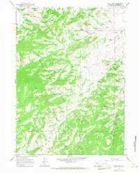 1964 Buck Peak1967 Print · USGSThe high ranching country of Converse County is captured in the mid-1960s within the boundaries of the Medicine Bow National Forest. Genealogists and local historians can trace legacy sites like Box Elder Sch, Snowshoe Ranch, and the Leahy Place nestled among the peaks.3 unique versions available
 - 1981 Map of Douglas
 1981 Douglas1981 Print · USGSThe North Platte River corridor in the early eighties shows a landscape shaped by energy and iron. Genealogists and industrial historians can trace rail-side settlements like Glenrock, explore the Big Muddy Oil Field, and locate the old siding at Fetterman.
 - 1992 Map of Buck Peak, 1996 Print
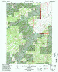 1992 Buck Peak1996 Print · USGSConverse County's high-country ranching and forest lands are documented here in the early 1990s. Researchers can locate remote homestead sites like the Buck Place and Leahy Place, or trace the old Box Elder Sch near the forks of Keely Creek.
 - 2021 Map of Buck Peak, 2021 Print
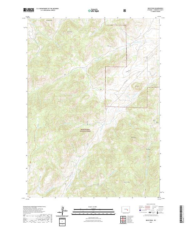 2021 Buck Peak2021 Print · USGSThe Laramie Range foothills come to life in this 2021 survey, showing the high-country drainages and peaks of southern Converse County. Researchers can trace land features from Buck Peak and Cherry Mountain to the remote course of Box Elder Creek.
End of results
Showing maps 1-6 of 6
Frequently asked questions
- What are the different types of historical maps available for Buck Place?
- What is the oldest map of Buck Place?
- Where can I purchase historical maps of Buck Place for my home or office?
- Where can I download high-res historical maps of Buck Place?
- Are there historical topographic maps available for Buck Place?
- Is there historical aerial imagery available for Buck Place?
- Where are historical maps of Buck Place sourced from?