Old Maps of Converse County, Wyoming
Explore 251 old maps of Converse County, spanning from 1943 to today. These high-resolution historic maps reveal how streets, neighborhoods, landmarks, and natural features evolved over time — perfect for genealogy, metal detecting, research, and local history exploration.
What you can do with these maps:
- See how Converse County changed over time: Compare historical maps to modern-day views to trace roads, homesites, rail lines & more.
- View detailed metadata: Each map includes creators, publishers, year, scale, and archive source.
- Overlay maps with satellite & LiDAR: Visualize the past alongside modern tools to explore terrain & human change.
- Trusted historical sources: Maps sourced from the USGS, Library of Congress, and other archives.
- Access maps your way: View online, download high-res files, or order prints for personal or research use.
Start exploring old maps of Converse County to uncover forgotten places, hidden landmarks, and the deep history beneath your feet.
Converse County, WY maps
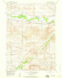
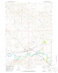
(251)- 1943 Map of Esterbrook, 1963 Print
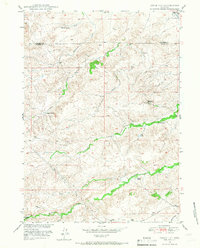
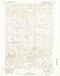
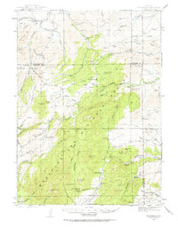 1943 Esterbrook1963 Print · USGSThe Laramie Range high country comes into focus in the early 1940s, showing a landscape of remote mountain ranches and forest lookouts. Researchers can trace historic family holdings like La Bonte Ranch and find small rural schoolhouses such as Morton Sch and Hanks Sch.
 - 1945 Map of Esterbrook
 1945 Esterbrook1945 Print · USGSThe Converse and Albany county line in the 1940s reveals a high-plains landscape of remote mountain schools and family ranches. Genealogists can locate family landmarks like La Bonte Ranch and Morton Sch or trace the old Horseshoe Trail.2 unique versions available
 - 1949 Map of Shawnee, 1958 Print
 1949 Shawnee1958 Print · USGSConverse County rangeland comes into focus in the late 1940s as the Missouri River Basin development project began. Genealogists can locate the local Cem near Shawnee or trace the early path of the Chicago and Northwestern railroad past Fisher.
 - 1949 Map of Campbell Hill, 1958 Print
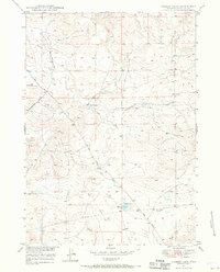
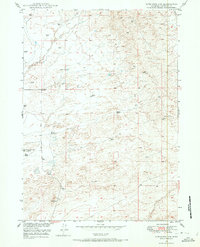
 1949 Campbell Hill1958 Print · USGSThe high plains of the Converse and Natrona county line are shown here in the late 1940s as petroleum development took hold. Researchers can locate early oil infrastructure at the Cole Creek Oil Field and trace legacy family holdings like the K Lazy S Ranch or the Dewitt Ranch.3 unique versions available
 - 1949 Map of Sundquist Ranch, 1958 Print
 1949 Sundquist Ranch1958 Print · USGSConverse County ranching and early energy development are captured here in the late forties. Researchers can trace the layout of the Sundquist Ranch and follow the route of a post-war Oil Pipe Line through Fetterman Creek country.2 unique versions available
 - 1949 Map of Orpha, 1959 Print
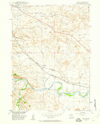
 1949 Orpha1959 Print · USGSConverse County at the close of the 1940s reveals a landscape still deeply etched by pioneer history and the North Platte river-and-rail economy. Researchers can trace the Oregon Trail and Emigrant Trail, locate the La Prele Stage Station, and find local landmarks like Whiting Sch.2 unique versions available
 - 1949 Map of Irvine, 1960 Print
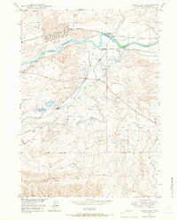
 1949 Irvine1960 Print · USGSThe North Platte River valley in the late 1940s reveals a landscape of irrigation and rail transport. Researchers can trace the Chicago and Northwestern line through Irvine or locate markers like Beacon 11A and Miller.2 unique versions available
 - 1949 Map of Careyhurst, 1966 Print
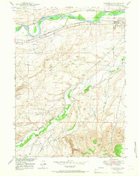
 1949 Careyhurst1966 Print · USGSThe North Platte River valley in the late 1940s reveals a landscape defined by the Chicago and Northwestern rail line and cattle ranching. Researchers can trace historic landmarks like the Careyhurst Ranch, Little Box Elder Cave, and the small settlement of Welch.2 unique versions available
 - 1949 Map of Parkerton, 1966 Print
 1949 Parkerton1966 Print · USGSConverse County was defined by its dual identity as a rail corridor and energy hub during the late 1940s. Genealogists and industrial historians can trace the development of the Big Muddy Oil Field and the early layout of Parkerton and Glenrock.2 unique versions available
 - 1949 Map of Poison Lake, 1967 Print
 1949 Poison Lake1967 Print · USGSConverse County ranching and frontier history are preserved here in the late 1940s. Genealogists and historians can locate legacy homesteads like Johnson Ranch and trace the paths to the Site of Old La Bonte Stage Station and the White School.
 - 1949 Map of Cedar Hill, 1967 Print
 1949 Cedar Hill1967 Print · USGSRanching life on the Converse and Platte county line is documented here during the late 1940s, showing a landscape defined by water and wind. Researchers can trace the heritage of the Fitzhugh Ranch or locate water sources like Bog Hole Springs and North Elkhorn Creek.2 unique versions available
 - 1949 Map of Gilbert Lake, 1970 Print
 1949 Gilbert Lake1970 Print · USGSRanching life in central Wyoming during the late 1940s is centered around isolated outposts and seasonal water sources. Genealogists and historians can trace the early road network, including Glenrock-Ross Road, and land use around Smith Ranch and Gilbert Lake.2 unique versions available
 - 1949 Map of Douglas, 1971 Print
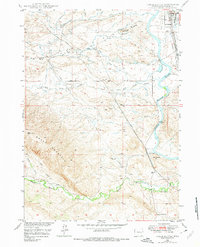
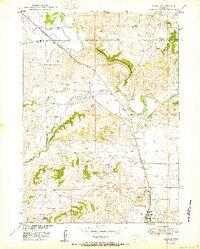
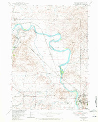 1949 Douglas1971 Print · USGSDouglas and the surrounding Converse County ranchlands appear here in the late 1940s, anchored by the historical junction of the North Platte River and early migration routes. Researchers can trace the legacy of the Old West at the Site of Old Fort Fetterman, the Bozeman Trail, and the Bill Hooker Monument.3 unique versions available
 - 1949 Map of Glenrock, 1971 Print
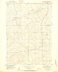
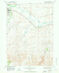 1949 Glenrock1971 Print · USGSSettlement and transit along the North Platte River define this Converse County area during the late 1940s. Genealogists and historians can trace pioneer footprints at the Oregon Trail Marker and H A Unthank Grave, or locate family sites like the Macy Place.2 unique versions available
 - 1949 Map of Leuenberger Ranch, 1973 Print
 1949 Leuenberger Ranch1973 Print · USGSCentral Wyoming ranching country in the late 1940s reveals a landscape of isolated homesteads and high-country trails. Genealogists and historians can trace family-named sites like Leuenberger Ranch and the historical Ross Bozeman Road Trail.
 - 1949 Map of Glenrock NW, 1973 Print
 1949 Glenrock NW1973 Print · USGSConverse County petroleum and ranching lands come into focus during the late 1940s development of the Missouri River Basin. Genealogists and historians can trace livestock operations at Hyland Ranch and early energy sites like the South Cole Creek Unit.2 unique versions available
 - 1949 Map of Dilts Ranch, 1975 Print
 1949 Dilts Ranch1975 Print · USGSCentral Wyoming ranching country is documented here just after the war, where the historic Emigrant Trail crosses the high plains. Researchers can trace the wagon route past the Oregon Trail Monument or locate early family holdings like Dilts Ranch and Elkhorn Ranch.
 - 1949 Map of Chalk Buttes, 1975 Print
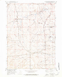
 1949 Chalk Buttes1975 Print · USGSConverse County at the end of the 1940s shows a landscape where historic overland routes meet modern rail and aviation. Trace the path of the Emigrant Trail past the Oregon Trail Monument or locate early landmarks like the Municipal Airport and Hot Springs.3 unique versions available
 - 1949 Map of Hylton Ranch, 1977 Print
 1949 Hylton Ranch1977 Print · USGSThe high plains of Converse County come into focus mid-century as a land of isolated ranching and resource extraction. Trace old routes like the Glenrock-Ross Road past the Hylton Ranch, or locate features like the Coal Mine and Top of the World.
 - 1949 Map of Clausen Ranch, 1977 Print
 1949 Clausen Ranch1977 Print · USGSConverse County ranching life is frozen in time during the late 1940s, showing the early infrastructure of the Missouri River Basin development. Researchers can trace family sites like Clausen Ranch or locate the long-vacant Clausen School and Midway School.2 unique versions available
 - 1949 Map of Orin, 1977 Print
 1949 Orin1977 Print · USGSConverse County ranching and rail infrastructure are at the forefront in the years following the war. Genealogists and historians can trace family landmarks like Osgood Ranch and McKinley (P O) or locate the James Bridger Ferry (Historical Marker).
 - 1949 Map of Antelope Creek, 1981 Print
 1949 Antelope Creek1981 Print · USGSRanching life in Converse County comes into focus in this late-1940s survey of the plains near Douglas. Researchers can locate family landmarks like Combs Ranch and Wallis Ranch, or trace the grounds of the Graves School (Abandoned).
 - 1950 Map of Glendo
 1950 Glendo1950 Print · USGSThe high plains of eastern Wyoming are captured here in the post-war era as the rail-and-river economy centered on the North Platte River matured. Genealogists and historians can trace the early layout of Glendo and locate vanished siding stops like Bona along the Chicago Burlington and Quincy tracks.
 - 1950 Map of Campbell Hill
 1950 Campbell Hill1950 Print · USGSConverse and Natrona counties are captured here at mid-century, where the burgeoning oil industry meets traditional high-plains ranching. Local historians can trace family landholdings like the K Lazy S Ranch or the legacy of the Big Muddy Coal Mine (Abandoned).
 - 1950 Map of Clausen Ranch
 1950 Clausen Ranch1950 Print · USGSRanching and early energy development meet in 1950s Wyoming, where the range is marked by cattle operations and a long-distance oil line. Genealogists can trace family holdings like Clausen Ranch and find the sites of Clausen School (Abandoned).
Showing maps 1-25 of 251
Top cities of Converse County
- Douglas historical maps
- Glenrock historical maps
- Rolling Hills historical maps
- Rolling Hills historical maps
- Lost Springs historical maps
Frequently asked questions
- What are the different types of historical maps available for Converse County?
- What is the oldest map of Converse County?
- Where can I purchase historical maps of Converse County for my home or office?
- Where can I download high-res historical maps of Converse County?
- Are there historical topographic maps available for Converse County?
- Is there historical aerial imagery available for Converse County?
- Where are historical maps of Converse County sourced from?