Old Maps of Douglas, Wyoming
Explore 16 old maps of Douglas, spanning from 1949 to today. These high-resolution historic maps reveal how streets, neighborhoods, landmarks, and natural features evolved over time — perfect for genealogy, metal detecting, research, and local history exploration.
What you can do with these maps:
- See how Douglas changed over time: Compare historical maps to modern-day views to trace roads, homesites, rail lines & more.
- View detailed metadata: Each map includes creators, publishers, year, scale, and archive source.
- Overlay maps with satellite & LiDAR: Visualize the past alongside modern tools to explore terrain & human change.
- Trusted historical sources: Maps sourced from the USGS, Library of Congress, and other archives.
- Access maps your way: View online, download high-res files, or order prints for personal or research use.
Start exploring old maps of Douglas to uncover forgotten places, hidden landmarks, and the deep history beneath your feet.
Douglas, WY maps
(16)- 1949 Map of Irvine, 1960 Print
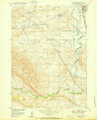
 1949 Irvine1960 Print · USGSThe North Platte River valley in the late 1940s reveals a landscape of irrigation and rail transport. Researchers can trace the Chicago and Northwestern line through Irvine or locate markers like Beacon 11A and Miller.2 unique versions available
 - 1949 Map of Douglas, 1971 Print
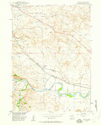
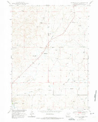
 1949 Douglas1971 Print · USGSDouglas and the surrounding Converse County ranchlands appear here in the late 1940s, anchored by the historical junction of the North Platte River and early migration routes. Researchers can trace the legacy of the Old West at the Site of Old Fort Fetterman, the Bozeman Trail, and the Bill Hooker Monument.3 unique versions available
 - 1949 Map of Chalk Buttes, 1975 Print
 1949 Chalk Buttes1975 Print · USGSConverse County at the end of the 1940s shows a landscape where historic overland routes meet modern rail and aviation. Trace the path of the Emigrant Trail past the Oregon Trail Monument or locate early landmarks like the Municipal Airport and Hot Springs.3 unique versions available
 - 1949 Map of Antelope Creek, 1981 Print
 1949 Antelope Creek1981 Print · USGSRanching life in Converse County comes into focus in this late-1940s survey of the plains near Douglas. Researchers can locate family landmarks like Combs Ranch and Wallis Ranch, or trace the grounds of the Graves School (Abandoned).
 - 1950 Map of Douglas
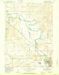 1950 Douglas1950 Print · USGSThe Douglas area in the mid-twentieth century was a vital crossroads of rail and river, deeply rooted in its frontier past. Trace the path of historical migrations at the Bozeman Trail Marker or locate the Site of Old Fort Fetterman and State Fair Grounds.
 - 1950 Map of Irvine
 1950 Irvine1950 Print · USGSConverse County rangeland and the Platte River valley are captured here at mid-century as the rail and ranching economy thrived. Genealogists and historians can locate family-named landmarks like Miller and Foster, or trace the paths of the Chicago and Northwestern and the Burlington railroads.
 - 1950 Map of Antelope Creek
 1950 Antelope Creek1950 Print · USGSConverse County ranching country is captured here at mid-century, showing the isolated homesteads and vital water sources of the high plains. Genealogists and local historians can locate Combs Ranch, Wallis Ranch, and the Graves School (Abandoned).
 - 1950 Map of Chalk Buttes
 1950 Chalk Buttes1950 Print · USGSConverse County seen at the start of the 1950s shows the city of Douglas as a critical rail hub where the North Platte River meets the high plains. Researchers can trace the path of the Oregon Trail Monument alongside modern infrastructure like pipe lines and the Municipal Airport.
 - 1954 Map of Torrington, 1963 Print
 1954 Torrington1963 Print · USGSEastern Wyoming and the Nebraska borderlands are captured here during the mid-fifties, showing a landscape shaped by the Platte River and the Laramie Range. Researchers can trace deep history at the Fort Laramie National Historical Site, the Old Doty Ranch Site, and along the Old Fetterman Road.4 unique versions available
 - 1958 Map of Torrington
 1958 Torrington1958 Print · USGSEastern Wyoming and the Nebraska borderlands are captured in the late fifties, showcasing a landscape of high plains ranching and river-fed industry. Trace the historic paths of the Union Pacific railroad and find legacy sites like Fort Laramie and Sunrise.
 - 1973 Map of Antelope Creek, 1975 Print
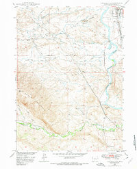
 1973 Antelope Creek1975 Print · USGSThe ranching country of Converse County is documented here during the early seventies, showing a landscape of family-owned spreads and upland drainage. Trace the locations of historic properties like Combs Ranch and the site of the Graves School.
 - 1981 Map of Douglas
 1981 Douglas1981 Print · USGSThe North Platte River corridor in the early eighties shows a landscape shaped by energy and iron. Genealogists and industrial historians can trace rail-side settlements like Glenrock, explore the Big Muddy Oil Field, and locate the old siding at Fetterman.
 - 2021 Map of Irvine, 2021 Print
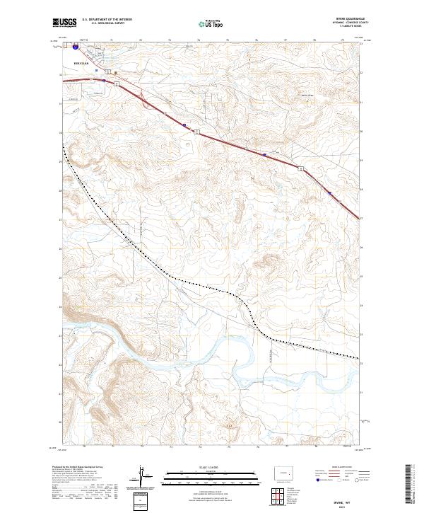 2021 Irvine2021 Print · USGSConverse County at the start of the 2020s shows a landscape of river-valley ranching and modern highway transport. Trace family lands and rural access along Irvine Rd, the banks of the North Platte River, and the outskirts of Douglas.
 - 2021 Map of Douglas, 2021 Print
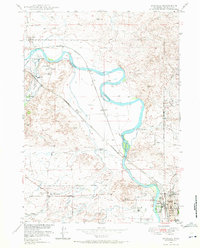
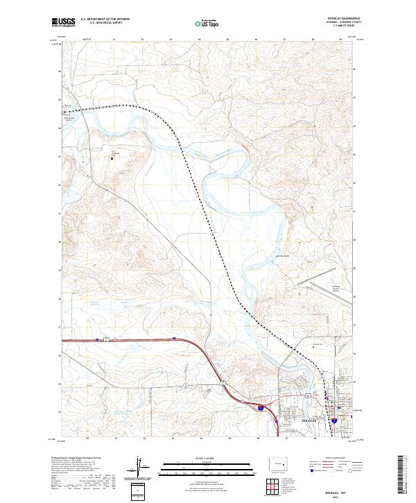 2021 Douglas2021 Print · USGSDouglas and the North Platte River valley are shown here in the early twenty-first century, highlighting a landscape of ranching and aviation. Genealogists can locate several burial sites including Fort Fetterman Cem and Pioneer Cem near the historic river bends.
 - 2021 Map of Antelope Creek, 2021 Print
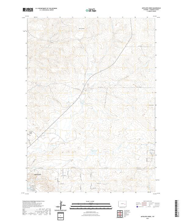 2021 Antelope Creek2021 Print · USGSThe northern edges of Douglas meet the high plains of Converse County in this recent survey. Local historians and land researchers can trace historical named routes like the Kit Carson Trl and Bridger Trl near the Baaken Esmay Reservoir.
 - 2021 Map of Chalk Buttes, 2021 Print
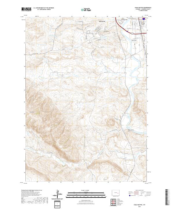 2021 Chalk Buttes2021 Print · USGSThe outskirts of Douglas meet the high plains in this modern survey of the North Platte riverfront. Genealogists and researchers can trace local landmarks like Douglas Hot Springs, the Chalk Buttes Reservoir, and Sheep Mtn.
End of results
Showing maps 1-16 of 16
Frequently asked questions
- What are the different types of historical maps available for Douglas?
- What is the oldest map of Douglas?
- Where can I purchase historical maps of Douglas for my home or office?
- Where can I download high-res historical maps of Douglas?
- Are there historical topographic maps available for Douglas?
- Is there historical aerial imagery available for Douglas?
- Where are historical maps of Douglas sourced from?