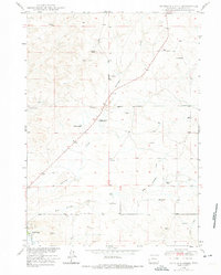
1973 Map of Antelope Creek
USGS Topo · Published 1975About this map
Antelope Creek and its tributary, East Antelope Creek, carve through this section of Converse County, where the landscape is defined by the cattle-ranching and water-management needs of the mid-20th century. Named family holdings like Combs Ranch and Wallis Ranch are prominent features, linked by the Highland Loop Road and numerous tracks serving scattered windmills and wells. This 1973 revision, based on late 1940s field work, captures a transition in local infrastructure, most notably marking the Graves School as no longer in use.
Find a feature on this map
14 named features on this map. Tap any name to fly to it.
Don’t see what you’re looking for? This feature index may not catch every label — zoom into the map to look around manually.
Map Details
Editions of this 1973 Antelope Creek Map
This is the sole edition of this map. No revisions or reprints were ever made.
Other maps of this area

1949 · Sundquist Ranch
USGS Topo · 1:24,000

1949 · Irvine
USGS Topo · 1:24,000

1949 · Douglas
USGS Topo · 1:24,000

1949 · Chalk Buttes
USGS Topo · 1:24,000

1949 · Clausen Ranch
USGS Topo · 1:24,000

1949 · Orin
USGS Topo · 1:24,000

1949 · Antelope Creek
USGS Topo · 1:24,000

1950 · Clausen Ranch
USGS Topo · 1:24,000

1950 · Douglas
USGS Topo · 1:24,000

1950 · Orin
USGS Topo · 1:24,000