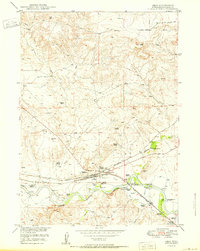
1950 Map of Orin
USGS Topo · Published 1950About this map
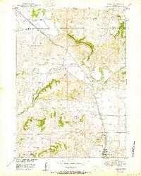
The North Platte River winds through the southern reaches of this landscape, serving as the historical and industrial heart of the region at the close of the 1940s. A significant landmark for Western history enthusiasts is the Pumping Sta James Bridger Ferry (Historical Marker), situated along the river's edge, which marks an important point of pioneer transit. The area's mid-century infrastructure is defined by a dense concentration of pumping stations and the intersection of major rail lines, including the Chicago and Northwestern and the Chicago Burlington and Quincy, which converge at Orin Junction. Settlement patterns are characterized by family-named holdings such as Townsend Ranch, Puckett Ranch, and Burke Ranch. Near the eastern boundary, the settlement of McKinley (PO) and nearby Ammon provide a look at the localized ranching communities established along Shawnee Creek and the railroad corridors.
Find a feature on this map
35 named features on this map. Tap any name to fly to it.
Don’t see what you’re looking for? This feature index may not catch every label — zoom into the map to look around manually.
Map Details
Editions of this 1950 Orin Map
This is the sole edition of this map. No revisions or reprints were ever made.
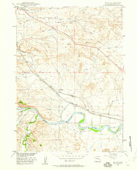
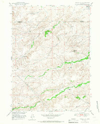
Other maps of this area

1949 · Shawnee
USGS Topo · 1:24,000
1949 · Irvine
USGS Topo · 1:24,000
1949 · Cedar Hill
USGS Topo · 1:24,000

1949 · Dilts Ranch
USGS Topo · 1:24,000
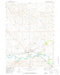
1949 · Orin
USGS Topo · 1:24,000

1949 · Antelope Creek
USGS Topo · 1:24,000
1950 · Glendo
USGS Topo · 1:24,000

1950 · Irvine
USGS Topo · 1:24,000

1950 · Antelope Creek
USGS Topo · 1:24,000

1950 · Shawnee
USGS Topo · 1:24,000