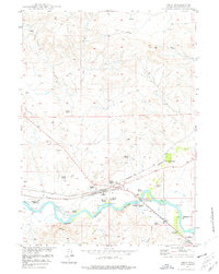
1949 Map of Orin
USGS Topo · Published 1977About this map
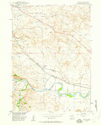
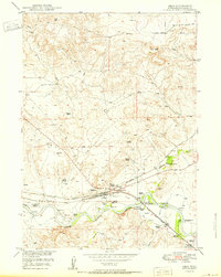
The North Platte River winds through this Converse County landscape, anchoring a valley defined by early ranching and vital transportation links. During the late 1940s, the area served as a crossroads where the Chicago and Northwestern and the Burlington and Quincy railroads met at Orin Junction. The map documents a corridor of family-named holdings along the river and its tributaries, including the Osgood Ranch, Puckett Ranch, and Rogers Ranch, illustrating the settlement pattern of the high plains.
Find a feature on this map
36 named features on this map. Tap any name to fly to it.
Don’t see what you’re looking for? This feature index may not catch every label — zoom into the map to look around manually.
Map Details
Editions of this 1949 Orin Map
This is the sole edition of this map. No revisions or reprints were ever made.
Other maps of this area

1949 · Shawnee
USGS Topo · 1:24,000
1949 · Irvine
USGS Topo · 1:24,000
1949 · Cedar Hill
USGS Topo · 1:24,000

1949 · Dilts Ranch
USGS Topo · 1:24,000

1949 · Antelope Creek
USGS Topo · 1:24,000
1950 · Glendo
USGS Topo · 1:24,000
1950 · Orin
USGS Topo · 1:24,000

1950 · Irvine
USGS Topo · 1:24,000

1950 · Antelope Creek
USGS Topo · 1:24,000

1950 · Shawnee
USGS Topo · 1:24,000