
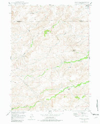
1949 Map of Cedar Hill
USGS Topo · Published 1967About this map
Elkhorn Ranch and the Fitzhugh Ranch anchor this late-1940s landscape along the border of Converse and Platte counties. The terrain is defined by a dense network of drainage systems, most notably the meandering paths of North Elkhorn Creek and Elkhorn Creek that cut through the central and southern sections. These water sources, along with Bog Hole Springs and Pollard Creek, supported the ranching operations that characterize this high plains region.
Find a feature on this map
17 named features on this map. Tap any name to fly to it.
Don’t see what you’re looking for? This feature index may not catch every label — zoom into the map to look around manually.
Map Details
Editions of this 1949 Cedar Hill Map
2 editions found
Other maps of this area

1943 · Esterbrook
USGS Topo · 1:62,500

1945 · Esterbrook
USGS Topo · 1:62,500

1949 · Shawnee
USGS Topo · 1:24,000

1949 · Irvine
USGS Topo · 1:24,000

1949 · Spring Creek
USGS Topo · 1:24,000

1949 · Dilts Ranch
USGS Topo · 1:24,000

1949 · Orin
USGS Topo · 1:24,000

1950 · Glendo
USGS Topo · 1:24,000

1950 · Spring Creek
USGS Topo · 1:24,000

1950 · Orin
USGS Topo · 1:24,000