
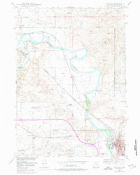
1949 Map of Douglas
USGS Topo · Published 1971About this map
The North Platte River winds through the heart of this Wyoming territory, serving as a corridor for generations of overland migration and early military presence. This survey documents a landscape thick with frontier history, notably the Site of Old Fort Fetterman and its accompanying Fort Fetterman Cemetery. The legacy of the westward expansion is explicitly recorded through the Old Fort Fetterman Reservation Boundary and markers for the Bozeman Trail and the Oregon Trail. To the south, the city of Douglas serves as a regional hub, featuring the State Fair Grounds and the Converse County Memorial Hospital. The surrounding plains are dotted with long-established cattle operations such as the Gibbs Ranch, Warner Ranch, and the Site of Hog Ranch, illustrating the transition from military outpost to a ranching-based economy connected by the Chicago and Northwestern railroad.
Find a feature on this map
26 named features on this map. Tap any name to fly to it.
Don’t see what you’re looking for? This feature index may not catch every label — zoom into the map to look around manually.
Map Details
Editions of this 1949 Douglas Map
3 editions found
Other maps of this area

1949 · Sundquist Ranch
USGS Topo · 1:24,000

1949 · Orpha
USGS Topo · 1:24,000

1949 · Irvine
USGS Topo · 1:24,000

1949 · Gilbert Lake
USGS Topo · 1:24,000

1949 · Chalk Buttes
USGS Topo · 1:24,000

1949 · Clausen Ranch
USGS Topo · 1:24,000

1949 · Antelope Creek
USGS Topo · 1:24,000

1950 · Clausen Ranch
USGS Topo · 1:24,000

1950 · Gilbert Lake
USGS Topo · 1:24,000

1950 · Douglas
USGS Topo · 1:24,000