
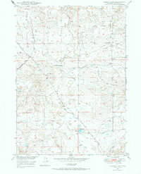
1949 Map of Gilbert Lake
USGS Topo · Published 1970About this map
Sage Creek and its various branches dominate this landscape in central Wyoming, showing the intricate drainage patterns of the high plains before the extensive modern modifications of the late 20th century. This 1949 survey was produced as part of the Department of the Interior program for the development of the Missouri River Basin, reflecting a post-war emphasis on water management and land use. The isolated Smith Ranch serves as a primary marker of human activity in an area defined by wide-open ranching tracts and winding watercourses like the Gilbert Ditch. Local transit was facilitated by the Highland Loop Road and the Glenrock-Ross Road, which provided essential links between the remote ranching operations and larger regional hubs. The presence of Gilbert Lake near the center of the sheet highlights the importance of seasonal or managed water sources for livestock and survival in this arid terrain.
Find a feature on this map
7 named features on this map. Tap any name to fly to it.
Don’t see what you’re looking for? This feature index may not catch every label — zoom into the map to look around manually.
Map Details
Editions of this 1949 Gilbert Lake Map
2 editions found
Other maps of this area

1949 · Sundquist Ranch
USGS Topo · 1:24,000

1949 · Orpha
USGS Topo · 1:24,000

1949 · Careyhurst
USGS Topo · 1:24,000

1949 · Douglas
USGS Topo · 1:24,000

1949 · Leuenberger Ranch
USGS Topo · 1:24,000

1950 · Careyhurst
USGS Topo · 1:24,000

1950 · Gilbert Lake
USGS Topo · 1:24,000

1950 · Leuenberger Ranch
USGS Topo · 1:24,000

1950 · Douglas
USGS Topo · 1:24,000

1950 · Orpha
USGS Topo · 1:24,000