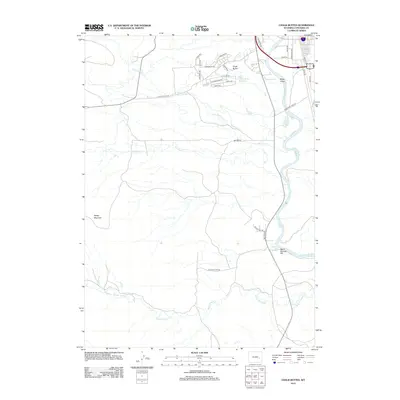
2012 Map of Chalk Buttes
USGS Topo · Published 2012About this map
The N Platte River carves through this high-plains landscape south of Douglas, where geothermal activity and livestock ranching define the local geography. Significant landmarks include the Douglas Hot Springs and Warm Springs Hill along the river's western bank, while the northern uplands are dominated by the Chalk Buttes and the nearby Chalk Buttes Reservoir. A network of drainage systems, including Wagon Hound Cr, Bed Tick Cr, and Little Bed Tick Cr, dissects the terrain, illustrating the complex hydrology of the Converse County basin. The presence of the Dilts Ranch and a concentration of residential roads such as Huxtable Rd and Valley Dr suggest a modern shift toward rural residential development while maintaining its heritage as a ranching corridor. To the southwest, Sheep Mountain rises as a prominent topographical feature, overlooking the confluence of Jack Cr and Flume Cr.
Find a feature on this map
37 named features on this map. Tap any name to fly to it.
Don’t see what you’re looking for? This feature index may not catch every label — zoom into the map to look around manually.
Map Details
Editions of this 2012 Chalk Buttes Map
This is the sole edition of this map. No revisions or reprints were ever made.
Other maps of this area

1949 · Orpha
USGS Topo · 1:24,000

1949 · Irvine
USGS Topo · 1:24,000

1949 · Poison Lake
USGS Topo · 1:24,000

1949 · Douglas
USGS Topo · 1:24,000

1949 · Dilts Ranch
USGS Topo · 1:24,000

1949 · Chalk Buttes
USGS Topo · 1:24,000

1949 · Antelope Creek
USGS Topo · 1:24,000

1950 · Poison Lake
USGS Topo · 1:24,000

1950 · Douglas
USGS Topo · 1:24,000

1950 · Orpha
USGS Topo · 1:24,000