2000s (21st Century) Maps of Douglas, Wyoming
Explore 4 historic maps of Douglas from the 2000s (21st Century). These maps offer a rare glimpse into what life looked like during the 2000s — showing old roads, neighborhoods, homes, and landmarks that have changed or disappeared over time.
Whether you're researching your family's past, planning a metal detecting trip, or studying how Douglas's landscape evolved across the 2000s, these high-resolution maps are a powerful tool for exploring the history of this region.
- Focus on a specific era: All maps on this page are from the 2000s, giving you a focused view of this time period.
- See what’s changed: Compare century-old streets, trails, and buildings to today's modern landscape using overlays and satellite layers.
- Research with precision: Use these maps for genealogy, historical research, land use analysis, or educational projects.
- View, download, or print: Maps are fully viewable online in high resolution, and can be downloaded or printed for your own records.
Start exploring Douglas's history through authentic maps from the 2000s. This is your window into the past.
Douglas, WY maps
(4)- 2021 Map of Irvine, 2021 Print
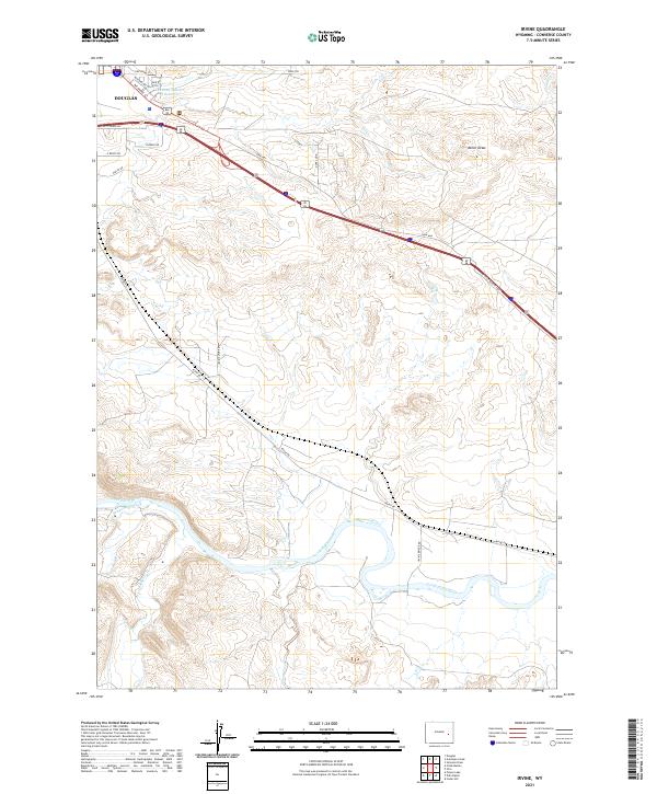 2021 Irvine2021 Print · USGSConverse County at the start of the 2020s shows a landscape of river-valley ranching and modern highway transport. Trace family lands and rural access along Irvine Rd, the banks of the North Platte River, and the outskirts of Douglas.
 - 2021 Map of Douglas, 2021 Print
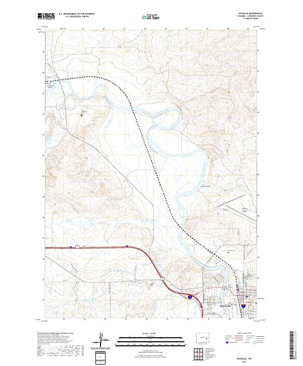 2021 Douglas2021 Print · USGSDouglas and the North Platte River valley are shown here in the early twenty-first century, highlighting a landscape of ranching and aviation. Genealogists can locate several burial sites including Fort Fetterman Cem and Pioneer Cem near the historic river bends.
 - 2021 Map of Antelope Creek, 2021 Print
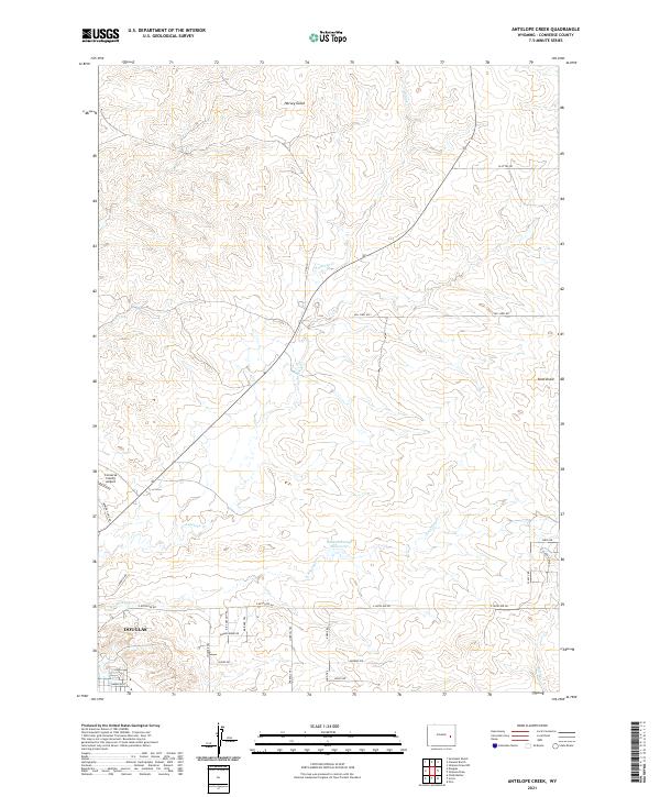 2021 Antelope Creek2021 Print · USGSThe northern edges of Douglas meet the high plains of Converse County in this recent survey. Local historians and land researchers can trace historical named routes like the Kit Carson Trl and Bridger Trl near the Baaken Esmay Reservoir.
 - 2021 Map of Chalk Buttes, 2021 Print
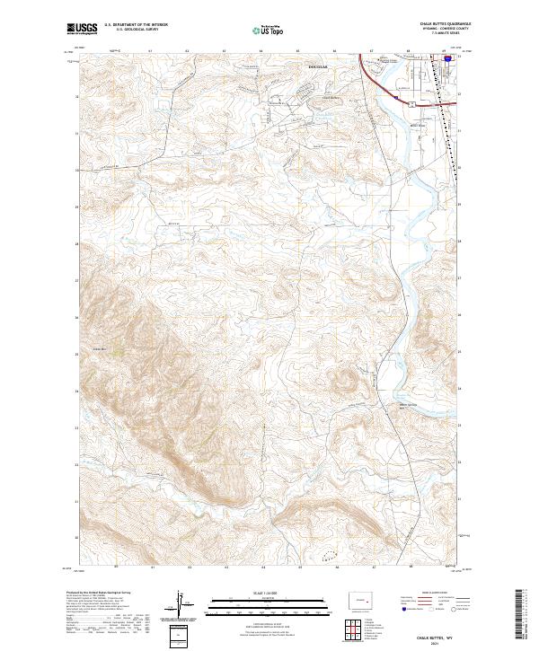 2021 Chalk Buttes2021 Print · USGSThe outskirts of Douglas meet the high plains in this modern survey of the North Platte riverfront. Genealogists and researchers can trace local landmarks like Douglas Hot Springs, the Chalk Buttes Reservoir, and Sheep Mtn.
End of results
Showing maps 1-4 of 4
Frequently asked questions
- What are the different types of historical maps available for Douglas?
- What is the oldest map of Douglas?
- Where can I purchase historical maps of Douglas for my home or office?
- Where can I download high-res historical maps of Douglas?
- Are there historical topographic maps available for Douglas?
- Is there historical aerial imagery available for Douglas?
- Where are historical maps of Douglas sourced from?