
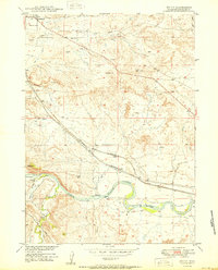
1949 Map of Antelope Creek
USGS Topo · Published 1981About this map
Antelope Creek and its southern branch, East Antelope Creek, carve through this central Wyoming landscape as it appeared in the late 1940s. The area is defined by a sparse ranching economy, with sites like Combs Ranch and Wallis Ranch representing the local settlement pattern. This survey, part of the Missouri River Basin development program, documents a specific moment of transition for rural infrastructure. The presence of the Graves School (Abandoned) south of Highland Loop Road suggests shifting demographics in this corner of Converse County. Toward the southern edge of the map, the outskirts of Douglas are visible, including the Douglas Cem, providing a detailed record for genealogists and local historians tracking the early footprint of the town and its outlying ranching families along Smith Creek.
Find a feature on this map
9 named features on this map. Tap any name to fly to it.
Don’t see what you’re looking for? This feature index may not catch every label — zoom into the map to look around manually.
Map Details
Editions of this 1949 Antelope Creek Map
This is the sole edition of this map. No revisions or reprints were ever made.
Other maps of this area

1949 · Sundquist Ranch
USGS Topo · 1:24,000

1949 · Irvine
USGS Topo · 1:24,000

1949 · Douglas
USGS Topo · 1:24,000

1949 · Chalk Buttes
USGS Topo · 1:24,000

1949 · Clausen Ranch
USGS Topo · 1:24,000

1949 · Orin
USGS Topo · 1:24,000

1950 · Clausen Ranch
USGS Topo · 1:24,000

1950 · Douglas
USGS Topo · 1:24,000

1950 · Orin
USGS Topo · 1:24,000
1950 · Irvine
USGS Topo · 1:24,000