1980s Maps of Converse County, Wyoming
Explore 43 historic maps of Converse County from the 1980s. These maps offer a rare glimpse into what life looked like during the 1980s — showing old roads, neighborhoods, homes, and landmarks that have changed or disappeared over time.
Whether you're researching your family's past, planning a metal detecting trip, or studying how Converse County's landscape evolved across the 1980s, these high-resolution maps are a powerful tool for exploring the history of this region.
- Focus on a specific era: All maps on this page are from the 1980s, giving you a focused view of this time period.
- See what’s changed: Compare century-old streets, trails, and buildings to today's modern landscape using overlays and satellite layers.
- Research with precision: Use these maps for genealogy, historical research, land use analysis, or educational projects.
- View, download, or print: Maps are fully viewable online in high resolution, and can be downloaded or printed for your own records.
Start exploring Converse County's history through authentic maps from the 1980s. This is your window into the past.
Converse County, WY maps
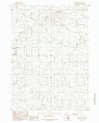
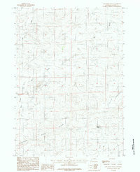
(43)- 1981 Map of Midwest
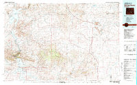
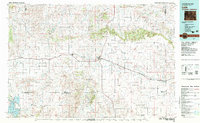
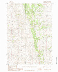
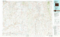 1981 Midwest1981 Print · USGSThe energy-rich plains of central Wyoming are mapped here during the early eighties, highlighting the massive Salt Creek Oil Field. Local historians can trace the rail lines of the Burlington Northern Railroad and locate landmarks like Teapot Rock and the town of Midwest.
 - 1981 Map of Wagonhound Creek
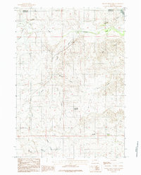
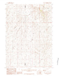
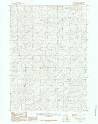
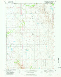 1981 Wagonhound Creek1981 Print · USGSEastern Wyoming ranching country is captured here in the early 1980s, centered on the Dull Center community. Researchers can trace local landmarks like Nachtman Sch and family-named features including Dull Reservoir and Nachtman Reservoir.
 - 1981 Map of Douglas
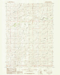
 1981 Douglas1981 Print · USGSThe North Platte River corridor in the early eighties shows a landscape shaped by energy and iron. Genealogists and industrial historians can trace rail-side settlements like Glenrock, explore the Big Muddy Oil Field, and locate the old siding at Fetterman.
 - 1981 Map of Pinnacle Rocks
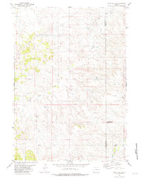
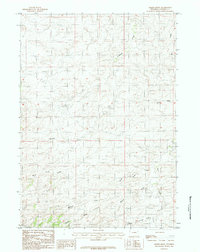
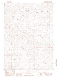
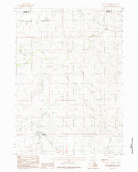
 1981 Pinnacle Rocks1981 Print · USGSConverse County and Niobrara County meet in this Wyoming landscape during the early 1980s. Researchers can trace the drainage patterns of Rattlesnake Hills and locate landmarks like Middle Creek Reservoir and Miller Buttes.
 - 1981 Map of Split Hill SW
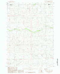
 1981 Split Hill SW1981 Print · USGSThe high plains of the Converse and Niobrara county line come alive in the early 1980s, showcasing a landscape defined by energy development. Trace industrial markers like the Pumping Sta, numerous Oil Well sites, and the paths of a Pipeline across Walker Creek.
 - 1981 Map of Shirley Basin
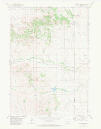
 1981 Shirley Basin1981 Print · USGSThe high Wyoming desert comes alive in this early 1980s survey of Carbon County, where massive reservoirs meet rugged mountain ranges. Researchers can trace the industrial activity at Shirley Basin and Mine Dumps or explore early shoreline footprints at Seminoe State Park.
 - 1981 Map of Laramie Peak
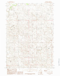
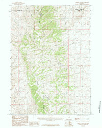
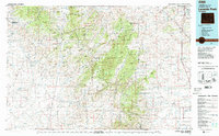 1981 Laramie Peak1981 Print · USGSThe Laramie Mountains and Medicine Bow National Forest define this landscape in the early eighties. Genealogists and historians can trace high-country settlements like Toltec and Binford, or locate industrial sites like the Mica Mine near the North Laramie River.2 unique versions available
 - 1981 Map of Split Hill, 1982 Print
 1981 Split Hill1982 Print · USGSEastern Wyoming's high plains are shown at a peak of energy exploration in the early 1980s. Researchers can locate remote ranch infrastructure and petroleum landmarks such as the Kaye Oil Field, Split Hill, and the isolated Landing Strips.
 - 1981 Map of Lance Creek, 1983 Print
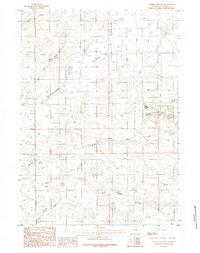
 1981 Lance Creek1983 Print · USGSEastern Wyoming at the start of the 1980s reveals a high-plains landscape dominated by the energy industry and complex drainage systems. Researchers can trace the footprints of the Kaye Oil Field and Clareton Oil Field or follow the waters of the Cheyenne River and Robbers Roost Creek.
 - 1982 Map of Lusk, 1983 Print
 1982 Lusk1983 Print · USGSNiobrara County and the surrounding high plains are shown in the early eighties as the Chicago and North Western line linked remote cattle towns. Researchers can trace the path of the Niobrara River or locate community hubs like Node, Keeline, and Prairie Center.
 - 1984 Map of Dugout Creek North
 1984 Dugout Creek North1984 Print · USGSThe high plains of eastern Wyoming are captured here in the mid-1980s, where the Campbell and Converse county line meets. Researchers can trace the complex drainage patterns of Antelope Creek and find remote landmarks like Black Hill Reservoir and the Rochelle Hills.
 - 1984 Map of Marsh Draw
 1984 Marsh Draw1984 Print · USGSConverse County's high plains drainage systems are captured here in the mid-1980s, showing a network of remote ranch trails and seasonal watercourses. Researchers can trace the paths of Antelope Creek and Marsh Draw or locate a secluded Spring.
 - 1984 Map of Coal Draw North
 1984 Coal Draw North1984 Print · USGSThe borderlands of Converse and Campbell counties come alive in the mid-1980s, showing a landscape defined by ranching and water management. Researchers can trace the path of the Betty Supply Ditch and locate remote landmarks like the Landing Strip and Antelope Flat.2 unique versions available
 - 1984 Map of Bobby Draw
 1984 Bobby Draw1984 Print · USGSConverse County industry and water management are front and center in the mid-1980s. Genealogists and historians can trace local resource use through the Open Pit Mine, the settlement of Bobby, and the Morton Reservoir.
 - 1984 Map of Whipple Hollow
 1984 Whipple Hollow1984 Print · USGSConverse County ranching and water management are the focus of this mid-eighties survey of the Wyoming high plains. Researchers can locate established homesteads like Leuenberger Ranch and trace vital water sources from Whipple Hollow Spring to Antelope Reservoir.
 - 1984 Map of Gumbo Hill
 1984 Gumbo Hill1984 Print · USGSConverse County ranchlands are documented here in the mid-eighties, showing a landscape shaped by water management and high plains topography. Researchers can trace the drainages of the Dry Fork Cheyenne River and locate family-named sites like Eberspecher Reservoir and Manser Reservoir.
 - 1984 Map of Patsy Draw
 1984 Patsy Draw1984 Print · USGSConverse County rangeland comes into focus in the early eighties, showing the essential water sources for local ranching. Trace family history and land use through Madsen Reservoir, Anderson Reservoir, and the complex drainage of the Cheyenne River and Dry Fork.
 - 1984 Map of Coal Draw South
 1984 Coal Draw South1984 Print · USGSConverse County's high plains and drainage basins are captured here in the mid-1980s. Researchers can trace the path of the Cheyenne River, locate a Mine Dump near Bear Creek, and identify water sources like Reynolds Reservoir.
 - 1984 Map of Seven L Creek East
 1984 Seven L Creek East1984 Print · USGSThe Converse and Natrona County borderlands are captured here in the mid-1980s, showcasing a landscape of high-plains draws and seasonal creeks. Researchers can trace the drainage patterns of Seven L Creek and locate landmarks like Pine Ridge and Sand Spring Creek.
 - 1984 Map of Sawmill Canyon
 1984 Sawmill Canyon1984 Print · USGSThe high ranching country of east-central Wyoming is shown here in the mid-1980s as it spans four county lines. Researchers can trace the rugged drainage systems of the Pine Ridge including Sawmill Canyon, Wind Creek, and the North Fork Powder R.
 - 1984 Map of Holdup Hollow
 1984 Holdup Hollow1984 Print · USGSConverse County ranching country is captured here during the 1980s, showcasing the high ridges and water sources of the high plains. Researchers can locate remote homesteads like Hylton Ranch and Leuenberger Ranch or trace the geography of Holdup Hollow and Silver Spoon Reservoir.
 - 1984 Map of Gillam Draw East
 1984 Gillam Draw East1984 Print · USGSThe rugged divide of Pine Ridge defines this Wyoming landscape during the mid-1980s. Researchers can trace the county line and the intricate network of watercourses including Big Bull Creek, Antelope Creek, and Holmes Draw.
 - 1984 Map of Thompson Draw
 1984 Thompson Draw1984 Print · USGSConverse County's high-plains drainage systems are captured here in the mid-seventies and eighties, showing a landscape defined by seasonal water and open range. Researchers can trace the distinctive Flat Allemand terrain and the routes of Stinking Water Creek or Bear Creek.
 - 1984 Map of Suicide Hill
 1984 Suicide Hill1984 Print · USGSConverse County ranching and mining lands come into focus during the mid-seventies and early eighties. Trace local landmarks from Harland Flat to the Strip Mine, or follow the winding Cheyenne River past M-S Hill and Suicide Hill.
 - 1984 Map of Betty Reservoir
 1984 Betty Reservoir1984 Print · USGSConverse County's high plains are captured in the early 1980s as a landscape of wide flats and vital water management. Researchers can trace the drainage patterns and land divisions around Betty Reservoir, Antelope Flat, and Haefele Draw.2 unique versions available
Showing maps 1-25 of 43
Top cities of Converse County
- Douglas historical maps
- Glenrock historical maps
- Rolling Hills historical maps
- Rolling Hills historical maps
- Lost Springs historical maps
Frequently asked questions
- What are the different types of historical maps available for Converse County?
- What is the oldest map of Converse County?
- Where can I purchase historical maps of Converse County for my home or office?
- Where can I download high-res historical maps of Converse County?
- Are there historical topographic maps available for Converse County?
- Is there historical aerial imagery available for Converse County?
- Where are historical maps of Converse County sourced from?