1990s Maps of Converse County, Wyoming
Explore 17 historic maps of Converse County from the 1990s. These maps offer a rare glimpse into what life looked like during the 1990s — showing old roads, neighborhoods, homes, and landmarks that have changed or disappeared over time.
Whether you're researching your family's past, planning a metal detecting trip, or studying how Converse County's landscape evolved across the 1990s, these high-resolution maps are a powerful tool for exploring the history of this region.
- Focus on a specific era: All maps on this page are from the 1990s, giving you a focused view of this time period.
- See what’s changed: Compare century-old streets, trails, and buildings to today's modern landscape using overlays and satellite layers.
- Research with precision: Use these maps for genealogy, historical research, land use analysis, or educational projects.
- View, download, or print: Maps are fully viewable online in high resolution, and can be downloaded or printed for your own records.
Start exploring Converse County's history through authentic maps from the 1990s. This is your window into the past.
Converse County, WY maps
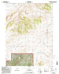
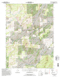
(17)- 1992 Map of Rock Creek, 1996 Print
 1992 Rock Creek1996 Print · USGSThe high-country border of Converse and Albany Counties is shown here in the early nineties as a network of vital mountain springs and headwaters. Researchers can trace remote locales like Russells Camp and Whiskey Springs or follow the path of the Little Medicine Bow River.
 - 1992 Map of Protsmans Knob, 1996 Print
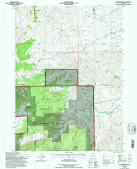
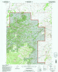
 1992 Protsmans Knob1996 Print · USGSConverse County ranching and forest lands are revealed in this early 1990s survey, showing the transition from the high plains to the mountains. Researchers can locate remote sites like the Miller Cabin, the prospect on the ridge, and named water sources like Mesa Spring.
 - 1992 Map of Esterbrook, 1996 Print
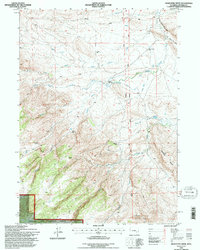
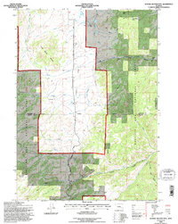
 1992 Esterbrook1996 Print · USGSThe high country of the Medicine Bow National Forest is documented here in the early nineties, centered on the Converse and Albany county lines. Trace local history through the mountain settlement of Esterbrook, family-named peaks like Reeder Hill, and old Mines.
 - 1992 Map of Maneater Creek, 1996 Print
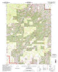
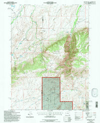
 1992 Maneater Creek1996 Print · USGSThe high plains of Converse County meet the forest edge in the early nineties, revealing a landscape shaped by ranching and water rights. Researchers can trace historic homesteads like Raeber Ranch and find the site of the rural Wagon Hound Sch.
 - 1992 Map of Warbonnet Peak, 1996 Print
 1992 Warbonnet Peak1996 Print · USGSThe high Laramie Mountains transition between Converse and Albany counties in the early nineties, revealing a landscape of remote mines and high-country ranching. Researchers can locate the Old Copper King Mine, trace the winding La Prele Creek, and find the H-V Ranch.
 - 1992 Map of Harris Park, 1996 Print
 1992 Harris Park1996 Print · USGSHigh in the Laramie Range during the early nineties, this area showcases the secluded mountain communities and rugged drainage basins of Albany County. Researchers can trace remote residential sites like Harmon Heights and Harris Park alongside landmarks like Albany Peak.
 - 1992 Map of Windy Peak, 1996 Print
 1992 Windy Peak1996 Print · USGSThe high Laramie Mountains at the Albany and Converse county line are shown here in the early nineties, centered on Medicine Bow National Forest. Researchers can trace the location of the Prager Sch and remote water sources like Wagon Wheel Spring or Shepherd Springs.
 - 1992 Map of Buffalo Peak, 1996 Print
 1992 Buffalo Peak1996 Print · USGSThe high country of Converse County is captured here in the early nineties, showing a landscape defined by the Medicine Bow National Forest. Researchers can trace remote sites like Silver Spruce Lodge, geologic landmarks like Bear Rock, and the deep cut of the La Prele Gorge.
 - 1992 Map of School Section Mtn, 1996 Print
 1992 School Section Mtn1996 Print · USGSThe high country of the Converse and Albany County line comes into focus in the early 1990s, where ranching and mining history overlap. Researchers can trace the Old Fort Fetterman Road past the Pyramid Mine and family outposts like Sims Ranch and Arnold Place.
 - 1992 Map of Banner Mtn, 1996 Print
 1992 Banner Mtn1996 Print · USGSThe high country of Converse and Natrona counties in the 1990s is captured here at the edge of the Medicine Bow National Forest. Genealogists and historians can trace family-named holdings like the Rissler Ranch and Banner Ranch.
 - 1992 Map of Saddleback Mtn, 1996 Print
 1992 Saddleback Mtn1996 Print · USGSThe Laramie Mountains of Converse and Albany counties are shown in the early nineties, a period when this high-country landscape remained largely undeveloped. You can trace the path to Mc Donald Cabin or locate remote high-altitude crossings like Jenkins Pass and West Fork Pass.2 unique versions available
 - 1992 Map of Squaw Spring, 1996 Print
 1992 Squaw Spring1996 Print · USGSRemote ranching life and early homesteads characterize this Wyoming landscape during the late twentieth century. Genealogists and historians can locate the Higginson Homestead, the Little Medicine Sch, and the winding Little Medicine Bow River.
 - 1992 Map of Laramie Peak, 1996 Print
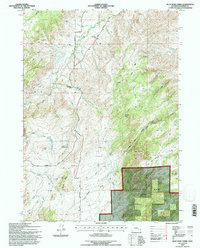
 1992 Laramie Peak1996 Print · USGSThe Converse County high country is mapped here in the early nineties, centered on the towering presence of Laramie Peak. Hikers and historians can trace the Horse and Pack Trail, the campgrounds of Friend Park, and the route of Esterbrook Road.2 unique versions available
 - 1992 Map of Reno Hill, 1996 Print
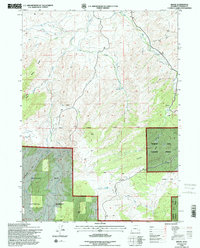
 1992 Reno Hill1996 Print · USGSHigh ranching and forest lands in Converse and Natrona counties are captured here in the early 1990s. Genealogists and local historians can locate remote outposts like Old Tobin Place, Barker Sheep Camp, and the Stewart Ranch.
 - 1992 Map of Blue Nose Creek, 1996 Print
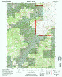
 1992 Blue Nose Creek1996 Print · USGSConverse County's ranching and wilderness history comes alive in this early 1990s survey of the high mountain drainages. Researchers can trace the Old Fort Fetterman Road and locate rural landmarks like the Moss Agate Sch and Chamberlain Place.
 - 1992 Map of Braae, 1996 Print
 1992 Braae1996 Print · USGSConverse County’s high country near the Laramie Range is documented here during the early nineties as cattle ranching and forestry shaped the land. Researchers can trace local landmarks like the settlement of Braae, the small Cem, and the waters of Indian Reservoir.
 - 1992 Map of Buck Peak, 1996 Print
 1992 Buck Peak1996 Print · USGSConverse County's high-country ranching and forest lands are documented here in the early 1990s. Researchers can locate remote homestead sites like the Buck Place and Leahy Place, or trace the old Box Elder Sch near the forks of Keely Creek.
End of results
Showing maps 1-17 of 17
Top cities of Converse County
- Douglas historical maps
- Glenrock historical maps
- Rolling Hills historical maps
- Rolling Hills historical maps
- Lost Springs historical maps
Frequently asked questions
- What are the different types of historical maps available for Converse County?
- What is the oldest map of Converse County?
- Where can I purchase historical maps of Converse County for my home or office?
- Where can I download high-res historical maps of Converse County?
- Are there historical topographic maps available for Converse County?
- Is there historical aerial imagery available for Converse County?
- Where are historical maps of Converse County sourced from?