Old Maps of Sussex Unit, Wyoming for Genealogy
Trace your family roots with 5 historic maps of Sussex Unit. These high-res maps reveal old neighborhoods, homesites, landmarks, and streets — helping you uncover where your ancestors lived and how the area evolved over time.
- Explore historic neighborhoods: Identify where your relatives may have lived in the 1800s or 1900s.
- Compare maps over time: Trace the changes in streets, buildings, and landmarks for multi-generational research.
- Perfect for genealogy & ancestry research: Used by family historians and researchers to map out lineage and migration.
These maps are an incredible resource for exploring your personal connection to Sussex Unit's past.
Sussex Unit, WY maps
(5)- 1954 Map of Linch, 1956 Print
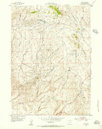 1954 Linch1956 Print · USGSJohnson County was a hub of energy production in the mid-1950s, where industrial oil camps met traditional Wyoming ranching. Researchers can trace early petroleum infrastructure at the Sussex Oil Field or locate family sites like Tillman Ranch and the Irvine Cow Camp.3 unique versions available
 - 1955 Map of Arminto, 1976 Print
 1955 Arminto1976 Print · USGSCentral Wyoming at the mid-century shows a landscape of energy reserves and high-plains ranching. Genealogists and historians can trace the Burlington Northern line through Lost Cabin and the famed Teapot Dome Naval Petroleum Reserve No 3.2 unique versions available
 - 1958 Map of Arminto
 1958 Arminto1958 Print · USGSCentral Wyoming in the late fifties was a landscape of high-plains energy and remote rail outposts. Researchers can trace the Chicago Burlington and Quincy railroad through towns like Arminto and Waltman or locate landmarks like Teapot Rock.
 - 1962 Map of Arminto
 1962 Arminto1962 Print · USGSCentral Wyoming in the early sixties reveals a landscape shaped by the Chicago and North Western railroad and early energy development. Trace the history of the region through remote outposts like Arminto, the US Naval Petroleum Reserve, and the geologic landmark at Hells Half Acre.
 - 2021 Map of Linch, 2021 Print
 2021 Linch2021 Print · USGSIn the high plains of Johnson County during the early twenty-first century, the small settlement of Linch anchors a landscape of ranching and resource extraction. Trace the intricate network of named drainage features like Moonshine Draw and vital water sources including Joe Grey Spring.
End of results
Showing maps 1-5 of 5
Top cities near Sussex Unit
Frequently asked questions
- What are the different types of historical maps available for Sussex Unit?
- What is the oldest map of Sussex Unit?
- Where can I purchase historical maps of Sussex Unit for my home or office?
- Where can I download high-res historical maps of Sussex Unit?
- Are there historical topographic maps available for Sussex Unit?
- Is there historical aerial imagery available for Sussex Unit?
- Where are historical maps of Sussex Unit sourced from?