
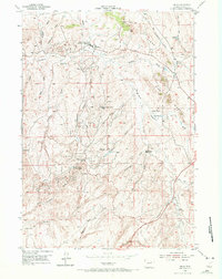
1954 Map of Linch
USGS Topo · Published 1956About this map
The Sussex Oil Field and surrounding petroleum deposits dominate this mid-century landscape in Johnson County, illustrating the intensive post-war industrialization of the Wyoming plains. Managed in part by the United States Atomic Energy Commission, the area is defined by a network of camps and infrastructure supporting the extraction economy. Worker settlements like the Sussex Unit, North Meadow Creek Camp, and Meadow Creek camps sit alongside the Linch post office, while the Sussex Repressuring Plant marks a significant technical hub for the field's operations.
Find a feature on this map
39 named features on this map. Tap any name to fly to it.
Don’t see what you’re looking for? This feature index may not catch every label — zoom into the map to look around manually.
Map Details
Editions of this 1954 Linch Map
3 editions found
Other maps of this area

1953 · Dry Fork Ranch
USGS Topo · 1:24,000

1954 · House Creek
USGS Topo · 1:24,000

1954 · Taylor Ranch
USGS Topo · 1:24,000

1955 · Arminto
USGS Topo · 1:250,000

1958 · Arminto
USGS Topo · 1:250,000

1959 · Edgerton
USGS Topo · 1:62,500

1961 · Dead Woman Crossing
USGS Topo · 1:24,000
1961 · Sussex
USGS Topo · 1:24,000

1962 · Arminto
USGS Topo · 1:250,000

1968 · Midwest
USGS Topo · 1:24,000