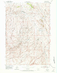
1954 Map of Linch
USGS Topo · Published 1972About this map
Linch and its surrounding oil fields define this mid-century industrial landscape in Johnson County. Surveyed by the Geological Survey and the Atomic Energy Commission, the map reveals a specialized extraction economy dominated by the Sussex Oil Field, North Meadow Creek Oil Field, and Meadow Creek Oil Field. The settlement pattern is largely dictated by these resources, featuring several worker outposts such as the Sussex Unit (Continental Camp), North Meadow Creek Camp, and Meadow Creek (Continental Camp).
Find a feature on this map
43 named features on this map. Tap any name to fly to it.
Don’t see what you’re looking for? This feature index may not catch every label — zoom into the map to look around manually.
Map Details
Editions of this 1954 Linch Map
3 editions found
Other maps of this area

1953 · Dry Fork Ranch
USGS Topo · 1:24,000

1954 · House Creek
USGS Topo · 1:24,000

1954 · Linch
USGS Topo · 1:24,000

1954 · Taylor Ranch
USGS Topo · 1:24,000

1955 · Arminto
USGS Topo · 1:250,000

1958 · Arminto
USGS Topo · 1:250,000

1959 · Edgerton
USGS Topo · 1:62,500

1961 · Dead Woman Crossing
USGS Topo · 1:24,000
1961 · Sussex
USGS Topo · 1:24,000

1962 · Arminto
USGS Topo · 1:250,000