Old Maps of Horse Creek, Wyoming for Metal Detecting
Plan your next treasure hunt with 9 historic maps of Horse Creek. Find old homesites, ghost towns, trails, and gathering spots that may be lost to time — perfect for identifying promising metal detecting locations.
- Locate forgotten sites: Uncover places like long-lost settlements, abandoned rail lines, or gathering spots.
- Plan better hunts: Use map overlays combined with LiDAR or satellite views to narrow in on historically rich areas.
- Made for detectorists: Thousands of hobbyists use these maps to discover relics, coins, and hidden history.
Use these historic maps to boost your research and find new opportunities beneath the surface of Horse Creek.
Horse Creek, WY maps
(9)- 1905 Map of Sherman
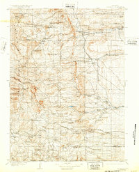 1905 Sherman1905 Print · USGSThe Laramie foothills and high plains at the turn of the century show a landscape defined by ranching and the railroad. Researchers can trace the Union Pacific RR through old stops like Leslie or locate historic homesteads such as Bakers Ranch and Islay PO.4 unique versions available
 - 1954 Map of Cheyenne, 1963 Print
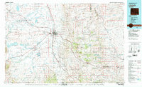
 1954 Cheyenne1963 Print · USGSSoutheastern Wyoming's high plains and the capital city's mid-century expansion are documented here during the early Cold War. Genealogists and historians can trace rail-aligned settlements like Pine Bluffs and Hillsdale, or explore landmarks like the Ames Monument and Francis E. Warren Air Force Base.3 unique versions available
 - 1958 Map of Cheyenne
 1958 Cheyenne1958 Print · USGSSoutheast Wyoming and the Nebraska border appear in the late 1950s as a hub of military defense and rail commerce. Genealogists can trace the Union Pacific through Cheyenne or locate the Horse Creek Oil Field and the State Capitol.2 unique versions available
 - 1962 Map of Horse Creek, 1964 Print
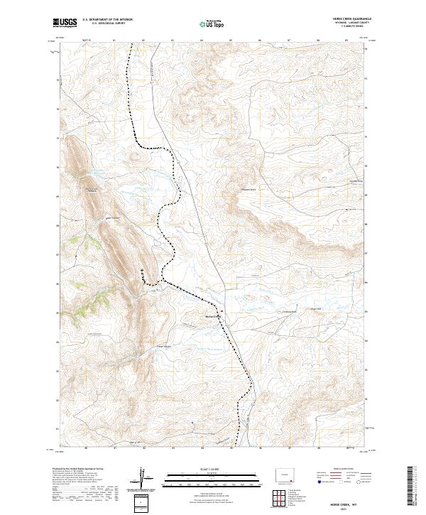
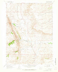 1962 Horse Creek1964 Print · USGSLaramie County ranching and rail operations are in full swing here during the early sixties. Genealogists and historians can trace the Colorado and Southern rail line to find Horse Creek Siding, the Horse Creek Quarries, and legacy holdings like Whitaker Ranch.
 - 1981 Map of Laramie
 1981 Laramie1981 Print · USGSLaramie and the high plains of the Laramie Mountains are captured here in the early eighties. Researchers can trace the Union Pacific rail stops, find Greenhill Cem, and locate early routes like the Overland Trail.2 unique versions available
 - 2012 Map of Horse Creek, 2012 Print
 2012 Horse Creek2012 Print · USGSCovers Horse Creek, including Murke, Laramie County, and other nearby areas
 - 2015 Map of Horse Creek, 2015 Print
 2015 Horse Creek2015 Print · USGSCovers Horse Creek, including Murke, Laramie County, and other nearby areas
 - 2017 Map of Horse Creek, 2017 Print
 2017 Horse Creek2017 Print · USGSCovers Horse Creek, including Murke, Laramie County, and other nearby areas
 - 2021 Map of Horse Creek, 2021 Print
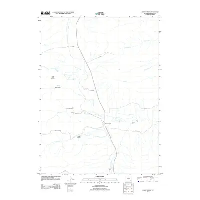
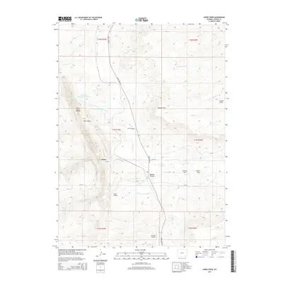
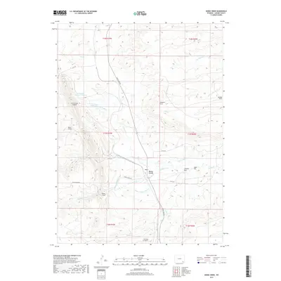
 2021 Horse Creek2021 Print · USGSLaramie County ranching country is centered around Horse Creek in this modern survey of the high Wyoming plains. Researchers can trace intricate water rights through the McLaughlin Ditch Number 5 and locate landmarks like Chimney Rock and Eagle Hill.
End of results
Showing maps 1-9 of 9
Frequently asked questions
- What are the different types of historical maps available for Horse Creek?
- What is the oldest map of Horse Creek?
- Where can I purchase historical maps of Horse Creek for my home or office?
- Where can I download high-res historical maps of Horse Creek?
- Are there historical topographic maps available for Horse Creek?
- Is there historical aerial imagery available for Horse Creek?
- Where are historical maps of Horse Creek sourced from?