Old Maps of Midwest, Wyoming for Academic Research
Study the evolution of Midwest with 6 high-resolution historic maps. Whether you're teaching, researching, or modeling changes in land use, these maps provide essential visual documentation of urban, environmental, and geographic change.
- Analyze long-term change: Track patterns in development, transportation, and natural features.
- Ideal for environmental or urban studies: Support academic projects with primary historical map data.
- Use in the classroom or lab: Educators and researchers rely on these maps to bring historical context to life.
These maps are a powerful tool for teaching, research, and visualizing how Midwest has changed over the decades.
Midwest, WY maps
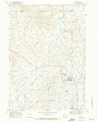
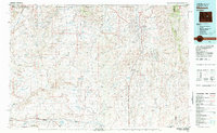
(6)- 1955 Map of Arminto, 1976 Print
 1955 Arminto1976 Print · USGSCentral Wyoming at the mid-century shows a landscape of energy reserves and high-plains ranching. Genealogists and historians can trace the Burlington Northern line through Lost Cabin and the famed Teapot Dome Naval Petroleum Reserve No 3.2 unique versions available
 - 1958 Map of Arminto
 1958 Arminto1958 Print · USGSCentral Wyoming in the late fifties was a landscape of high-plains energy and remote rail outposts. Researchers can trace the Chicago Burlington and Quincy railroad through towns like Arminto and Waltman or locate landmarks like Teapot Rock.
 - 1962 Map of Arminto
 1962 Arminto1962 Print · USGSCentral Wyoming in the early sixties reveals a landscape shaped by the Chicago and North Western railroad and early energy development. Trace the history of the region through remote outposts like Arminto, the US Naval Petroleum Reserve, and the geologic landmark at Hells Half Acre.
 - 1968 Map of Midwest, 1972 Print
 1968 Midwest1972 Print · USGSMidwest and Edgerton are captured here in the late sixties as bustling hubs of the Wyoming energy landscape. Genealogists and historians can trace the industrial footprint of the Shannon Pool Oil Field alongside local landmarks like Midwest Cem and the Gas Plant Camp.2 unique versions available
 - 1981 Map of Midwest
 1981 Midwest1981 Print · USGSThe energy-rich plains of central Wyoming are mapped here during the early eighties, highlighting the massive Salt Creek Oil Field. Local historians can trace the rail lines of the Burlington Northern Railroad and locate landmarks like Teapot Rock and the town of Midwest.
 - 2021 Map of Midwest, 2021 Print
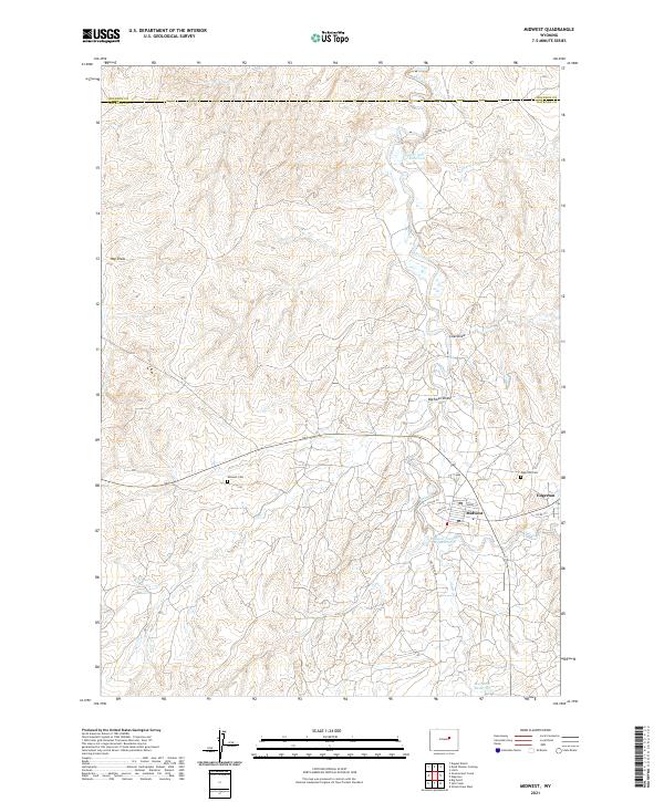 2021 Midwest2021 Print · USGSMidwest and Edgerton are shown during their modern era as key energy-sector settlements near the Johnson County border. Researchers can locate family sites at the Midwest Cemetery or trace water features like Salt Creek and the Lower Salt Creek Reservoir.
End of results
Showing maps 1-6 of 6
Top cities near Midwest
Frequently asked questions
- What are the different types of historical maps available for Midwest?
- What is the oldest map of Midwest?
- Where can I purchase historical maps of Midwest for my home or office?
- Where can I download high-res historical maps of Midwest?
- Are there historical topographic maps available for Midwest?
- Is there historical aerial imagery available for Midwest?
- Where are historical maps of Midwest sourced from?