Old Maps of Raderville, Wyoming for Academic Research
Study the evolution of Raderville with 7 high-resolution historic maps. Whether you're teaching, researching, or modeling changes in land use, these maps provide essential visual documentation of urban, environmental, and geographic change.
- Analyze long-term change: Track patterns in development, transportation, and natural features.
- Ideal for environmental or urban studies: Support academic projects with primary historical map data.
- Use in the classroom or lab: Educators and researchers rely on these maps to bring historical context to life.
These maps are a powerful tool for teaching, research, and visualizing how Raderville has changed over the decades.
Raderville, WY maps
(7)- 1952 Map of Ervay Basin, 1954 Print
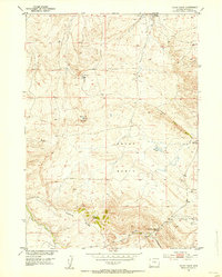 1952 Ervay Basin1954 Print · USGSNatrona County's ranching and energy landscape comes into focus during the early fifties, showing the isolated settlements of the high plains. Trace family ties and land use through the JE Ranch, the JE School, and the small community of Raderville.3 unique versions available
 - 1955 Map of Casper, 1977 Print
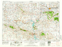
 1955 Casper1977 Print · USGSCentral Wyoming in the mid-fifties is defined by its massive water projects and an emerging energy economy centered around Casper. Genealogists and historians can trace old ranching outposts like Ervay alongside industrial sites such as the Uranium Mill and Poison Spider Oil Field.
 - 1958 Map of Casper
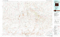
 1958 Casper1958 Print · USGSCentral Wyoming in the late fifties is defined by its massive high-desert reservoirs and the burgeoning energy infrastructure around Casper. Genealogists and researchers can trace remote outposts like Bairoil and Love Ranch or locate the Poison Spider Oil Field.2 unique versions available
 - 1962 Map of Casper
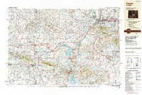
 1962 Casper1962 Print · USGSCentral Wyoming during the early sixties was a landscape of expanding energy production and massive water projects. Researchers can trace the mid-century footprint of the Lost Soldier Oil Field, the development of Casper Air Terminal, and the irrigation network of Pathfinder Reservoir.
 - 1981 Map of Rattlesnake Hills
 1981 Rattlesnake Hills1981 Print · USGSThe high central Wyoming desert comes into focus in the early 1980s, revealing a landscape defined by the Beaver Divide and the Granite Mountains. Genealogists and researchers can locate the remote Lucky Mac Camp, industrial mines, and seasonal landmarks like Buffalo Wallows or Puddle Springs.
 - 1988 Map of Casper
 1988 Casper1988 Print · USGSHigh plains and mountain ranges define Central Wyoming in the late eighties, centered on the growth of the Casper urban corridor. Genealogists and researchers can trace the rail lines of the Chicago and North Western RR or locate small outposts like Jeffrey City and Bairoil.
 - 2021 Map of Ervay Basin, 2021 Print
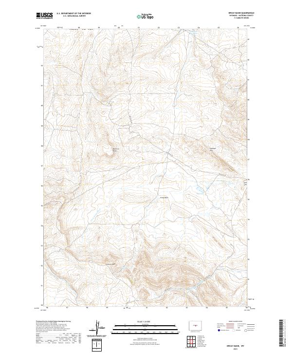 2021 Ervay Basin2021 Print · USGSHigh plains ranching and remote topography define this Natrona County landscape in the early 2020s. Researchers can trace the seasonal flow of the S Fork Powder River and locate isolated water sources like JE Sulphur Spring and Collins Spring.
End of results
Showing maps 1-7 of 7
Frequently asked questions
- What are the different types of historical maps available for Raderville?
- What is the oldest map of Raderville?
- Where can I purchase historical maps of Raderville for my home or office?
- Where can I download high-res historical maps of Raderville?
- Are there historical topographic maps available for Raderville?
- Is there historical aerial imagery available for Raderville?
- Where are historical maps of Raderville sourced from?