Old Maps of Redbird, Wyoming
Explore 8 old maps of Redbird, spanning from 1955 to today. These high-resolution historic maps reveal how streets, neighborhoods, landmarks, and natural features evolved over time — perfect for genealogy, metal detecting, research, and local history exploration.
What you can do with these maps:
- See how Redbird changed over time: Compare historical maps to modern-day views to trace roads, homesites, rail lines & more.
- View detailed metadata: Each map includes creators, publishers, year, scale, and archive source.
- Overlay maps with satellite & LiDAR: Visualize the past alongside modern tools to explore terrain & human change.
- Trusted historical sources: Maps sourced from the USGS, Library of Congress, and other archives.
- Access maps your way: View online, download high-res files, or order prints for personal or research use.
Start exploring old maps of Redbird to uncover forgotten places, hidden landmarks, and the deep history beneath your feet.
Redbird, WY maps
(8)- 1955 Map of Newcastle, 1963 Print
 1955 Newcastle1963 Print · USGSThe high plains of eastern Wyoming and western South Dakota are captured in the mid-fifties, showing a landscape of sprawling ranches and emerging oil fields. Researchers can locate family landmarks like Saunders Ranch, trace the Chicago Burlington & Quincy RR, and explore small rail towns such as Osage and Edgemont.2 unique versions available
 - 1958 Map of Newcastle
 1958 Newcastle1958 Print · USGSThe high plains of eastern Wyoming meet the Black Hills in the late fifties, showcasing a landscape of rail-connected towns and historic trails. Trace the path of the Chicago Burlington & Quincy RR through Newcastle or locate the Bozeman Trail Monument and Summitt Ridge Lookout Tower.
 - 1981 Map of Redbird
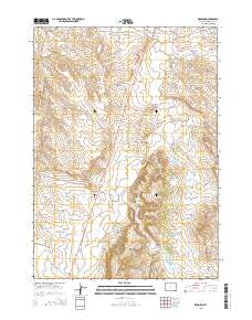
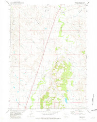 1981 Redbird1981 Print · USGSIn the early eighties, this Niobrara County landscape was a hub of energy exploration and cattle ranching. Trace the network of Oil Wells, Prospects, and water sources like Old Woman Creek and Antelope Creek across the Creek Hills.
 - 1981 Map of Lance Creek, 1983 Print
 1981 Lance Creek1983 Print · USGSEastern Wyoming at the start of the 1980s reveals a high-plains landscape dominated by the energy industry and complex drainage systems. Researchers can trace the footprints of the Kaye Oil Field and Clareton Oil Field or follow the waters of the Cheyenne River and Robbers Roost Creek.
 - 2012 Map of Redbird, 2012 Print
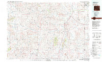
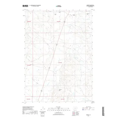
 2012 Redbird2012 Print · USGSCovers Redbird, including Niobrara County, United States, and other nearby areas
 - 2015 Map of Redbird, 2015 Print
 2015 Redbird2015 Print · USGSCovers Redbird, including Niobrara County, United States, and other nearby areas
 - 2017 Map of Redbird, 2017 Print
 2017 Redbird2017 Print · USGSCovers Redbird, including Niobrara County, United States, and other nearby areas
 - 2021 Map of Redbird, 2021 Print
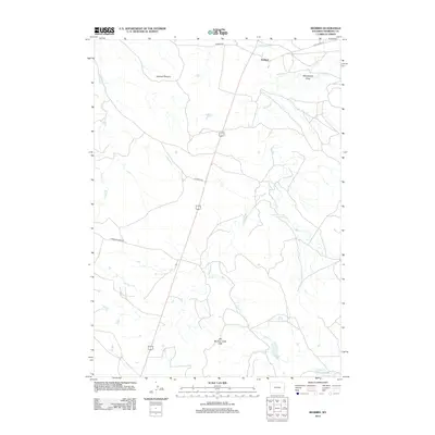
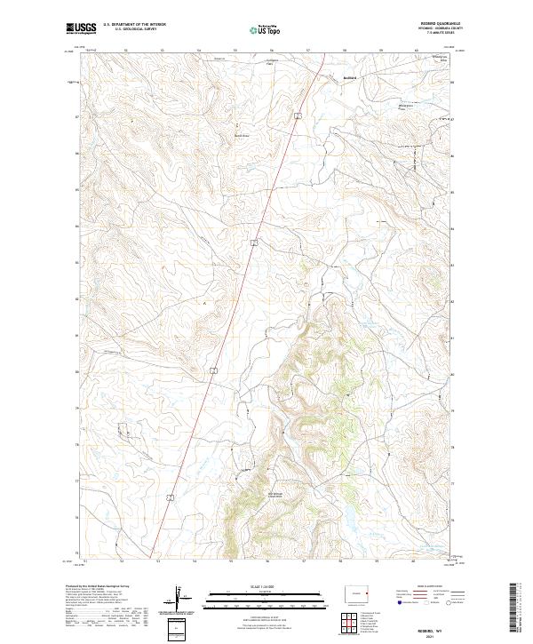 2021 Redbird2021 Print · USGSThe northern reaches of Niobrara County appear in detail as they were in the early twenty-first century, centered on the settlement of Redbird. Researchers can trace the ranching landscape across Culligans Flats or locate water features like Old Woman Cr and Sorem Number 1 Reservoir.
End of results
Showing maps 1-8 of 8
Frequently asked questions
- What are the different types of historical maps available for Redbird?
- What is the oldest map of Redbird?
- Where can I purchase historical maps of Redbird for my home or office?
- Where can I download high-res historical maps of Redbird?
- Are there historical topographic maps available for Redbird?
- Is there historical aerial imagery available for Redbird?
- Where are historical maps of Redbird sourced from?