Old Maps of Niobrara County, Wyoming
Explore 367 old maps of Niobrara County, spanning from 1899 to today. These high-resolution historic maps reveal how streets, neighborhoods, landmarks, and natural features evolved over time — perfect for genealogy, metal detecting, research, and local history exploration.
What you can do with these maps:
- See how Niobrara County changed over time: Compare historical maps to modern-day views to trace roads, homesites, rail lines & more.
- View detailed metadata: Each map includes creators, publishers, year, scale, and archive source.
- Overlay maps with satellite & LiDAR: Visualize the past alongside modern tools to explore terrain & human change.
- Trusted historical sources: Maps sourced from the USGS, Library of Congress, and other archives.
- Access maps your way: View online, download high-res files, or order prints for personal or research use.
Start exploring old maps of Niobrara County to uncover forgotten places, hidden landmarks, and the deep history beneath your feet.
Niobrara County, WY maps
(367)- 1899 Map of Newcastle, 1964 Print
 1899 Newcastle1964 Print · USGSThe Wyoming-South Dakota borderlands appear here at the close of the nineteenth century, as railroads and ranching reshaped the Black Hills. Researchers can trace early cattle operations like YT Ranch and mining infrastructure at Cambria and Newcastle.
 - 1901 Map of Newcastle
 1901 Newcastle1901 Print · USGSThe Wyoming-South Dakota borderlands come alive in this survey conducted just before the turn of the century, centered on the railroad hub of Newcastle. Genealogists and historians can trace early cattle history at Lak Ranch and the industrial spur leading to the coal-mining town of Cambria.3 unique versions available
 - 1949 Map of Cedar Top, 1963 Print
 1949 Cedar Top1963 Print · USGSThe Platte and Niobrara county line runs through this Wyoming landscape in the late 1940s. Local history researchers can trace landmarks like the Spanish Diggings, Sheep Mountain, and the unique Spouting Spring.2 unique versions available
 - 1950 Map of Amend Ranch
 1950 Amend Ranch1950 Print · USGSConverse County ranching life is captured here at mid-century, showing the isolated homesteads and vital water sources of the high plains. Genealogists and historians can trace family holdings like Amend Ranch and Reese Bros Ranch, or locate the Prairie View Cem.
 - 1950 Map of Cedar Top
 1950 Cedar Top1950 Print · USGSThe high plains of eastern Wyoming are captured here at mid-century, straddling the border of Niobrara and Platte counties. Researchers can trace the ranching landscape through landmarks like Spanish Diggings and the elevations of Sheep Mountain and Horse Tooth.
 - 1950 Map of Prairie View School
 1950 Prairie View School1950 Print · USGSThe high plains of Niobrara County come alive in this mid-century survey of Wyoming's ranching country. Researchers can trace the layout of family holdings like the Hester Ranch and Richardson Ranch or locate the community center at Prairie View Sch.2 unique versions available
 - 1950 Map of Jewel Springs
 1950 Jewel Springs1950 Print · USGSThe high plains of eastern Wyoming are captured here in the mid-century, where the North Platte River meets a rugged landscape of ranching and conservation. Researchers can locate numerous family-named landmarks and water sources like Jewel Springs, Buck Spring, and the Haystack Mountain State Game Preserve.
 - 1951 Map of Dewey, 1953 Print
 1951 Dewey1953 Print · USGSCrossing the state line during the early fifties, this map captures the railroad-dependent life of the Wyoming-South Dakota borderlands. Genealogists and historians can trace the rail corridor between Dakoming and Dewey or locate the Lucky Strike Bentonite Mine.4 unique versions available
 - 1951 Map of Dewey SW, 1953 Print
 1951 Dewey SW1953 Print · USGSEastern Wyoming ranching and early energy development are captured here in the early fifties. Researchers can trace land use through features like the Artesian Well, Oil Wells, and the path of Robbers Roost Creek.2 unique versions available
 - 1951 Map of Twentyone Divide, 1953 Print
 1951 Twentyone Divide1953 Print · USGSThe high ridges of the Wyoming and South Dakota border are captured here in the early 1950s. Trace the path of the Chicago Burlington and Quincy railroad or locate the isolated Cheyenne River School and the remote Artesian Well.2 unique versions available
 - 1954 Map of Torrington, 1963 Print
 1954 Torrington1963 Print · USGSEastern Wyoming and the Nebraska borderlands are captured here during the mid-fifties, showing a landscape shaped by the Platte River and the Laramie Range. Researchers can trace deep history at the Fort Laramie National Historical Site, the Old Doty Ranch Site, and along the Old Fetterman Road.4 unique versions available
 - 1955 Map of Newcastle, 1963 Print
 1955 Newcastle1963 Print · USGSThe high plains of eastern Wyoming and western South Dakota are captured in the mid-fifties, showing a landscape of sprawling ranches and emerging oil fields. Researchers can locate family landmarks like Saunders Ranch, trace the Chicago Burlington & Quincy RR, and explore small rail towns such as Osage and Edgemont.2 unique versions available
 - 1958 Map of Torrington
 1958 Torrington1958 Print · USGSEastern Wyoming and the Nebraska borderlands are captured in the late fifties, showcasing a landscape of high plains ranching and river-fed industry. Trace the historic paths of the Union Pacific railroad and find legacy sites like Fort Laramie and Sunrise.
 - 1958 Map of Newcastle
 1958 Newcastle1958 Print · USGSThe high plains of eastern Wyoming meet the Black Hills in the late fifties, showcasing a landscape of rail-connected towns and historic trails. Trace the path of the Chicago Burlington & Quincy RR through Newcastle or locate the Bozeman Trail Monument and Summitt Ridge Lookout Tower.
 - 1961 Map of Jewel Springs, 1965 Print
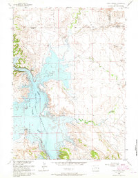 1961 Jewel Springs1965 Print · USGSThe North Platte River valley is captured in the early sixties just after the creation of the Glendo Reservoir. Genealogists and historians can trace the historic Emigrant Trail across the plains near Jewel Springs and Crandall Dam.
 - 1970 Map of Lost Springs, 1973 Print
 1970 Lost Springs1973 Print · USGSLost Springs and the surrounding high plains of Converse County are shown in detail during the early 1970s. Local researchers can trace the Chicago and North Western rail line, the mining operations at Rosin Mine, and terrain features like Rocky Top.
 - 1970 Map of Lost Springs NW, 1973 Print
 1970 Lost Springs NW1973 Print · USGSThe high plains on the Converse and Niobrara county line come into focus as energy exploration began to mark the ranching landscape. Trace the locations of Manning Ranch and Sunset Mine alongside local landmarks like Flat Top.
 - 1970 Map of Cooley Draw, 1973 Print
 1970 Cooley Draw1973 Print · USGSNiobrara County's high plains are captured here in the early seventies, showing a landscape shaped by remote ranching and essential water sources. Genealogists and researchers can locate family-named landmarks like Three Willow Spring, Flat Top Hill, and Baby Springs Draw.
 - 1970 Map of Keeline, 1973 Print
 1970 Keeline1973 Print · USGSThe high plains of Niobrara County come into focus during the early 1970s, centered on the railroad outpost of Keeline. Trace the winding path of Lance Creek and locate family landmarks like the Joss Landing Strip and the distinct heights of Chimney Rock.
 - 1974 Map of Mc Master Reservoir, 1977 Print
 1974 Mc Master Reservoir1977 Print · USGSThe Niobrara River valley in the mid-1970s shows a landscape of high plains ranching and resource exploration. Researchers can trace the Chicago and North Western rail line as it follows the river past McMaster Reservoir and several remote wells.
 - 1974 Map of Lone Tree Hill, 1977 Print
 1974 Lone Tree Hill1977 Print · USGSNiobrara County's high plains rangeland is captured here in the mid-1970s, showcasing the isolated ranching landscape of eastern Wyoming. Researchers can trace the drainage of Muddy Creek and find rural infrastructure like Jireh Road and the prominent Lone Tree Hill.
 - 1974 Map of Silver Springs, 1978 Print
 1974 Silver Springs1978 Print · USGSNiobrara County ranching country is captured here during the 1970s, showing a landscape defined by seasonal draws and springs. Researchers can locate the Mother Featherlegs Cemetery and trace the rugged Wanker Hills and Page Flat.
 - 1974 Map of Rawhide Buttes East, 1978 Print
 1974 Rawhide Buttes East1978 Print · USGSEastern Wyoming at the height of the 1970s shows a landscape of prominent high-plains landmarks and seasonal watercourses. Genealogists and researchers can trace local family-named features like J M Creek and Wolf Spring or locate the Quarries near Bald Butte.
 - 1974 Map of Reynolds Spring, 1978 Print
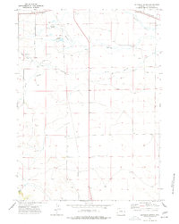 1974 Reynolds Spring1978 Print · USGSNiobrara County’s high plains and river valleys are captured here in the mid-seventies, showing a landscape of ranching and resource extraction. Researchers can trace family history at Reynolds Cem or locate the old Drive-in Theater and Roadside Park along the rail lines.
 - 1977 Map of Hileman Draw, 1978 Print
 1977 Hileman Draw1978 Print · USGSThe high plains of eastern Wyoming are captured here in the late 1970s, showing a landscape defined by livestock and early energy utility. Genealogists and historians can trace the route of the long Pipeline past Pumping Sta and the settlement at Little Tetons.
Showing maps 1-25 of 367
Top cities of Niobrara County
Frequently asked questions
- What are the different types of historical maps available for Niobrara County?
- What is the oldest map of Niobrara County?
- Where can I purchase historical maps of Niobrara County for my home or office?
- Where can I download high-res historical maps of Niobrara County?
- Are there historical topographic maps available for Niobrara County?
- Is there historical aerial imagery available for Niobrara County?
- Where are historical maps of Niobrara County sourced from?